
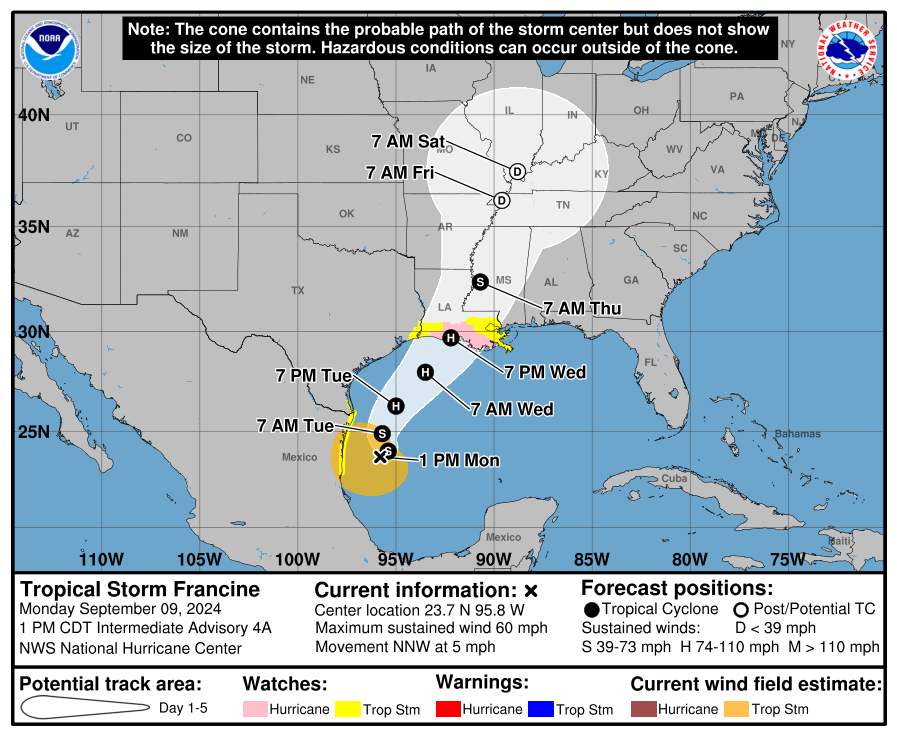

Tropical Storm Francine was officially named earlier today and is expected to make landfall as a hurricane somewhere along the Louisiana coast on Wednesday evening.
Francine is expected to travel up along the Mississippi River, bringing impacts to our neck of the woods by Thursday lasting into the weekend as a Tropical Depression.
Our two main impacts from Francine will be rain and a low-end tornado threat.
The heaviest rain will likely come Thursday and Friday, but rain chances will linger into the weekend due to tropical moisture hanging around.
Although the heaviest rain is expected more-so to our south and west, rainfall totals of 2 to 3 inches will be possible.
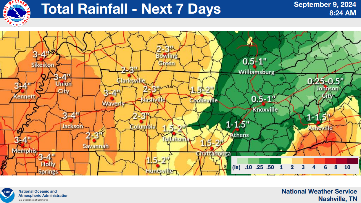
Widespread flooding issues are not expected, but a few localized spots could see some minor flooding if heavy rain “trains” over the same area. If you do have outdoor plans Thursday thru this weekend, an indoor backup plan seems like the safe bet. On the other hand, this will be some much-needed rainfall.
As for the severe side of things…
“As far as any severe potential, the best chance for Middle Tennessee will be Friday. Model soundings show low level backing along with around 500 J/kg of MUCAPE which could be supportive of rotating cells. With that said, there are many details still to be worked out.” says NWS Nashville.
Often with these tropical systems, they tend to bring their own energy, bringing a low-end chance of some gusty winds and a brief, weak tornado. There is still a lot of question marks, so things will likely change! Keep an eye out for future forecast updates.
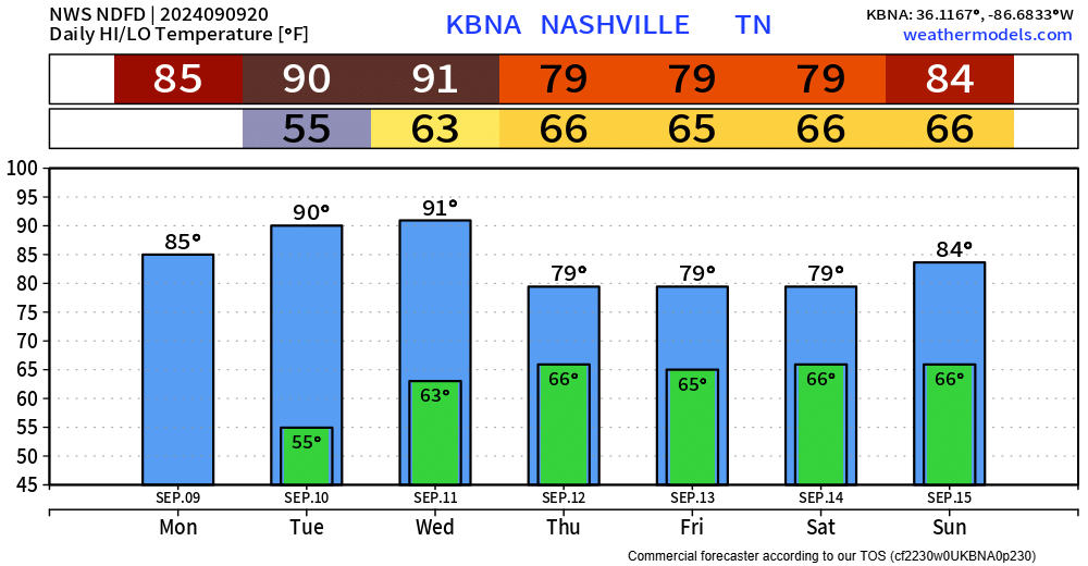
On the bright side, the rain will bring below-average high temperatures.
Categories: Featured Blog