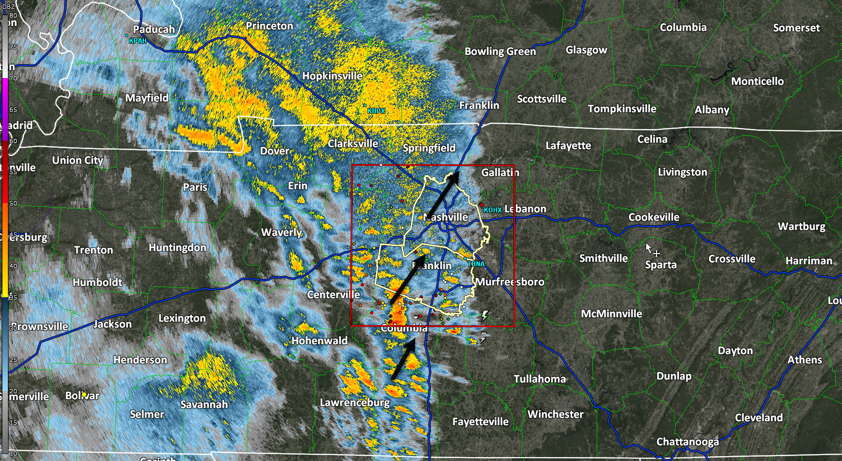
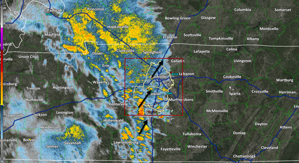
Concern rising for severe storms Tuesday. Damaging straight line winds, and/or large hail, and/or tornado.
Rough ETA Tuesday late morning until dark.
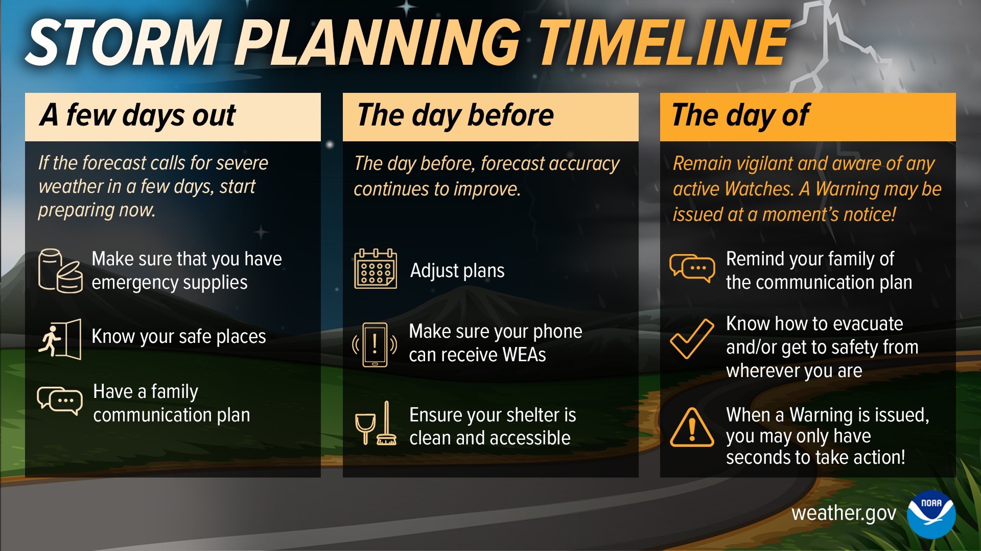
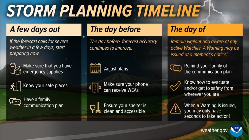
Review severe weather plans today.
Tuesday severe summary from NWS-Nashville:

Concern rising for severe storms Tuesday. Damaging straight line winds, and/or large hail, and/or tornado.
Rough ETA Tuesday late morning until dark.
Review severe weather plans today.
Tuesday severe summary from NWS-Nashville:
Planters: another frost/freeze possible mid/late next week.
Thursday – tomorrow morning – from 3A – 9A. “Frost could harm sensitive outdoor vegetation. Sensitive outdoor plants may be killed if left uncovered.” -@NWSNashville
Wed Thursday ✅
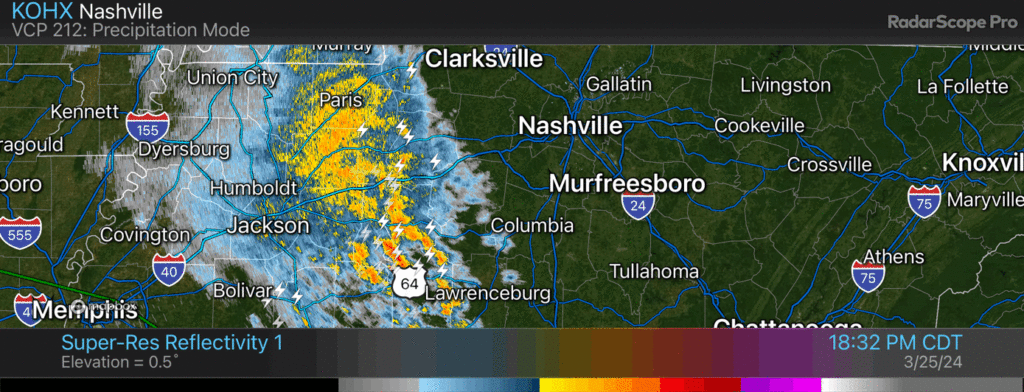
This is a lot of lightning for not very much rain. Most of it is CG so head inside (cloud to ground). 752 PM
Several CG (cloud to ground) lightning strikes slowly incoming. Head inside.
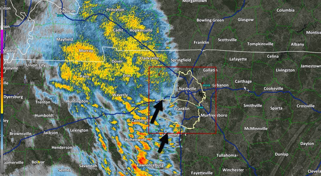
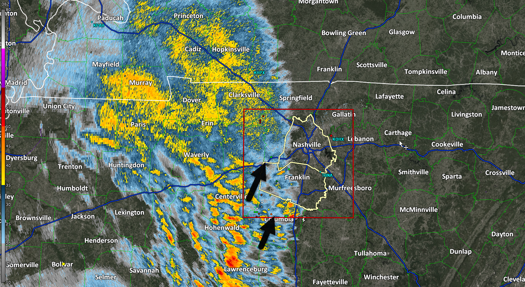
Rain, thunderstorms slowly creeping closer, ahead of schedule.
Wind, lightning the only notable features.
Winds cranking. Last hour, BNA reported 23 MPH sustained, 33 MPH gusts. Both should increase tonight.

Rain ETA getting later. 9-10 PM per latest HRRR model.
I do not expect severe weather. Unlikely this is a “stay up all nighter.”
Winds get strong around 8 PM and continue overnight/while we sleep. Gusts to 50 (!!!) possible. Secure loose objects. Tether 88 lb aunts.
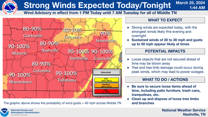
Winds 20-30 MPH sustained with gusts to 50 MPH late afternoon – overnight.
Rain ETA after dark lasting thru the night.
Neither tornado nor hail expected. Rain heavy and straight line winds strong. Lightning possible. Rain totals around 1” or so.
Outdoor burning Sunday ❌.
“Much of Middle Tennessee will experience an elevated fire
danger tomorrow owing to increased wind speeds and very low relative humidity values.”
-@NWSNashville
You must be logged in to post a comment.