Today – Cool & Dry – Low 65°
The overcast skies are in no hurry to depart.

Track our proximity to clear skies on visible satellite!

Friday – Mostly Sunny – Wake Up 49°, High 78°
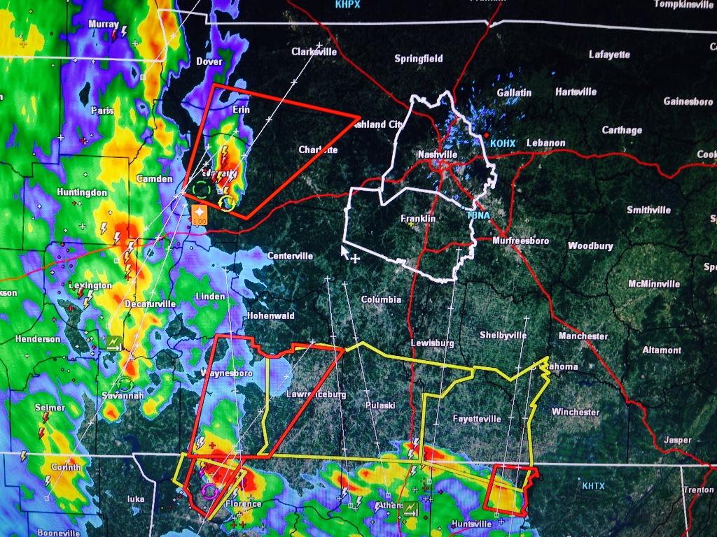
We dodged a bullet yesterday. The Cumberland Electric Company Reported that over 2,000 people in Clarksville lost power last night — in the area with a tornado signature on radar.

Today the NWS is surveying what appeared to be a long-track tornado-producing supercell which moved across western Middle TN late Monday afternoon.
2:42 PM – The National Weather Service issued a Special Weather Statement for both Davidson and Williamson Counties for Monday into Tuesday morning.

2:30 PM – The Storm Prediction Center put out a Mesoscale Discussion that included Middle Tennessee. It has confirmed, however, that the system has missed us to the east.
Current Temp
Current Radar Loops


Saturday – Mid 60s – Rain

Rain will be here mid-morning, and should continue off and on through most of the afternoon and evening. The HRRR model thinks there may be a break in the rain by mid afternoon. If you have outdoor activities planned, I suggest you just watch for gaps in the rain on the above radar loops.