
Rain likely Friday. Lightning unlikely. Hi Res data in range tonight w/ deets. After a quiet weekend, another system late Mon-Tue. Strong winds likely but severe (at least for now) appears unlikely (bc no CAPE). This will be watched.
Spending this blue sky Weds emotionally preparing for a summertime of questions about cicadas and inaccuracies in the coming Twister movie reboot.
Thankfully, no more sub-freezing temperatures expected in the next 7 days after dipping down into the low to mid 20s last night.
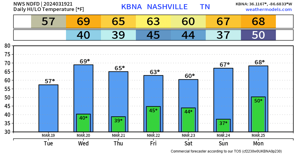
High temps back near 70 degrees tomorrow, with high staying in the 60s for the remainder of the week.
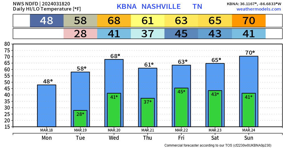
Hard freeze expected tonight with low dipping down into the mid 20s. We’ll wake up with temps in the upper 20s.
“We’re still about 2 weeks from our last average freeze date, so this isn’t abnormal, but it’ll be painful for anyone who jumped the gun on planting.” – NWS Nashville
Hard Freeze Expected Monday Night, Fire Danger Highest Mon + Tues.

Main headlines this week will be a hard freeze and fire danger.
Official low tonight is 33°, but your backyard may make it below freezing. High temps Monday only expected to make it in the mid 40s.
Hard freeze expected overnight Monday.

Green Thumbers and Burners, heads up. OTW your need to read: low.
Very little overnight rain, meh.
Do No Burning Monday, Tuesday. “There is an initial concern that most of mid state region will experience marginal fire dangerthresholds at least on Monday and Tuesday due to dry conditions, low afternoon humidity levels, and favorable 20 foot winds. Too early to issue any specific fire weather related products, but something certainly to keep an eye out for.” NWS-Nashville.

Next Event Thu/Fri. Deets here. Must read? Nah.
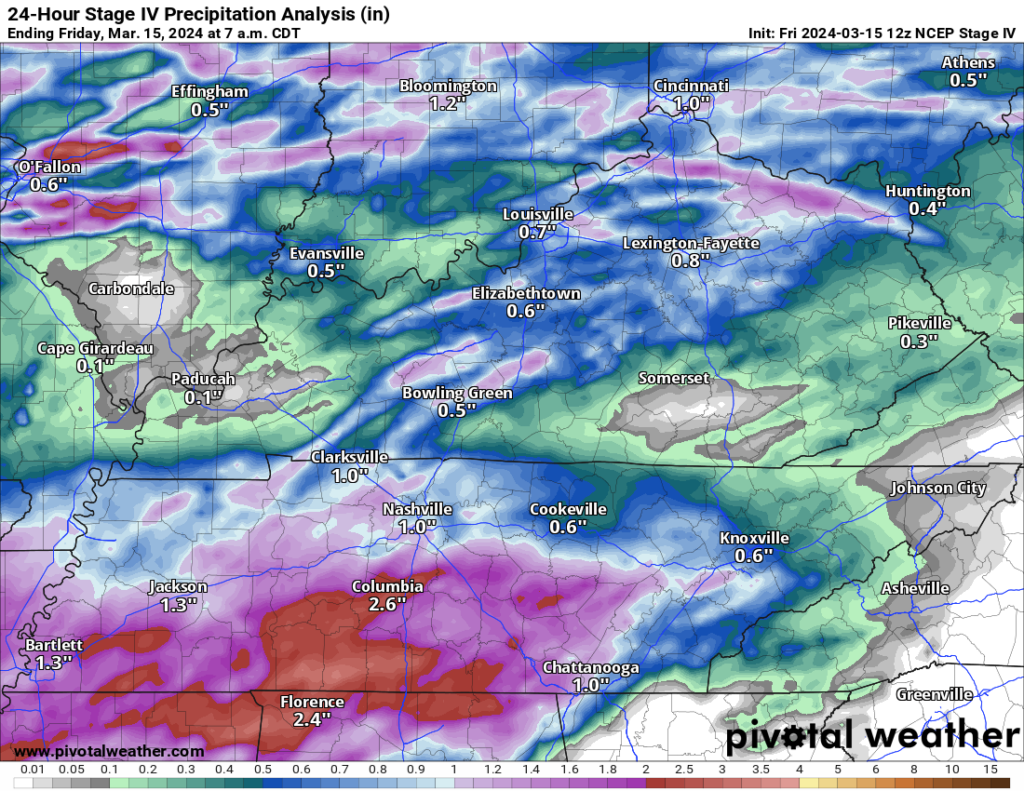
Last Night Review. Rain last night avg around 1″+, more for those south of 840.
One family in my hood got lightning through the roof. No fire, somehow, and thankfully. No one hurt.
We’ll be covering the event today/tonight over on Twitter and also YouTube Live (if a warning is issued). See you there! twitter.com/nashseverewx
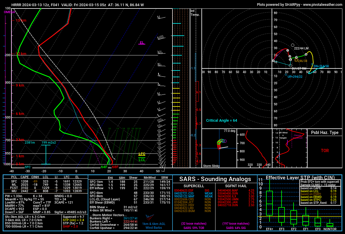
My anxiety level rising for Thursday night. What looked like a meh line incoming is now in range of convective allowing models like the HRRR. Those models show strong/severe storms arriving late night Thursday or the wee hours Friday AM.
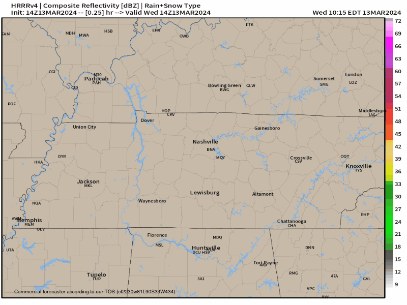
Inconsequential isolated daytime showers found in HRRR model for today:
You must be logged in to post a comment.