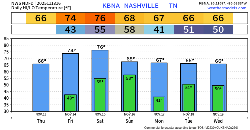
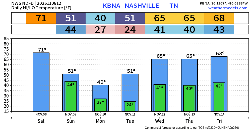
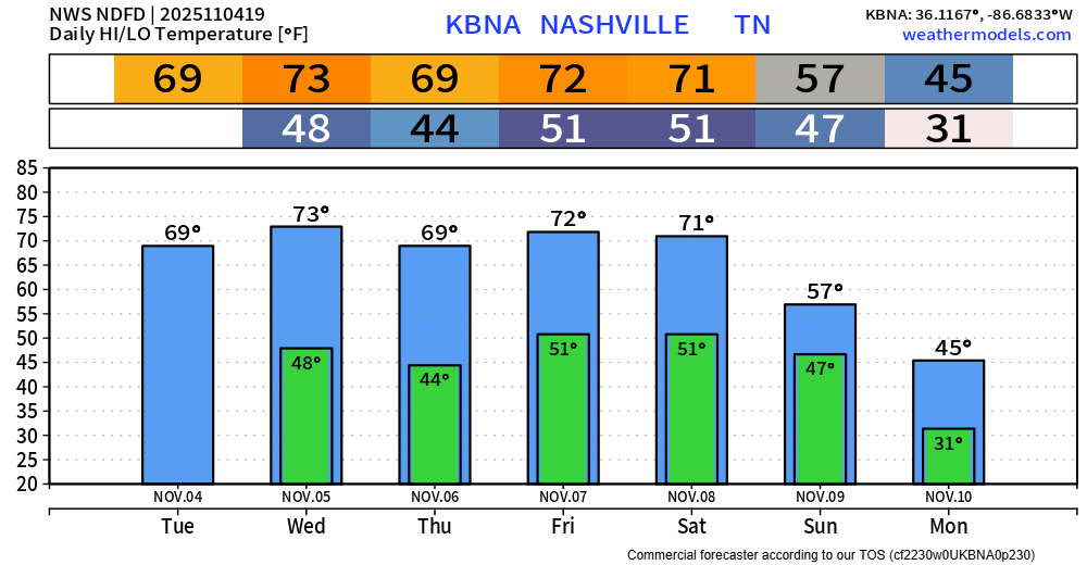
Temperatures will continue to be very nice, especially for mid-November standards. Highs in the mid 70s Friday and Saturday, mid to upper 60s otherwise. Outdoor plans are encouraged Friday and Saturday.

Temperatures will continue to be very nice, especially for mid-November standards. Highs in the mid 70s Friday and Saturday, mid to upper 60s otherwise. Outdoor plans are encouraged Friday and Saturday.

Seeing the Northern Lights had always been on my bucket list. I was fully prepared to take a trip up to some very high-latitude place to see them – until May 2024 when they were visible all the way down here. We got treated again in October of 2024, and yet again last night. It doesn’t get any less cool each time.
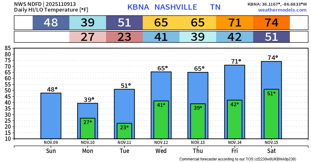
BNA bottomed out at 24° last night, with many spots colder than that. Thankfully, we won’t see temperatures that cold again for a while.
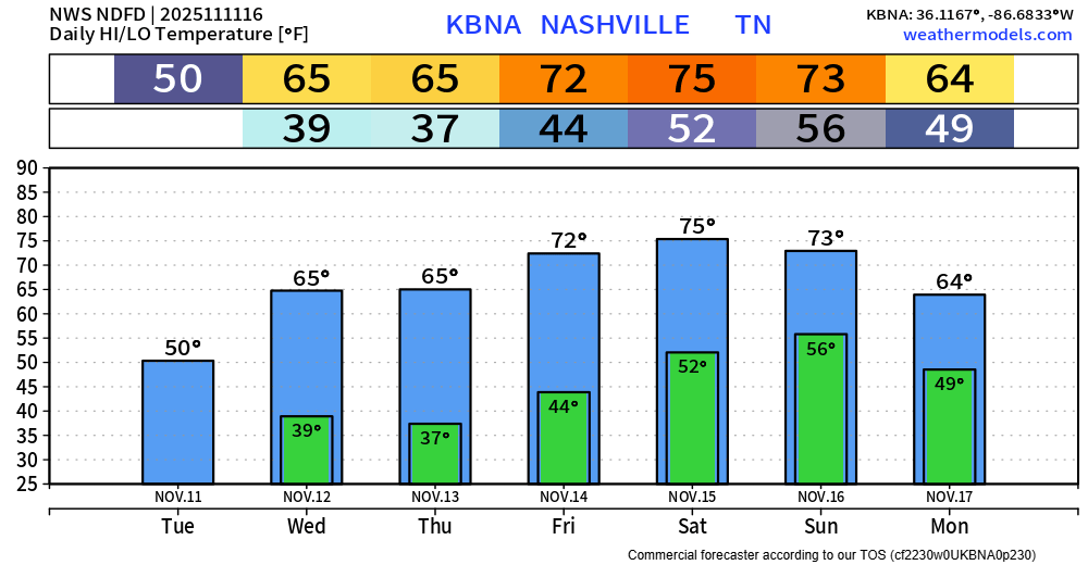
We’ll have a nice warming trend this week, with high temps getting all the way into the low to mid 70s. We’ll go from ~15° below average to ~15° above average in the span of just a few days. That checks out for around here.
A few lucky folks have already seen more snow flurries this morning, with more expected throughout the day. However, with temps expected to be above freezing (BNA is already at 33° as of 9a) any flurries will melt on contact with the ground – no accumulation is expected. Per usual, the Plateau will see some accumulation.
Yesterday our high was 75°. Tomorrow morning it will feel like ~15°. Quite the flip of a switch.
Our cold front has moved thru, which has already brought in cooler and drier air thanks to a strong NW breeze.
Our dense fog should begin to mix out here over the next several hours. For now, leave plenty of room between you and other cars if driving and use your headlights.
Today we get temps in the low 70s and plenty of sun. If you don’t already have outdoor plans, maybe you can make some.
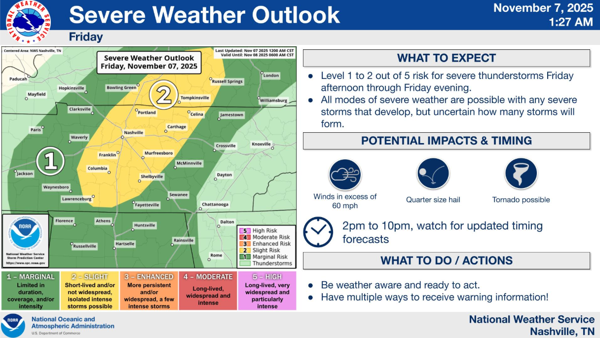
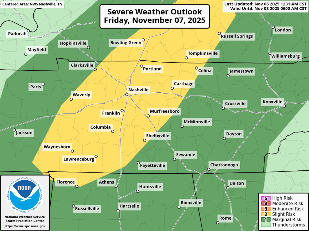
Thinking on today’s low-end severe potential this afternoon and evening largely remains the same.
In short: damaging straight-line will be the main threat with any strong thunderstorms this afternoon and evening, but a tornado or hail cannot be ruled out. Stay weather aware, especially those with outdoor plans, and have a way to receive warnings in case one is issued for you. Lots more deets below.
Similar to yesterday’s blog, I do want to address today’s lovely weather before we dive into the severe talk – because nice weather deserves attention too.
High temps will surge into the low 70s today. Local high school teams that moved their playoff games up to today will be treated with nice weather. Temps near 60° by kickoff, mid 50s by the end of the game.
Before we hop into the severe weather talk, I do want to mention that today and Thursday will both be lovely days. High temps near 70° – which is nearly ten degrees above average. Plenty of sun, nice treat for early November.
We have very quickly warmed up from the mid 30s this morning, with BNA sitting at 70° at the 1p observation.
High temps near 70° will be common thru Saturday, nearly 10° above average for the start of November.