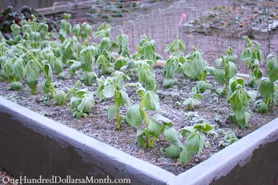
🥶Hard freeze tonight and Sunday night. Regular ole freeze Monday night. Early blooms ain’t gonna like it.
I think I’m going to just cover everything with bedsheets and leave it for 4 days. It’ll look like a yard sale, but I don’t care. lol

🥶Hard freeze tonight and Sunday night. Regular ole freeze Monday night. Early blooms ain’t gonna like it.
I think I’m going to just cover everything with bedsheets and leave it for 4 days. It’ll look like a yard sale, but I don’t care. lol
Low temperatures will be below freezing for the next four nights or so. At least a couple of these freezes will be “hard freezes.” Protect any landscaping/plants that has been overeager in past weeks.
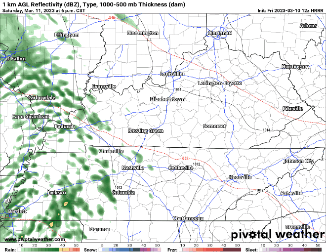
HRRR model (see 👇🏽) thinks ETA midnight tonight. Most of the rain gone by 7 AM, then off and on light showers after that. Side-eye all ETAs as usual. Think all rain gone by mid-afternoon Friday. Totals around a half inch, enough to rain out water intolerant rollyball fields Friday night and maybe Saturday morning.

Expect rain starting late Thursday night, most of it falling before sunrise Friday morning, gone by early Friday afternoon:
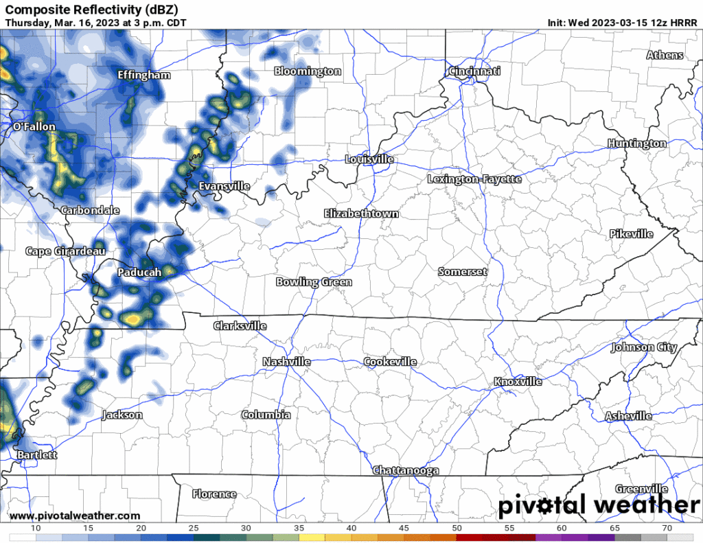
Lightning unlikely but briefly possible Thursday night around midnight. Nothing severe. No flooding. Rain totals about a half inch may rain out rollyballing on some fields.
In this blog: freezy Weds (and weekend) morning(s), rain Friday.
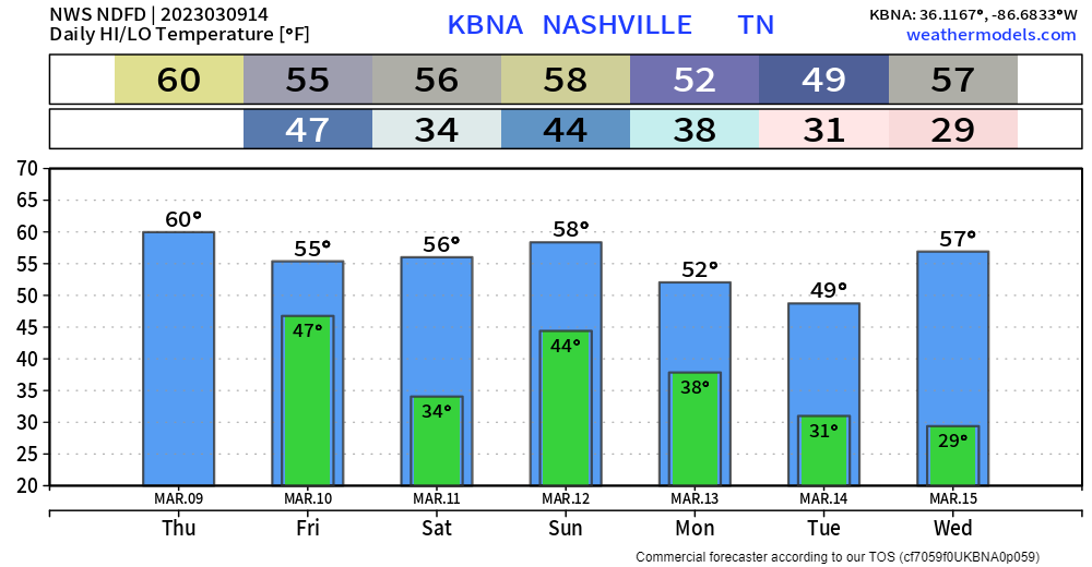
Hard freeze is when we get to 27°. That’ll happen tomorrow morning. Kills plants, big sad. We should hit 24° around sunrise Weds, hard freezin for a few hours before we quickly warm up to 56°. Some of us will be even colder than that.
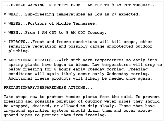

A freeze warning has been issued for our two counties (and much of Middle TN) beginning overnight through tomorrow morning. Here are the deets .
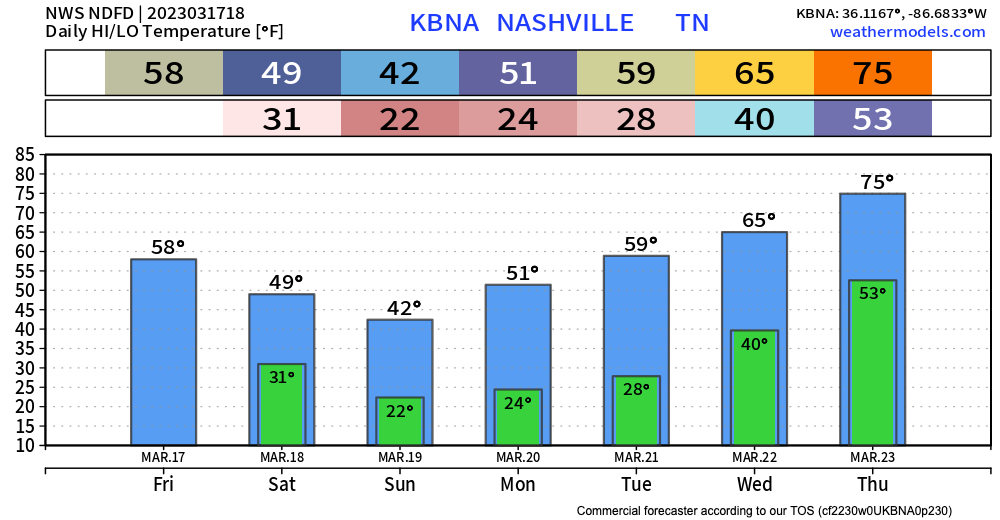
This weeks weather will be pretty. As mentioned yesterday, we’ll have cold mornings and sunny, warm afternoons. Temps will try to get into the 50s today and tomorrow, then trying for the 60s Wednesday and Thursday.
For most of the week we’ll see a repeating pattern of cold mornings and sunny days with temps rising into the high 40s to 50s. This is pretty typical for this time of year.
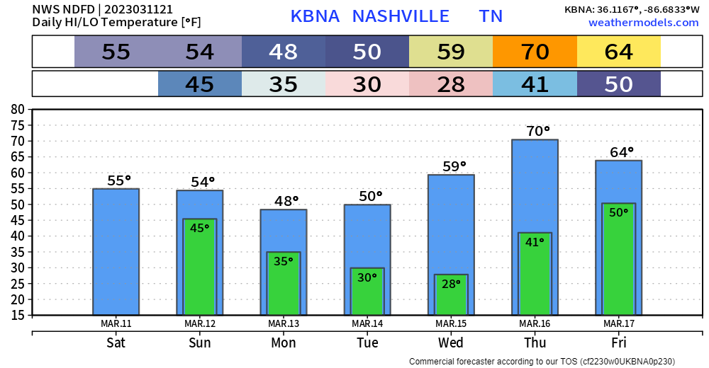
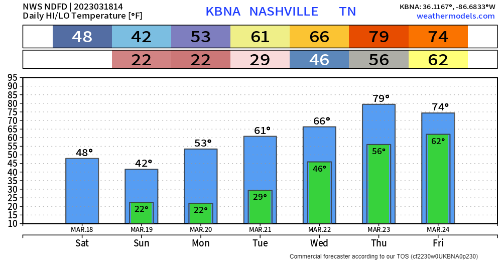
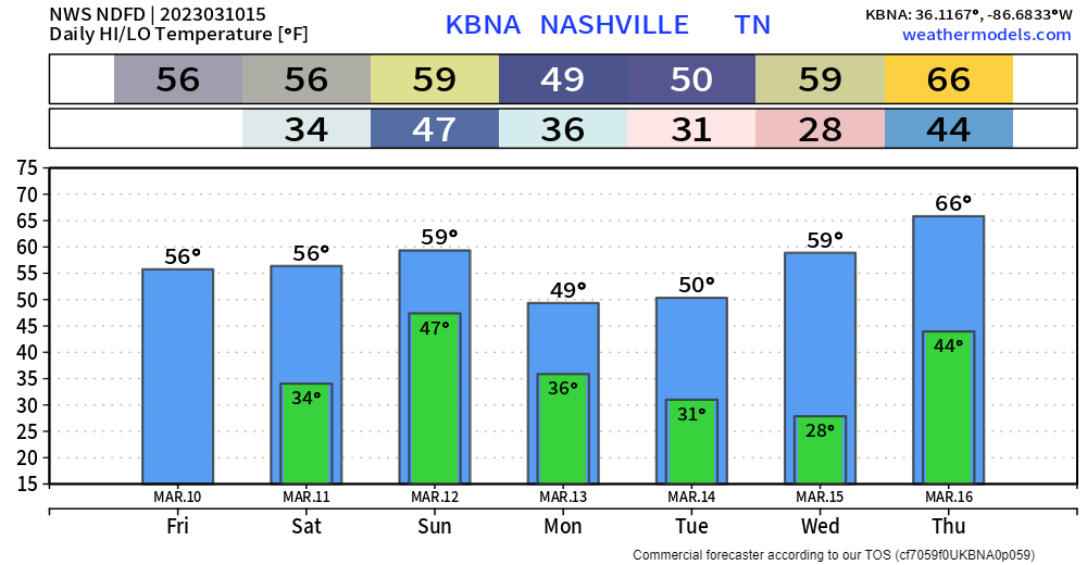
Those of us who’ve been around Nashville for a while know that planting stuff before tax day is really just a demonstration of your lack of self-control. This describes me perfectly. I’m well aware that those green graph bars up there show two nights of sub-freezing temperatures, but I’m ready to get on with things, for the love. On the bright side, the only things I planted were fairly hearty shrubs. They should be alright. But, really, let’s get on with it.
We’ve managed to dodged rain the past couple days thanks to dry air aloft. We’ll stay dry until Saturday evening when rain chances creep back in.
The HRRR model above only goes out as far as the loop shows, but showers are expected to continue through Sunday afternoon. Just some rain, not concerned about severe weather or flooding. We should stay dry Sunday night – Wednesday.
Really not much to cover here. Temps around average, some rain chances. No severe weather. Boring weather is good weather though?
I do not fault you if you look like this reading the blog.

Anyway, some rain chances come in around lunch, maybe sooner. There’s some pretty dry air sitting above the surface, so it may take a while for the rain to actually make it to the ground. A rain jacket or umbrella, and it’ll not be bothersome. Should clear out for evening plans/SEC tourney goers.
You must be logged in to post a comment.