

We have three consecutive days of severe weather chances and/or dangerous heat. Let’s discuss.
Today
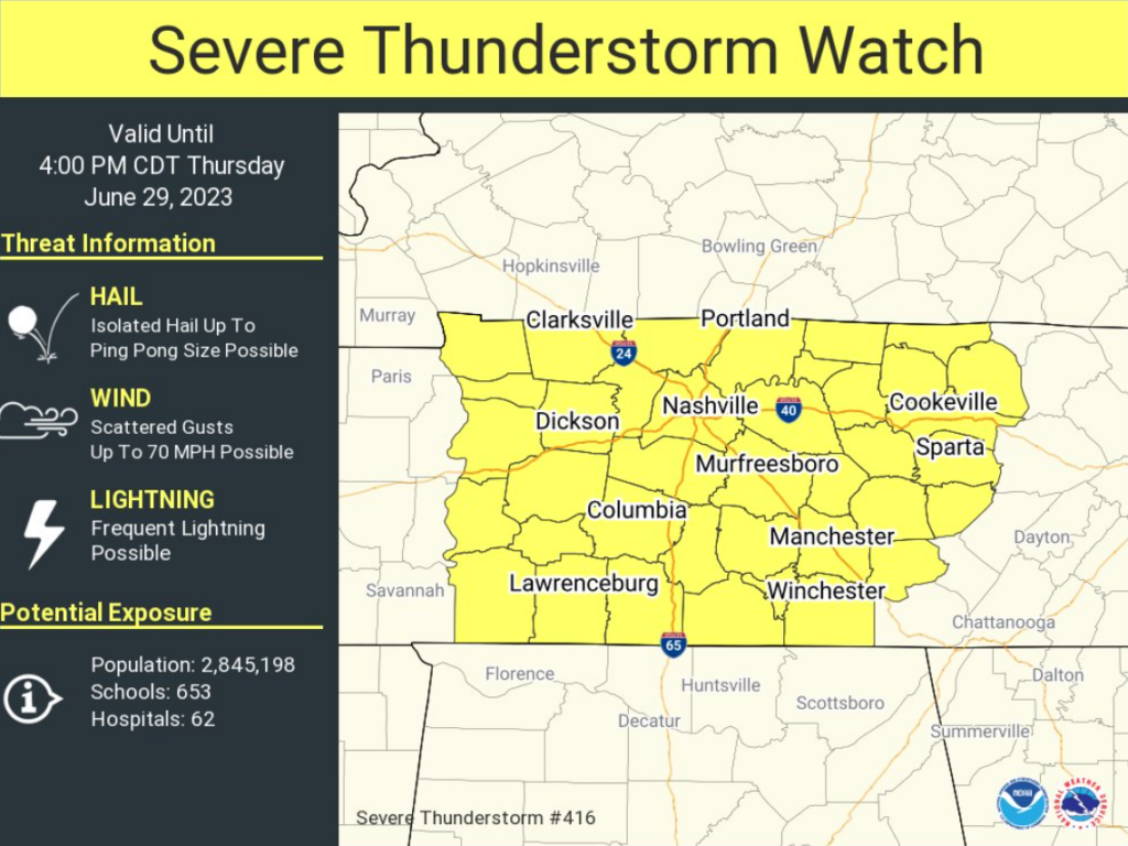
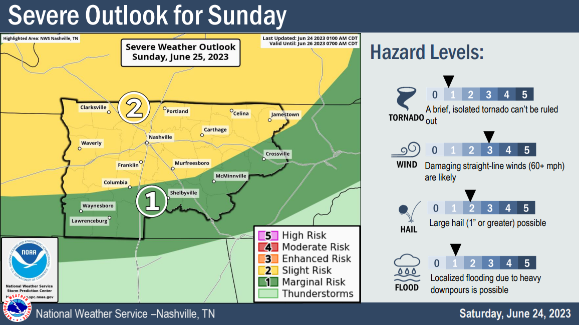
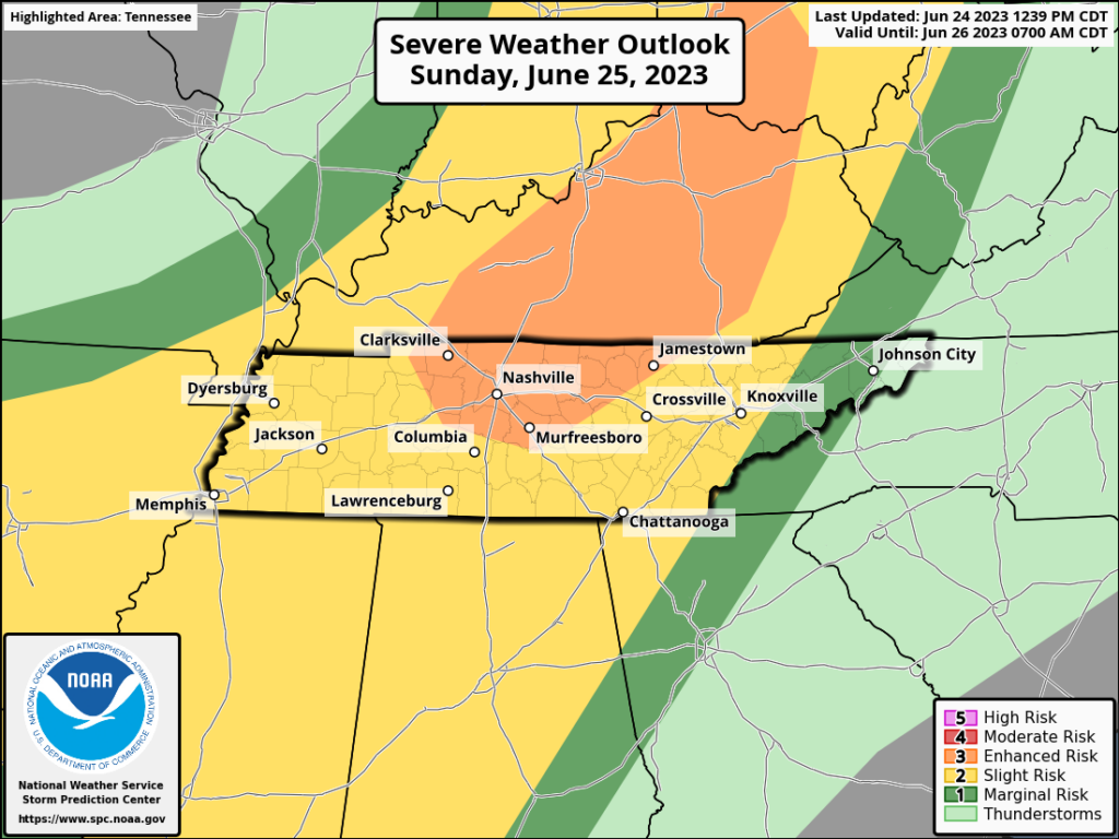
Both counties are under a Severe Thunderstorm Watch until 4pm today. Main concerns are damaging straight-line winds and hail. Not concerned with tornadoes. Updates are constantly flowing, stay connected to our Twitter for frequent updates.


You must be logged in to post a comment.