

Majority of morning round of showers/storms missed us to the east. Still can’t rule out a couple stray showers/storms.
The absence of rain this morning will allow our temperatures to get into the low to mid 90’s this afternoon, paired with dewpoints in the low 70’s = heat index values around 100°. Take breaks if you have to be outside.
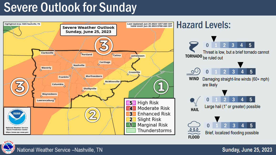
The Storm Prediction Center has outlooked our two counites with a:
- 💨 30% chance of damaging straight-line winds within 25 miles
- ☄️ 15% chance of severe hail within 25 miles
- 🌪️ 2% chance of a tornado within 25 miles
🕒 Timing:
There is some uncertainty with the timing of these storms. Models have been speeding up, slowing down, the timing of the storms.
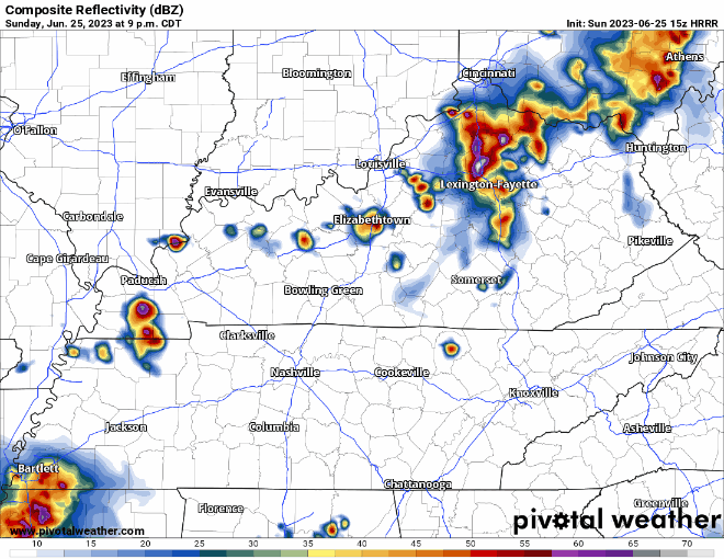
The latest run of the HRRR model (above) has an ETA of around 11pm tonight. With how inconsistent the different runs of the models have been, I think a timeframe of 8pm-midnight is more realistic.
Keep in mind, this is the same model that thought it would be raining/storming this morning. Models are not perfect. Some models have a solid line of storms moving thru tonight, some think we don’t see any rain.
The ingredients will be in place for severe weather, the question is how widespread the storms will be. We’ll be watching all day and night, Tweeting and updating the blog as needed. As the day goes on, the hope is that confidence increases, and we’ll have a better idea of what happens tonight.
Stay connected throughout the day, especially if you plan on being out and about tonight. *If* a warning is issued for any portion of our two counties, we’ll go live on our YouTube channel, which you can get to by clicking here.
Rest of the Week
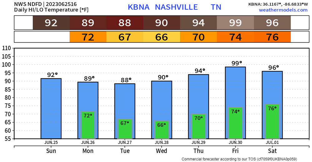
Monday thru Wednesday look dry for the most part. Real Wattery chances return Thursday, which is also when some serious heat arrives. Friday we’ll be flirting with the 100° mark. That’s disgusting.
Quick References:
Weather changes constantly.
Follow @NashSevereWx on Twitter for any changes to this forecast.
Live coverage during tornado and severe thunderstorm warnings:

Look good.
Support the mission.

We are 100% community supported. No ads. No subscription fees. Keep it free for everyone.


Categories: Forecast Blogs (Legacy)
You must be logged in to post a comment.