Few quick + light showers possible thru lunchtime. Most of us will stay dry today though. Highs all the way in the mid 50s.
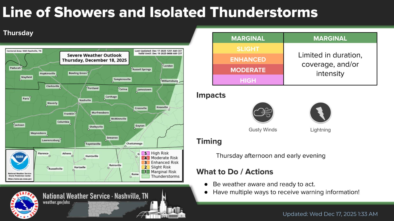
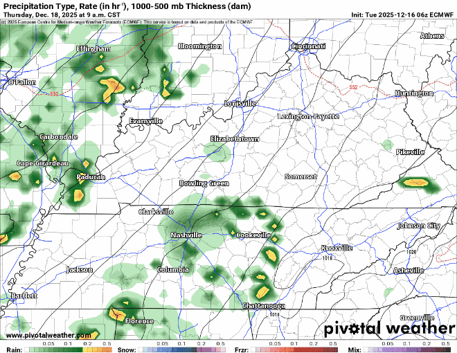
Thinking on Thursday’s very, very low chance of a strong storm or two remains unchanged.

Few quick + light showers possible thru lunchtime. Most of us will stay dry today though. Highs all the way in the mid 50s.
Thinking on Thursday’s very, very low chance of a strong storm or two remains unchanged.
These clouds have been fairly stubborn this morning but should eventually give way to some sun. We’ll make it close to 50° this afternoon.
Maybe a few quick sprinkles Wednesday morning, but most likely just some clouds. Highs into the mid 50s.
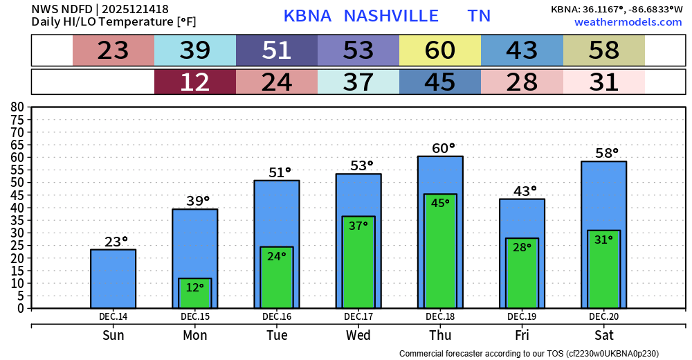
We’ll finally return above freezing today after ~36 hours of below freezing temps. High temp of around 40° certainly isn’t warm, but it’s improvement.
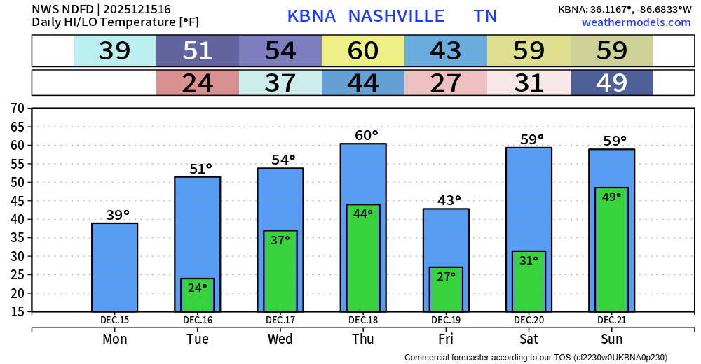
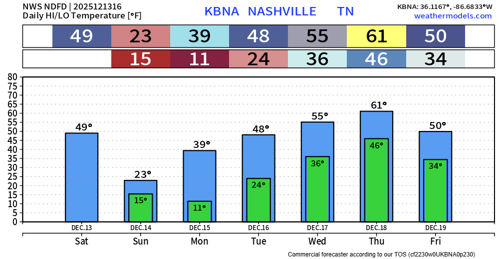
We’ll gradually warm up over the next several days, even making it all the way to 60° for a high by Thursday, leaving the near 0° wind chills in the past.
If you haven’t been outside today – it’s cold. Don’t let the sun fool you. Wind chill values (aka “feels like” temps) will be near the single digits all day. If you need to go outside today to do anything, be sure to have several layers on, hypothermia can set in quickly with this kind of cold.
If you are trying to decide about getting something done outside either today or Sunday – I could not recommend today more.
That’s not entirely because today will be super nice, but because Sunday will be brutally cold.
High temps in the mid 50s today will be slightly above our average high of 50°. Lots of sun.
Highs will be around 50° on Saturday. Out of the two weekend days, this will be the day to get stuff done outside if you need to.
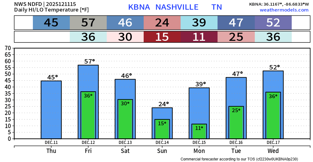
Today will be chilly with highs only reaching the mid 40s – which will be nice compared to what we deal with Sunday.
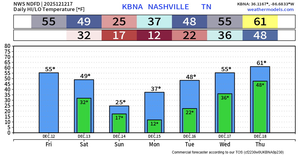
Friday will be the “warm” day out of the next 7, with highs in the upper 50s.


Our next weather system will approach Wednesday. It’ll be a cold front that’ll knock our temps back down for Thursday, but nothing extreme. Not even expecting precip with this cold front.
However, you will notice south winds pick up ahead of this front. Gusts to 30 mph possible tonight and into Wednesday. Strap down your outdoor decorations!

Endure today, and things will get better tomorrow. That applies to more than today’s weather, btw.
You must be logged in to post a comment.