

High temps in the mid 50s today will be slightly above our average high of 50°. Lots of sun.
Highs will be around 50° on Saturday. Out of the two weekend days, this will be the day to get stuff done outside if you need to.
That’s because we’ll dip below freezing Saturday night and not make it above 32° until midday Monday.
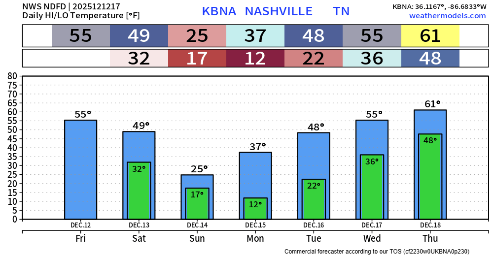
Sunday will not be a good day for outdoor plans.
Wake up temps will be near 15°, combined with wind gusts up to 30mph. That will cause our wind chill values to be near 0°. Layers on layers will be needed for the walk out the door.
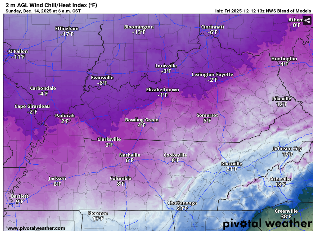
You’ll need the layers upon layers all day. Those gusty winds paired with our lovely high temperature of 25° will keep wind chill values in the single digits for most, if not all, of the day.

With temperatures below freezing for ~36 consecutive hours, don’t forget about the 4 P’s. People, pipes, pets and plants.
Temperatures will be near 10° as you head out the door Monday morning. Your heavy coat will be working overtime.
Thankfully, we’ll gradually warm up throughout the week. Highs get all the way back up to 60° by Thursday, which is also when rain chances return.
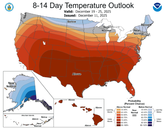
These warmer than average temperatures will continue thru Christmas. For those dreaming of a White Christmas, sorry.
Categories: Featured Blog