
Fog possible tonight into Thursday morning, low beams might get some work in.
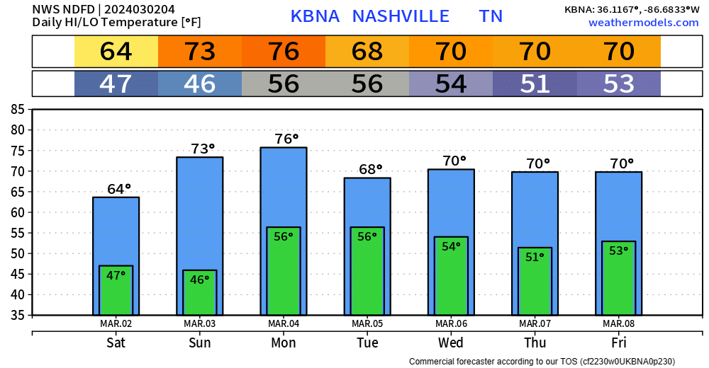
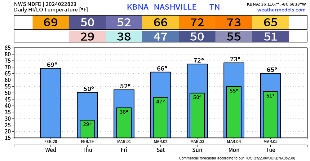
We’ll get by with a dry and warm Thursday. High temperatures get into the upper 60s.
Friday morning our rain chances return.

Fog possible tonight into Thursday morning, low beams might get some work in.
We’ll get by with a dry and warm Thursday. High temperatures get into the upper 60s.
Friday morning our rain chances return.
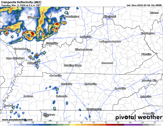
Some more rain tonight and early Wednesday morning.
Rain jacket or umbrella may be useful for your AM commute to school/work, but don’t think you’ll need it for the way home. A couple showers can’t be ruled out during the day tomorrow, but they’d be no big deal.
Majority of us have been able to stay dry today, and likely will remain dry thru the remainder of the day.
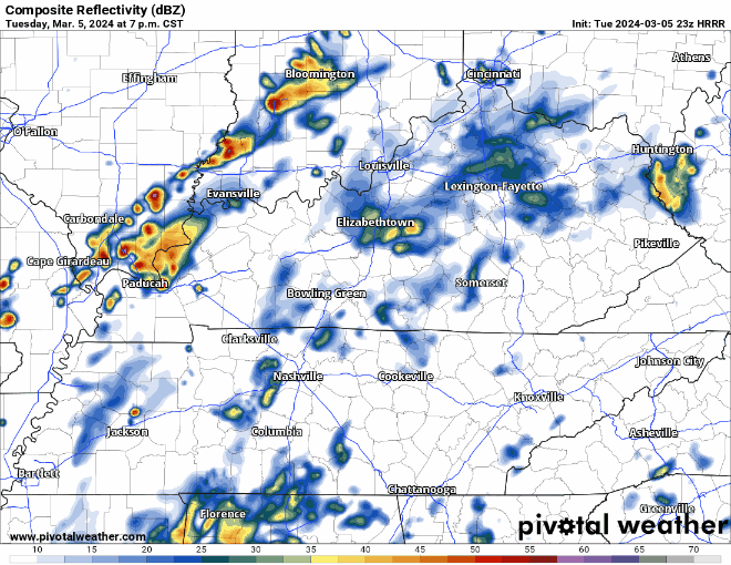
The same cannot be said for Tuesday, as showers are storms look likely throughout the day.
(Heads up: this gif file size is fairly large and may take a while to load)

Nice day today. Warm temperatures will continue throughout the week, but the dry conditions won’t.
Thankfully Monday will only have scattered shower chances. Majority of us will be dry most of the day.
Clouds have finally cleared out, leaving us with a nice afternoon.
Tomorrow will be even warmer, with high temperatures getting into the low 70s. Sunday looks like our last dry day for a good while.
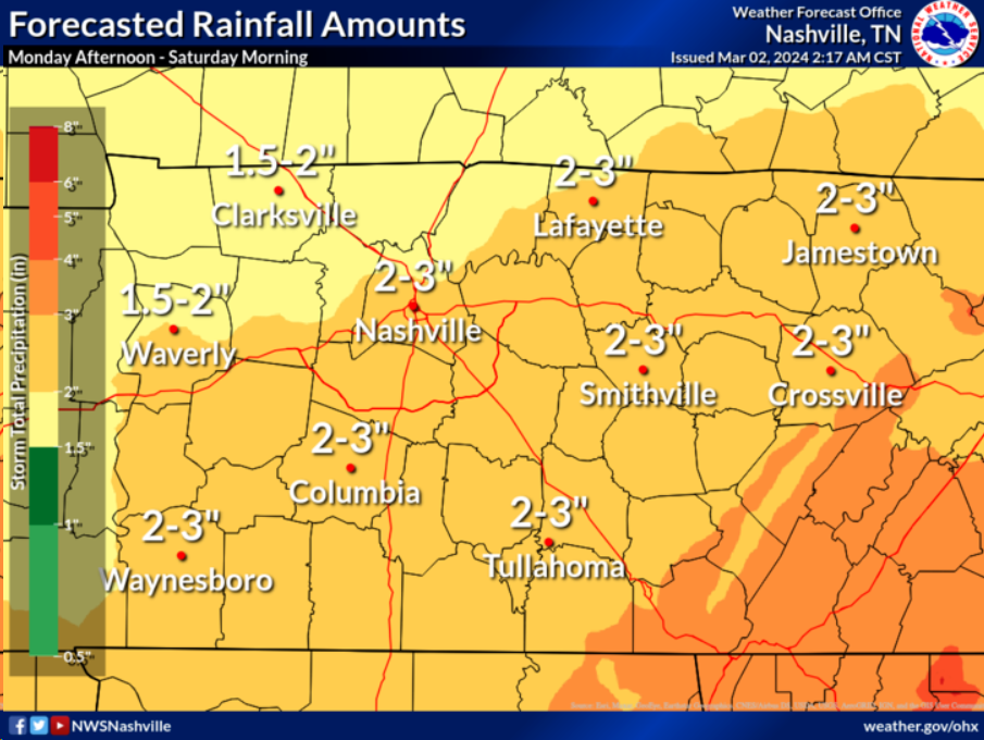
The upcoming week will be warm but filled with rain chances.
If you are up right now, props. If you see this in this morning – that’s okay too, it’s late.
We get rewarded with a warm + dry weekend.
Dry weather can’t last forever as rain chances return Monday, and last thru mid next week.

Chilly day today, and tomorrow will fairly similar but with rain chances.
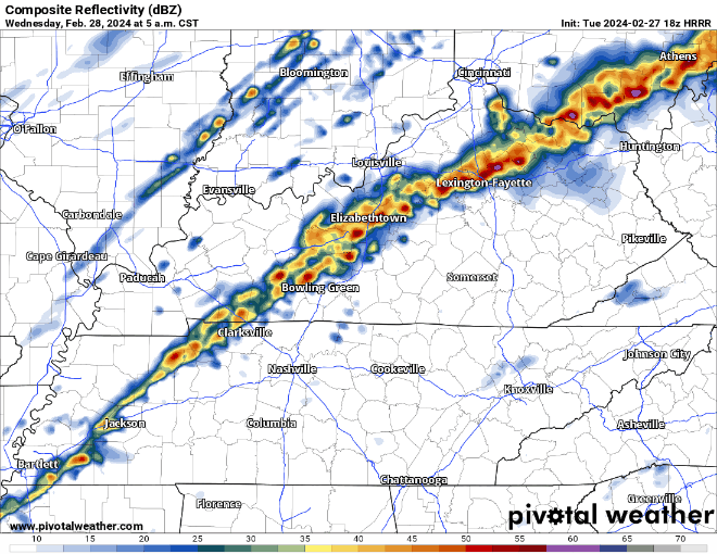
HRRR model (above) shows rain beginning early Friday, lasting on and off throughout the day. No severe weather concerns, just a cold rain. Bleh.
This morning, temperatures were in the low 70s. As of 6:45pm, we are in the low 40s, and on our way to about 28° tonight. Your backyard may be a few degrees warmer/colder.
We’re expected to barely make it to 50° on our extra day for 2024.
Another warm day despite the cloud cover.
Wind Advisory is in effect now thru noon Wednesday. Wind gusts up to 40 – 45 mph will be possible.
Early Wednesday morning, a line of rain/storms is expected to move thru. Severe weather is not expected, but a storm on the strong side cannot be ruled out.

Beautiful day today, 3 degrees short of the record high of 79° at BNA.
Similar temperatures for Tuesday, but we have some non-thunderstorm winds and rain to deal with.
A Wind Advisory will go into effect starting noon Tuesday and go thru 6am Wednesday. Sustained winds around 20mph, with gusts up to 40mph will be possible. Secure any outdoor furniture and bring in those trash cans ASAP.
You must be logged in to post a comment.