
Beautiful day today, 3 degrees short of the record high of 79° at BNA.
Similar temperatures for Tuesday, but we have some non-thunderstorm winds and rain to deal with.
A Wind Advisory will go into effect starting noon Tuesday and go thru 6am Wednesday. Sustained winds around 20mph, with gusts up to 40mph will be possible. Secure any outdoor furniture and bring in those trash cans ASAP.

HRRR model shows some showers moving thru Tuesday AM. Rain jacket won’t be a bad idea for the commute to work/school.
Some additional light showers are possible Tuesday evening.
The main topic the past few days has been about the line of rain/storms expected to move thru our area Wednesday morning. As of right now, we are not outlooked for any severe weather.
HRRR model (above) thinks the line will push thru ~ 6 – 8am Wednesday (subject to change).
- A few thunderstorms could be embedded in the line with some gusty winds
- As of now, the line is expected to sub-severe
- Things can always change, so be sure to check back for updates
After the line pushes thru, temperatures will drop. Temps during the day Wednesday will be in the 40s and 50s, and we’ll get below freezing Thursday AM.
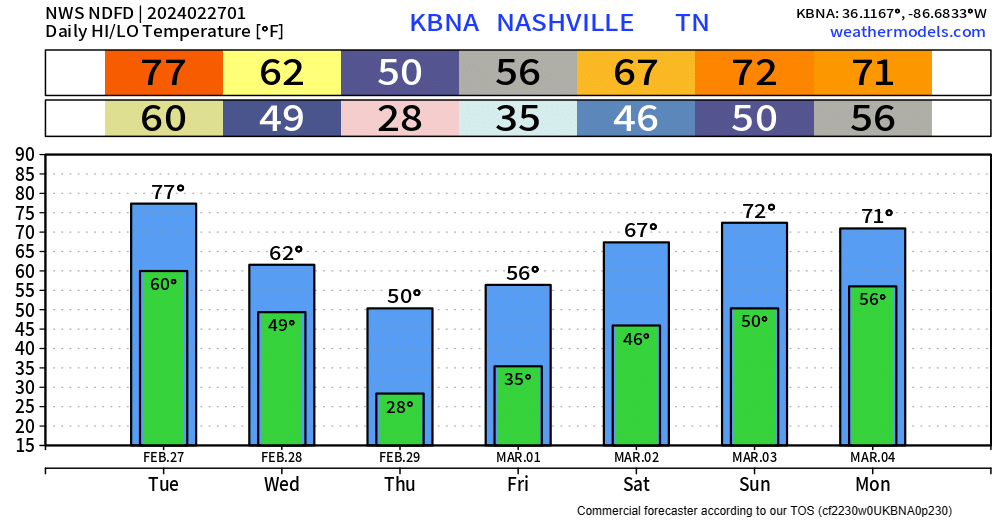
Temperatures will quickly recover over the weekend. Rain chances return Friday, but Saturday/Sunday look dry.
Categories: Featured Blog