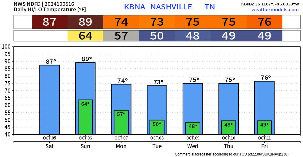
Today and Sunday will be our last “hot” days for the foreseeable future. Upper 80s today, even pushing 90° tomorrow.

A cold front will push thru Sunday night, escorting cooler and drier air – making it feel more like October.

Today and Sunday will be our last “hot” days for the foreseeable future. Upper 80s today, even pushing 90° tomorrow.
A cold front will push thru Sunday night, escorting cooler and drier air – making it feel more like October.

High temps this weekend will be in the mid to upper 80s – about 10° above average for this time of the year. A few spots may end up hitting 90° on Sunday. On average, our last 90° day is September 15, so this would certainly be a bit late in the season, but nothing unheard of.

High temperatures above average thru Sunday, then a cold front pushes thru sometime Sunday PM, knocking our temps down to where they ought to be this time of year – bringing in more of a Fall feel.

No rain chances to talk about for the remainder of the week.
In fact, most of the lower 48 will be dry over the next seven days.

An updated drought monitor will come out tomorrow and will presumably show improvement in our drought thanks to recent rainfall.

As a cold front pushes thru the area, some light showers will be possible this afternoon and evening, no big deal – some (most?) of us will stay dry. HRRR model shown below
Andddd besides that, there are no more rain chances to discuss for this week. Warm afternoons, cool mornings.

A few spotty showers are traversing thru the area and will continue to do so thru the evening. Not everyone will see rain and those that do will only see some light rain. Don’t see it seriously affecting any outdoor plans. You can always check the radar on our website here: Radar | Nashville Severe Weather

On and off light showers will be possible thru the rest of the day as a low-pressure system sitting over us continues to squeeze moisture out, but any rainfall totals will be very light. You can always check the radar on our website here: Radar | Nashville Severe Weather

Continued on/off showers will continue thru tonight.
Rain gear seems like a must have for any outdoor activities. No downpours, no lightning, just rain.
Same thing for Sunday. Rain jacket will be a good idea, morning, afternoon, and evening.

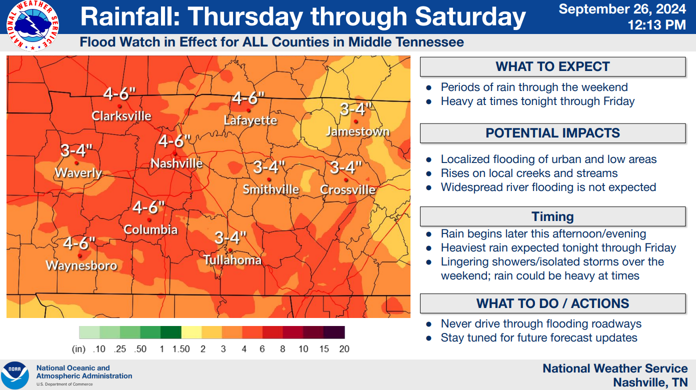
As of 1:15p BNA has measured 4.05″ of rain and counting, similar rainfall totals have fallen across our two counties. Thankfully, the rainfall rates have been manageable, and we have only seen a couple of instances of water over roads.
A rough timeline (!that could change!)
Now for the deets.
Latest HRRR model expects rain to begin tonight around 6p, +/- an hour or so.

A steady, consistent rain will continue throughout overnight and continue into Friday.
You must be logged in to post a comment.