
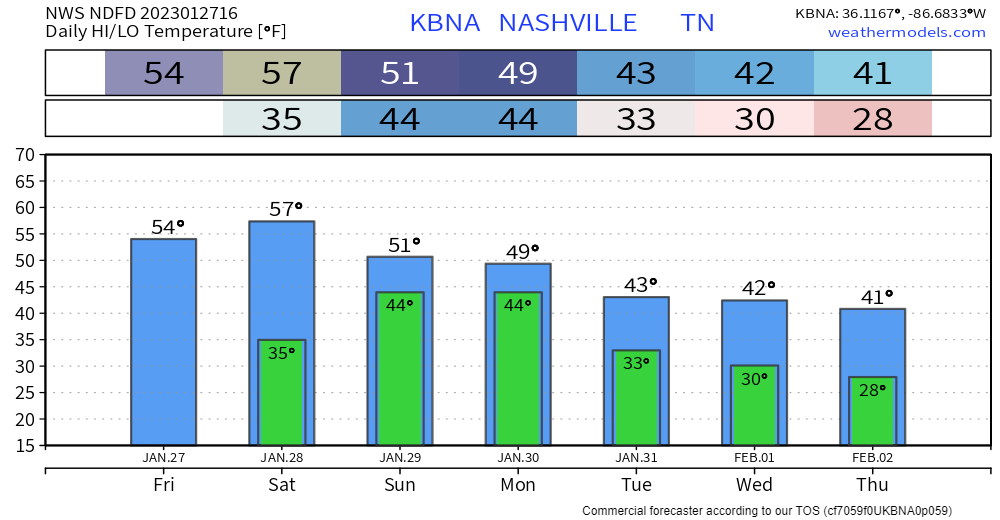
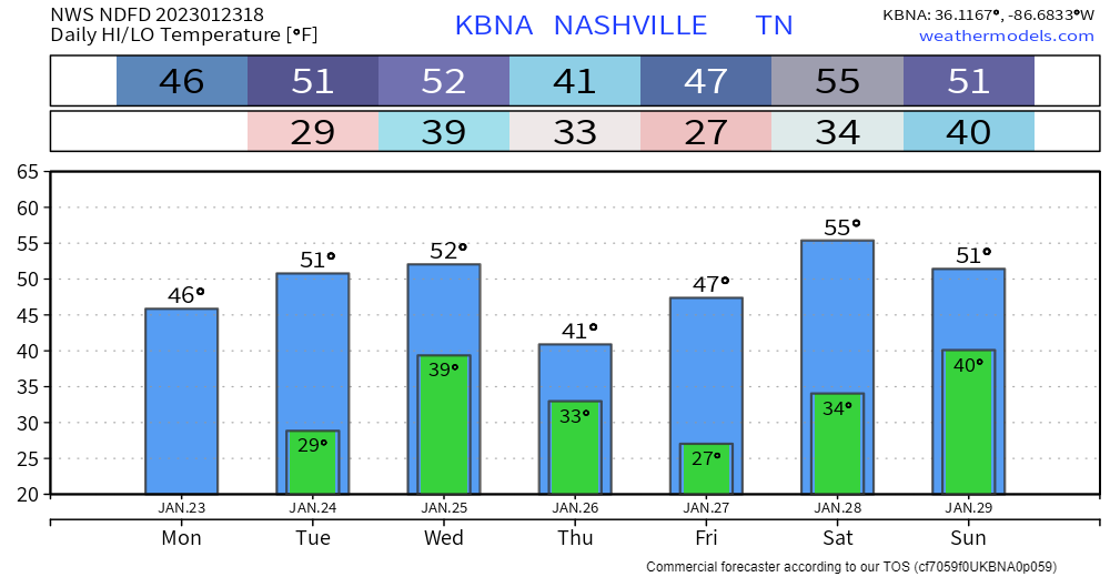
Showers are pretty much gone from this morning, maybe a few more tonight. Clouds will hang around all day.
Maybe some showers Monday morning, shouldn’t be too much of a disruption.
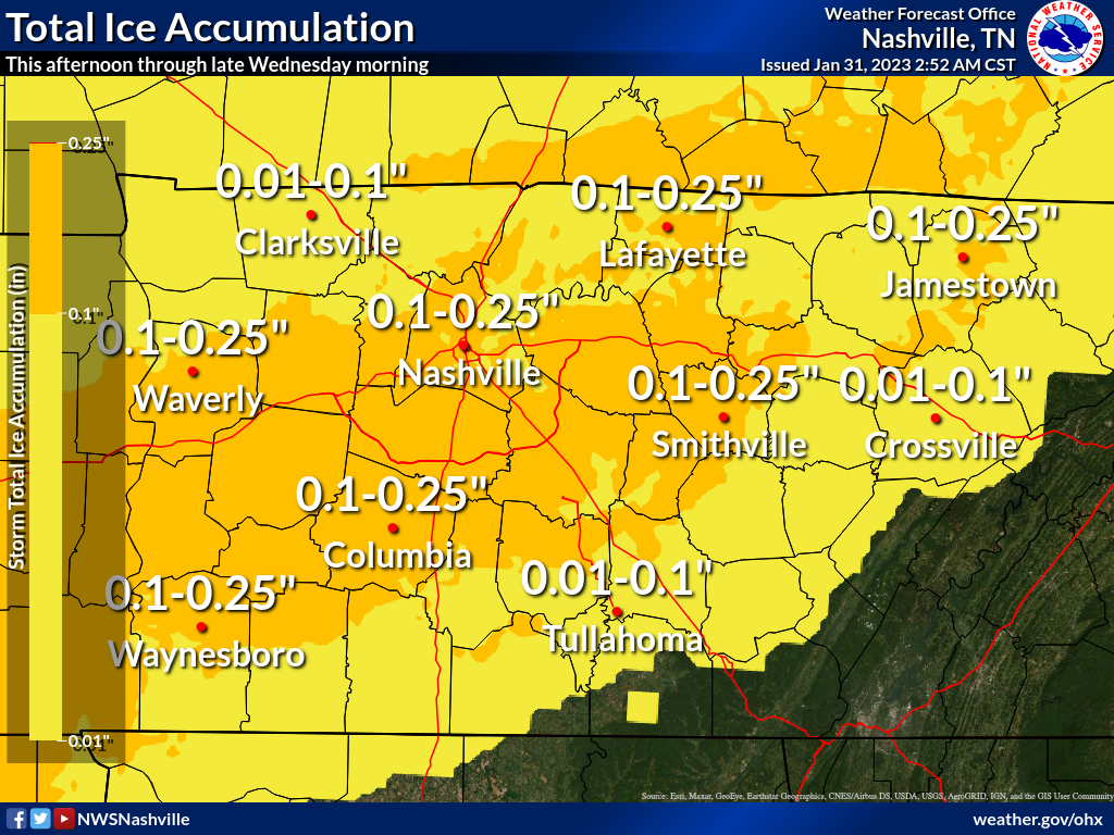
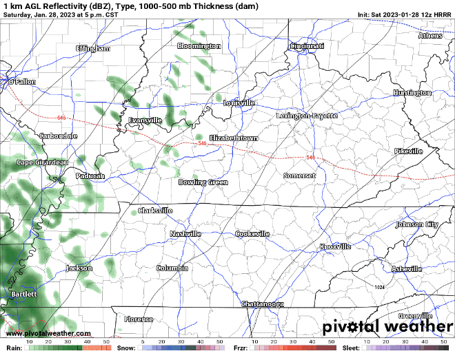
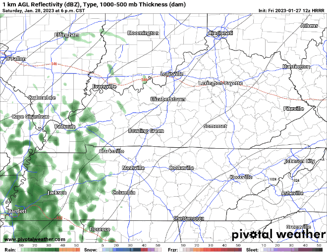
Overnight Monday and into the early hours of Tuesday, some more showers move in. Temperatures look to be around 31-32°, however our pal Ned will create a nose of warm air just above the surface, making precipitation fall as rain and potentially freezing on contact with the ground. Precipitation should stop before Tuesday rush hour, but some minor impacts are possible with the freezing rain. HRRR model, below, gives its best guess at what it’ll look like. read more


You must be logged in to post a comment.