
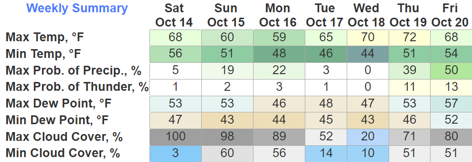
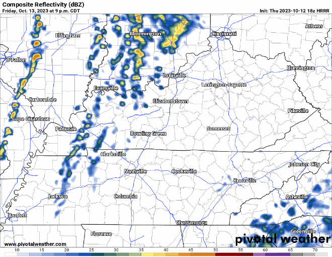
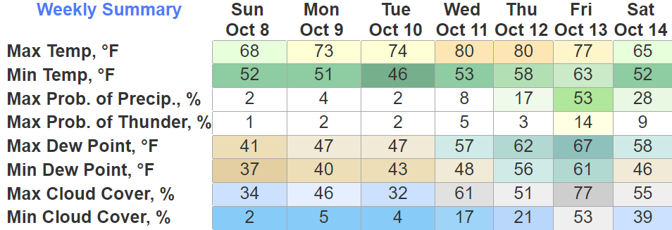
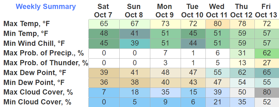
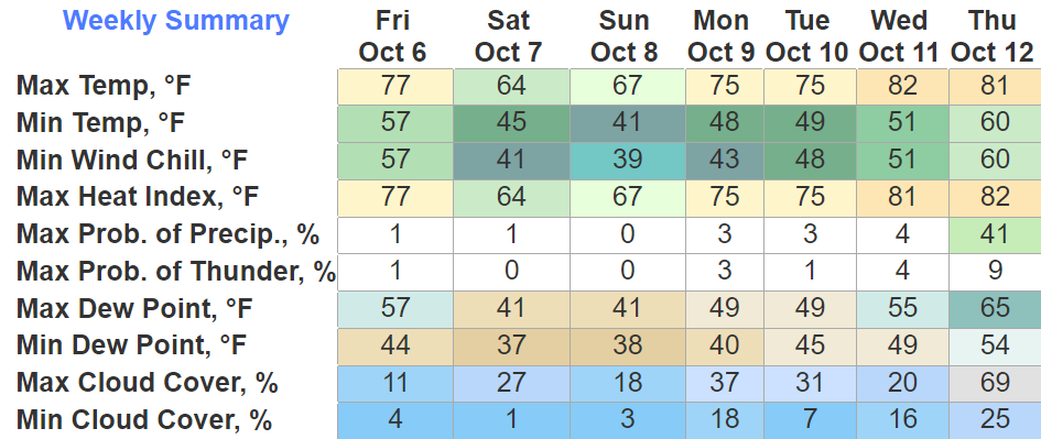
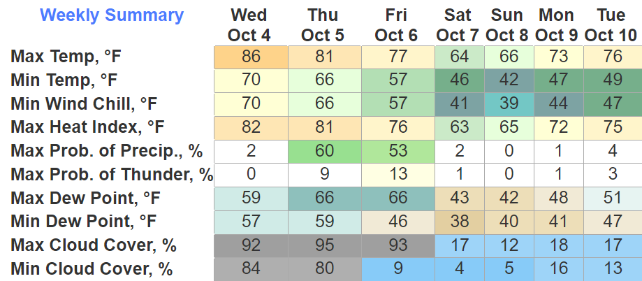
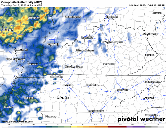
Some cloud cover moving thru may partially block your viewing of the partial eclipse.
Hopefully the cloud cover can move on outta here so we can get a cool viewing.
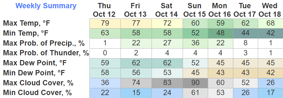
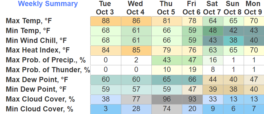
Besides blocking the show, the cloud cover will also help keep our temps down in the 60s today. Bring a sweater to your viewing party.

You must be logged in to post a comment.