Another nice day, doesn’t seem like late October tho, and it won’t for the next few days either.
We finally get something to talk about Friday, when rain chances *finally* come back around.

Another nice day, doesn’t seem like late October tho, and it won’t for the next few days either.
We finally get something to talk about Friday, when rain chances *finally* come back around.
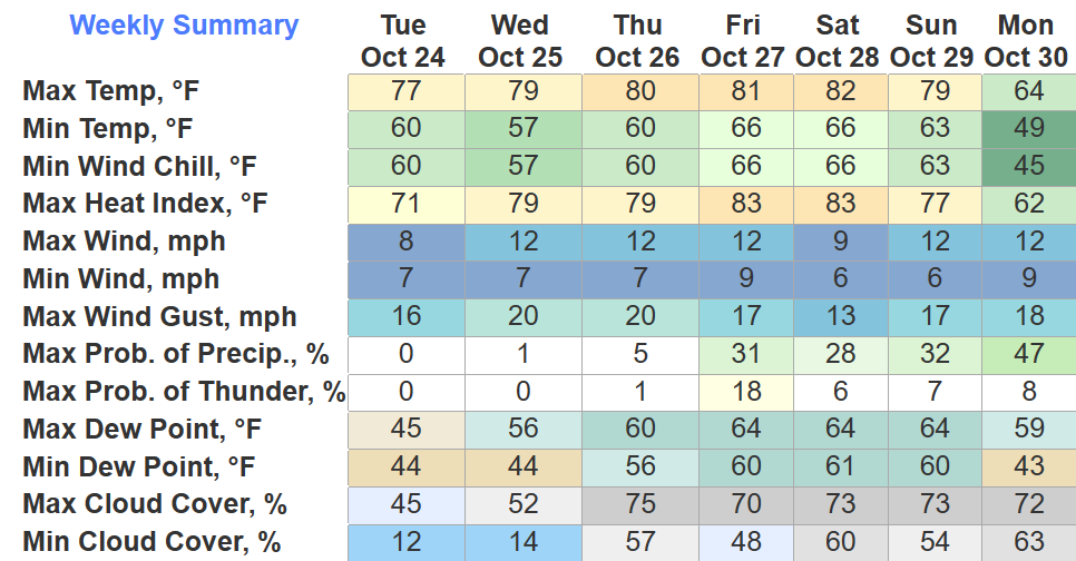
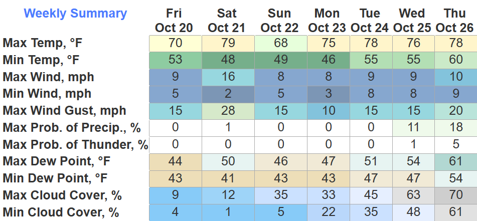
If you were to solely look at the high temps for the next seven days, you would probably not guess this is a forecast for late October. Well, here we are.
Temperature-wise, we stay very steady for the forecast. Upper 70s/low 80s for high temps, with a jacket being required in the morning.
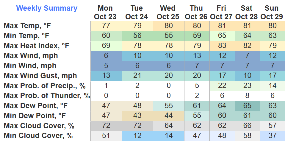
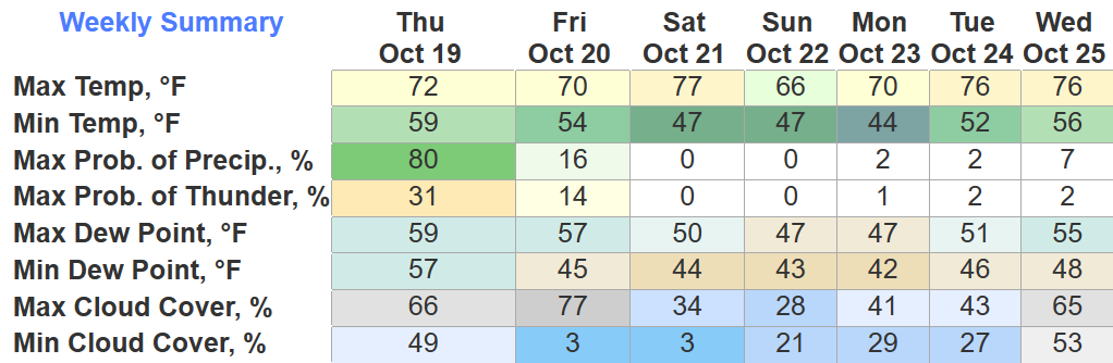
Temperature wise, this week looks great. Maybe even a little too warm with high temps reaching the 80° mark by Thursday – around 10° above average. Dewpoint slowly increase throughout the week, getting slightly muggy by the end of the week.
Not too many complaints for today besides it being a bit too gusty. BNA has had several gusts in the 20-25mph range, and these will likely continue until later this evening.
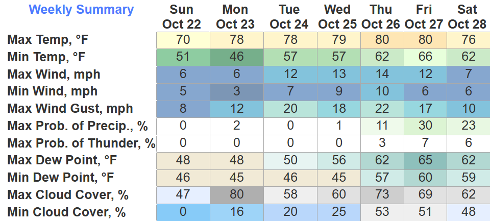
Sunday will be the coolest day of the next 7 with high temps struggling to reach 70°.
No news is good news I suppose. Very quiet weather pattern upcoming.
High temps near 80° tomorrow and it’ll be a bit gusty, particularly in the afternoon + evening, with wind gusts up to 30mph possible. Might want to secure outdoor furniture and 88-pound aunts.
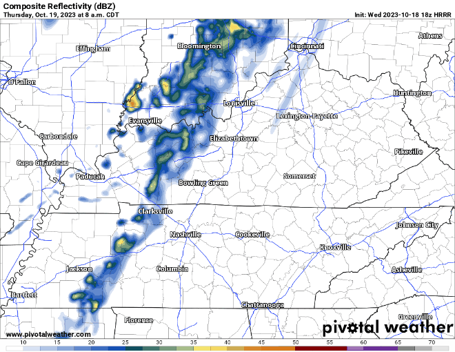
Some of us have seen heavier storms today, some of us haven’t seen much at all. Some more showers/storms will continue to move thru for the next couple hours. You can always check the radar here: Radar – Nashville Severe Weather
Another beautiful day today, unfortunately the same cannot be said about tomorrow.
Looks like there will be two lines of showers. First one looks to arrive around mid-morning – just some light showers.
The clouds are finally moving out; thus allowing us to cool down and wake up to a chilly morning. Tomorrow will be a bit warmer thanks to the big yellow light in the sky showing out.
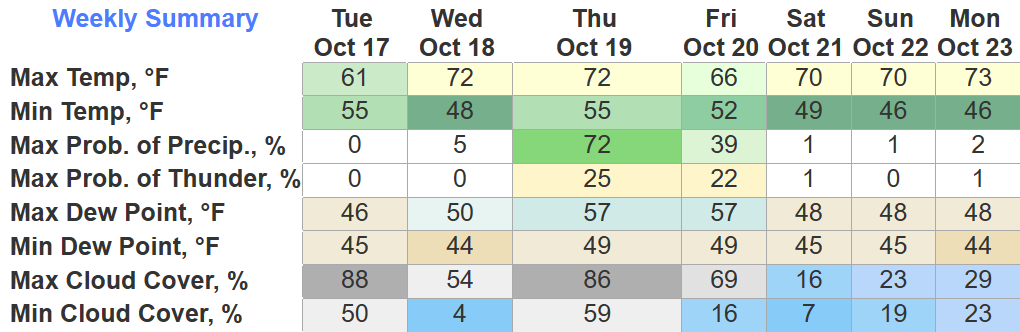
Rain chances pick back up Thursday, models show most of the rain during the back half of the day, but we’ll have to wait and see for specifics.
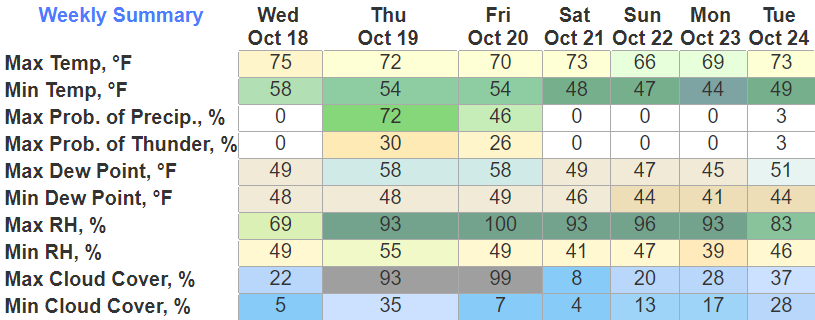
Drizzle is moving out, and the clouds will finally break around midday tomorrow; this will allow temps to get up into the mid 60s.
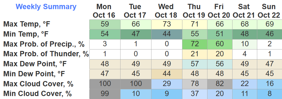
Temps continue to climb into the 70s Wednesday and Thursday, but this will also come with some decent rain chances.
Very dreary, drizzly day. Hey fall.
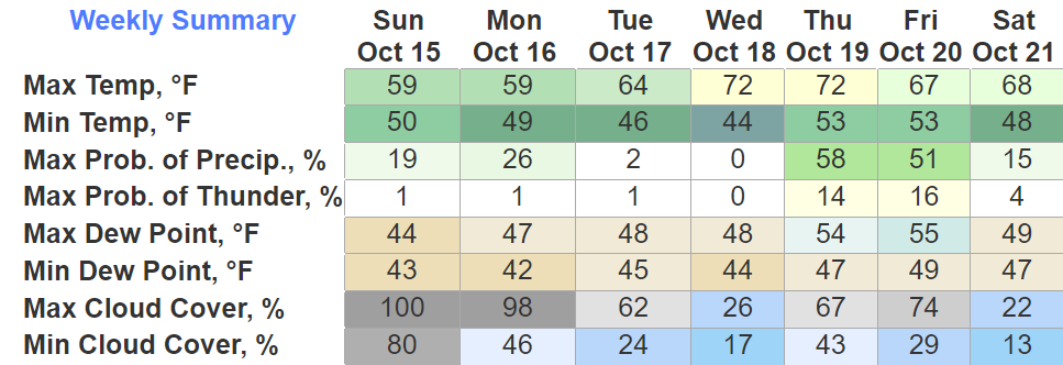
Very similar conditions Monday, cool temps, on/off drizzle. Drizzle chances dimmish Tuesday.
We see the 70s come back Wednesday and Thursday. Rain chances come back around Thursday night into Friday. Should clear out before your Friday night activities, but too far to know fo sho.
You must be logged in to post a comment.