
Another nice day, doesn’t seem like late October tho, and it won’t for the next few days either.
We finally get something to talk about Friday, when rain chances *finally* come back around.
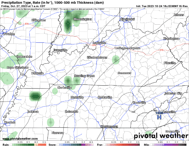
The EURO model (above) shows some decent rain moving thru our area Friday, still too early to nail down a specific ETA, but generally sometime during the day. No severe weather expected, but maybe a rumble of thunder.
Rain chances stay low, but still existent throughout the weekend (no rainouts expected) until a cold front comes thru at some point. The current thinking is at some time Sunday or Monday. This cold front would bring 1) showers 2) some legit fall weather back.
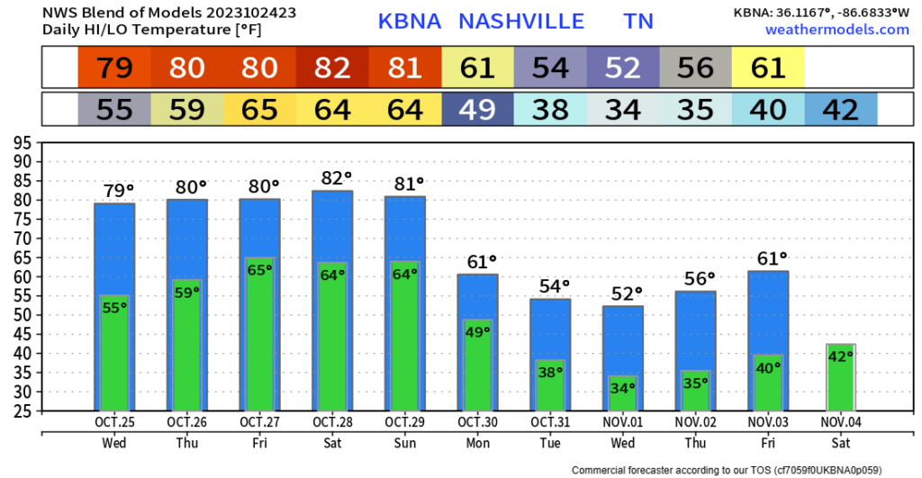
Looking at the Blend of Models, it has a good clear line of when that cold front comes on thru. Bringing in our first potential chance at a frost/freeze as November comes around.
As of right now, trick-or-treating looks cold, but dry. This is still a week away, so we are still in itsanyonesguess territory.
Quick References:
Weather changes constantly.
Follow @NashSevereWx on Twitter for any changes to this forecast.
Live coverage during tornado and severe thunderstorm warnings:

Look good.
Support the mission.

We are 100% community supported. No ads. No subscription fees. Keep it free for everyone.


Categories: Forecast Blogs (Legacy)
You must be logged in to post a comment.