
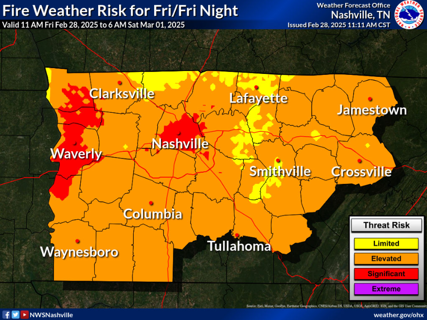
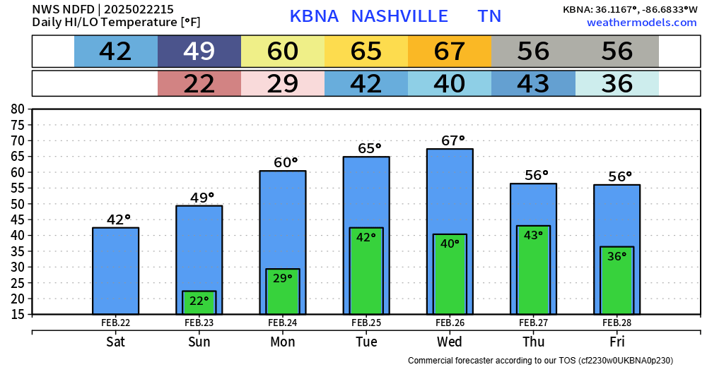
Outdoor burning continues to be discouraged, with gusty winds and low relative humidity values expected thru this evening.
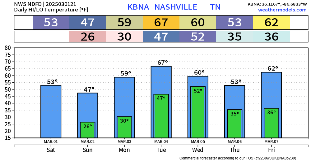
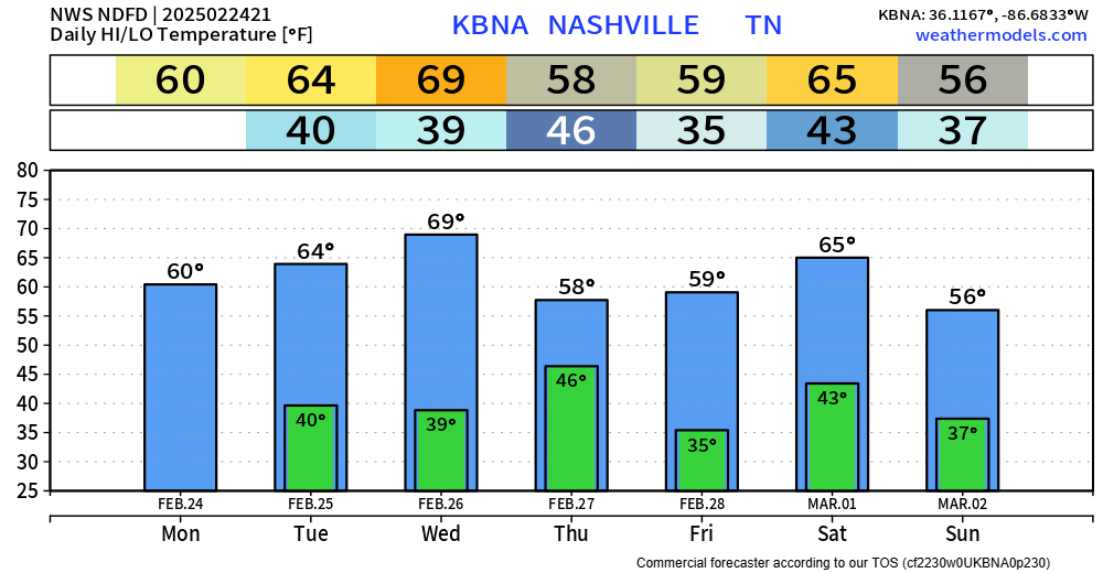
Skipping ahead to Tuesday.
Not much has changed. We continue to be outlooked with a 15% chance of severe weather within 25 miles.

You must be logged in to post a comment.