“Soup-er” Cold, Warmer Weekend

Current Official Hourly Observation (taken at :53 on the hour) & Radar

“Soup-er Cold.”

Because you’re gonna want to eat some “soup” to warm up!

(Editor’s Note: Honestly, I can’t think of anything better than The Intern’s soup joke. I would be a dead man had I made that pun during a guest appearance on the Andy Gibb Talk Show. For this I BLAME WINTER). read more

NWS Week-Ahead Conference Call: No Accumulating Snow Expected

Light rain will continue today, ending sometime tonight.

An arctic cold front will arrive tomorrow night with rain + non-accumulating snow. A few flurries may be flying Wednesday, but no travel impacts are expected here. read more

Tuesday Night Dusting? Maybe.

Current Official Hourly Observation (taken at :53 on the hour)

Tonight – Increasing Clouds – Midnight Temp 45

Clouds will gather overnight. Rain is on the way.

MondayRain – Morning Low 41 / 55 Afternoon High read more

Rain Overnight; Mild January Weekend; Snow Wednesday?

TonightRain – Temps in Mid 50s

Officially, rain should arrive around 9 PM, and continue into the wee hours of Saturday morning. The HRRR thinks it’ll start later than that, around 1 AM or 2 AM. The time is in the upper right corner in EST (so subtract one hour): read more

Cold 48 Hrs, Wintry Mix/Rain Late Wed-Early Thu

Current Official Hourly Observation (taken at :53 on the hour)

Today – Afternoon High 9, Overnight Low 4

Precip. A few flurries will fly today, but no meaningful accumulations are expected.

Winds. Will start to die down tonight and tomorrow, relieving us of the more extreme wind chills. read more

Tonight & Tomorrow

Current Official Hourly Observation (taken at :53 on the hour)

8:40 PM Update

Our NWS issued the following statement at 8:32 PM:

Read the full statement here.

Also watching much lighter snow than we saw earlier tonight work SE down I-24. Radar at 8:29 PM: read more

9 AM Update - 1″ Snow, ETA 6-9 PM, Bitter Cold Mon/Tue

9:00 AM Update

We have new forecast graphics.

Looks like a pretty nice day! Keep reading.

Snow ETA is 6 PM to 9 PM, but could be as low as 5 PM.  Rain should begin before then (around 4 PM or so). read more

Sunday Snow, Then Dangerously Cold Temps - Coldest in 20 Years

At 3:05 PM, our NWS issued a Special Weather Statement titled “Anywhere from 1″ to 4″ of Snow Possible Sunday Afternoon and Evening.” The 4″ is more likely for the plateau and counties north of Davidson Co. Click here to read the statement. Much of what it says is covered below. read more

Tomorrow’s Dusting/COLD & Sunday Snow/Monday SUPERCOLD

This afternoon’s weather “is the warmest we’ll see for quite a while.” (NWS).

Thursday

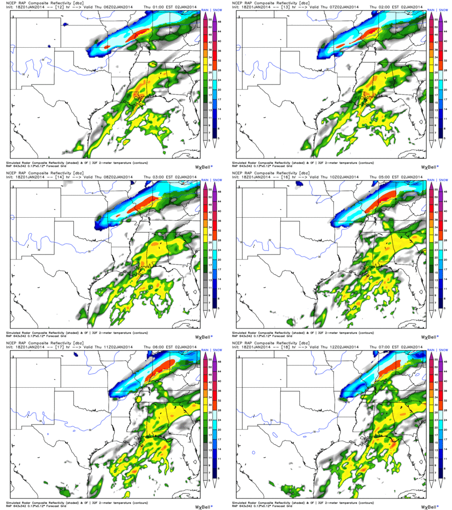
The RAP shows the rain-changing-to-snow approaching tonight, Midnight to 6 AM:

Most of the rain will fall before the freezing line pushes through: read more

Dusting Thursday + Crazy Snowmageddon Rumors Sunday-Tuesday

Thursday

GFS Model

A cold front arrives Thursday morning, pushing rain out ahead of it, as shown by the GFS model:

Around noon Thursday, the cold front pushes through middle Tennessee, changing the rain to snow: read more