Current Observations and Radar (refresh to update)


Tonight – Few More Spits of Rain
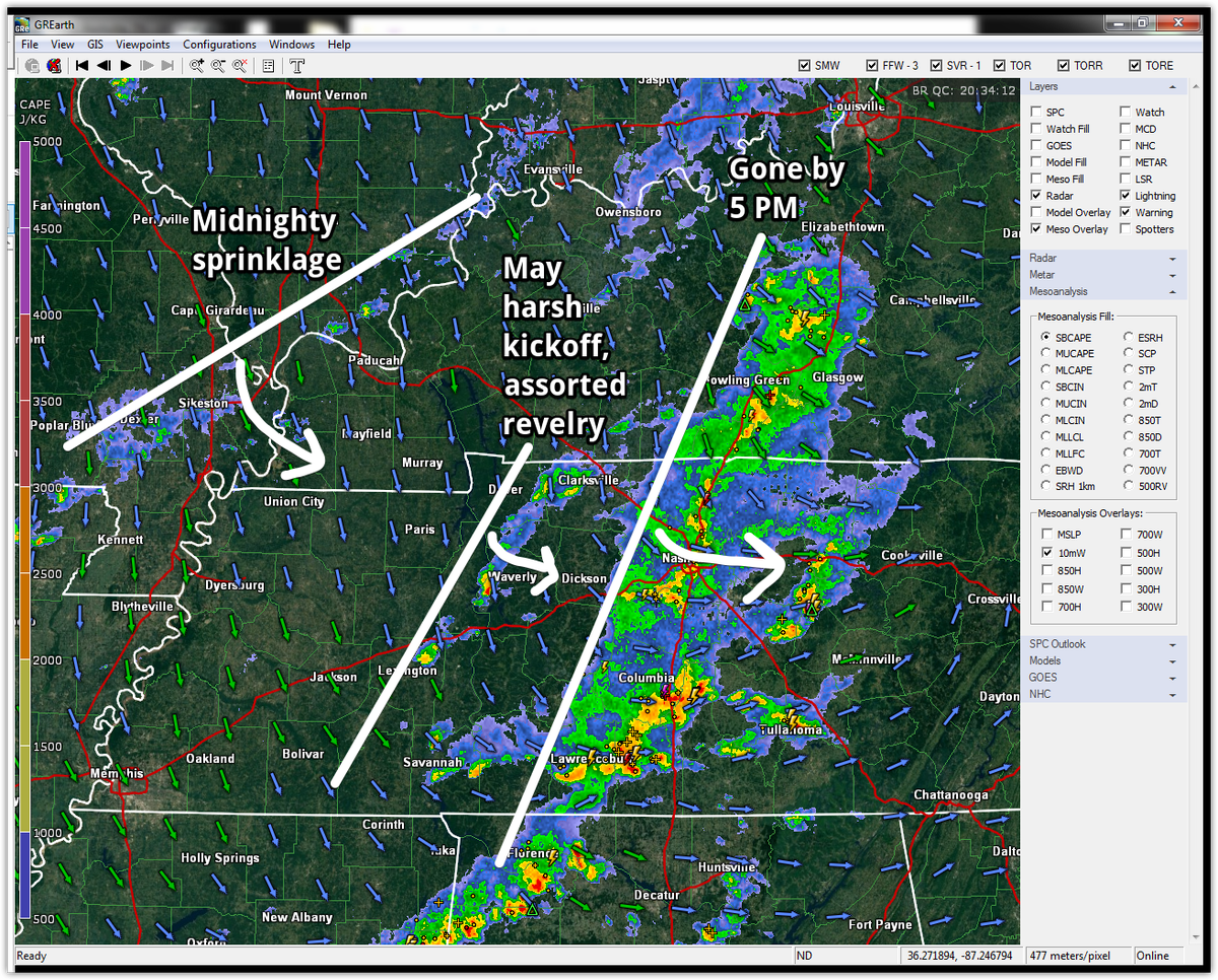
So, bring a rain jacket or umbrella, but the lightning will be gone by dark.
Saturday – Lingering Rain? – High 71°
We should be pretty clear, although cloudy, in the morning.
As cooler, drier air pours in from the north, an upper level disturbance will swing down the back side of the departing trough. This will cloud us up and may bring intermittent rain in late morning and into the afternoon. It shouldn’t be much, but the weather models are calling for it. read more