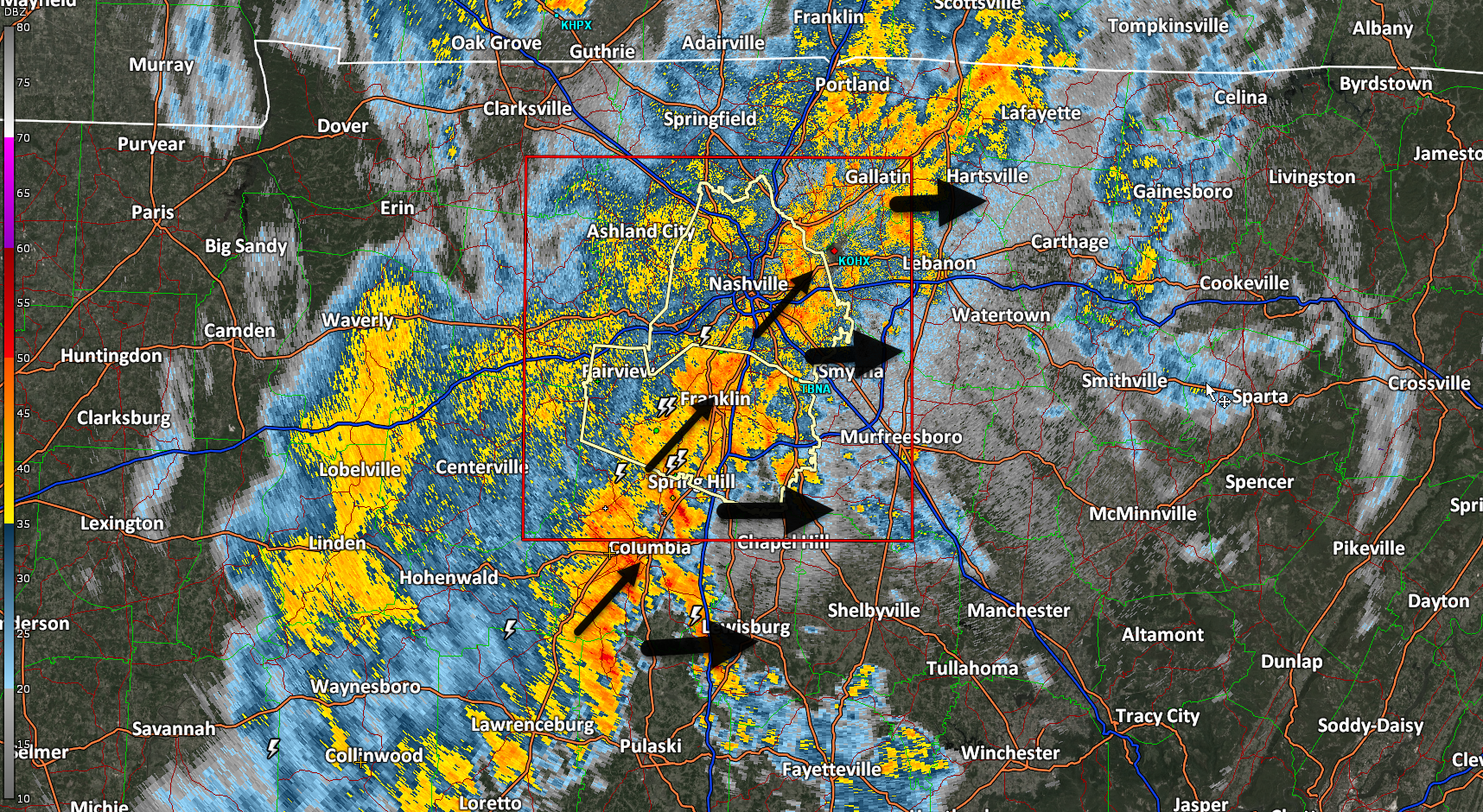
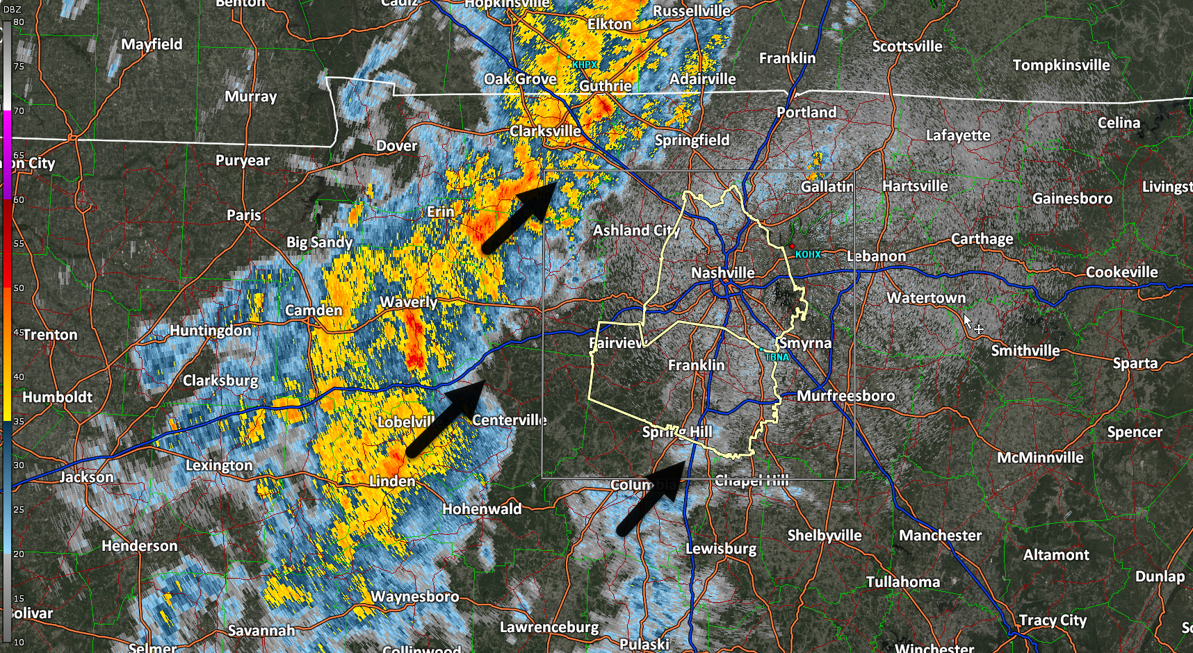
Few lightning strikes, some those house rattling positive strikes. Most of us will sleep thru it. No severe weather worries tonight. Get some sleep. Rain gone by morning commute. Radar from 1205 AM
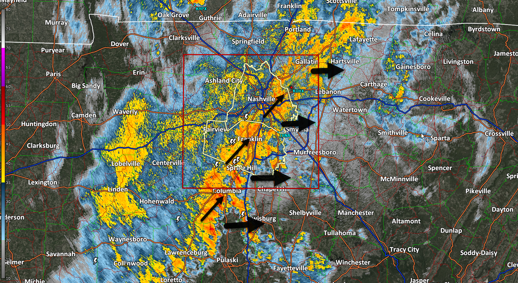

Few lightning strikes, some those house rattling positive strikes. Most of us will sleep thru it. No severe weather worries tonight. Get some sleep. Rain gone by morning commute. Radar from 1205 AM

Sleepytime lightning possible overnight. Think most of us will just hear the rain. No severe weather concerns. 939 PM
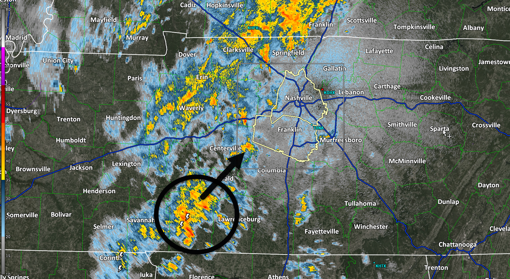
No lightning detected anywhere close to us at 8:12 PM. Will take a few hours for the heavier rain to slide east over us. No concerns tonight, y’all, no severe weather.
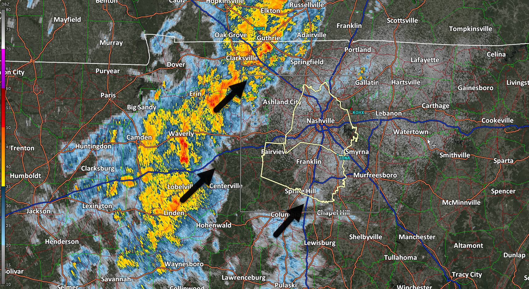
Activity should ramp up over the next couple hours, bringing in some showers and sub-severe storms. Maybe a few rumbles of thunder and some gusty winds, but nothing of concern. HRRR model below shows the story.
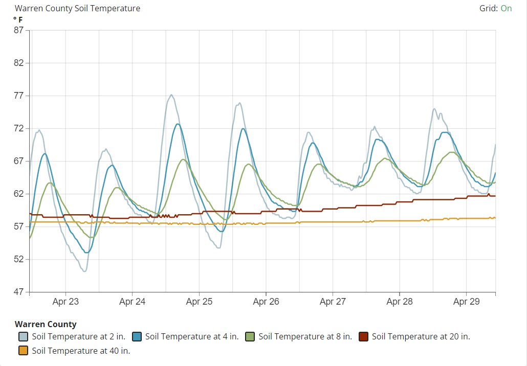
Cicada invasion soon. Little buggers [NOTE: language sanitized] emerge with ground temps at 64F. Closest reliable data source to us – from the KY mesonet in Warren Co KY – shows their soils getting close to the magic number. We are probably a little bit warmer here, being further south. Our forecast has 87F and 89F temps Wed & Thu. So expect them to start showing up this week. Some of us have already seen them. I lived through the invasion in the 80s and it was not pretty. Pro tip: avoid perms, keep it tight, because those lil buggers [again, language sanitized] will pull up in your hair, shoutout to my screaming mother. Also if you have a vehicle with a big front grille, invest in a pressure washer.

Rain, few thunderstorms to begin after dark. HRRR guesses ETA 8-9 PM. Heavier rain after midnight. Lightning only hazard. No hail, damaging winds, or tornado forecast. ETA sunrise Tues.
High temperatures will get into the low 80s Monday before some rain/storm chances arrive.
HRRR model (above) has a rough ETA of 7-9 pm Monday. A few rumbles of thunder are possible, but no severe weather is expected. Majority of the activity should be to our east by rush hour Tuesday morning.

Windy yet very warm day today. Wind gusts up to 25 – 30 mph will be possible throughout the day but expected to stay below Wind Advisory levels.
Sunday will be very similar, a tad less windy though. Good viewing weather for the Preds bounce back game.
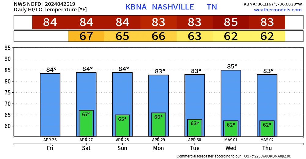
Very warm upcoming week, as high temps will run about 10° above average. We may not see temps in the 50s for the next 7 days.
Very nice Friday evening in store, perfect for watching a Preds dub.

Marathon weather still looks alright. Only hiccup could be a quick sprinkle.
A couple scattered showers are possible starting tonight, lasting thru about mid-morning Friday. HRRR model below paints the picture.
Maybe a rumble of thunder, but meh.
Friday during the day should be lovely, highs getting all the way up into the low to mid 80s.
You must be logged in to post a comment.