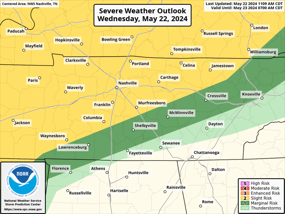
Bad storms Sunday night/overnight: hail, damaging straight line winds, tornado risk.

This afternoon/tonight. Clouds are limiting storm potential. Models think rain will fade through afternoon. Graduations tonight may be OK but we cannot rule out an isolated storm popping up.

Storms overnight should mature over Kentucky and drop south. HRRR model ETA 3-4 AM. Lightning, heavy rain, strong straight line winds main hazards. Tornado risk much further west where only a 2% probability within 25 miles is outlooked. read more

Damaging Wind and Hail Threat This Evening, Active Weather Pattern Ahead

Stormy afternoon and evening ahead of us.

The Storm Prediction Center has outlooked our Davidson and Williamson counties with a:

  • 15% chance of damaging straight-line winds within 25 miles
  • 15% chance of severe hail within 25 miles
  • we are not included in any tornado probabilities, the chances are extremely low but not zero

And not to be forgotten is the flash flooding threat.

Timing:

Coverage of storms should gradually increase over the next couple of hours. read more

Playing the Rain Lottery This Evening, Hot + Dry Start to Next Week

It’s that time of the year where we have no choice but to play the rain lottery. All will enter, few will win.

Rain/thunderstorm chances will diminish as we get closer to sunset. Impossible to know exactly who wins and when, but if you do see some rain, it won’t last forever. Lightning is possible, so if you have any outdoor plans, know where you can head inside and wait it out. read more