
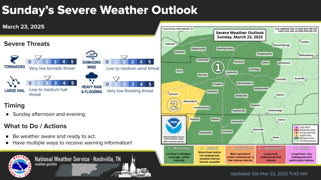
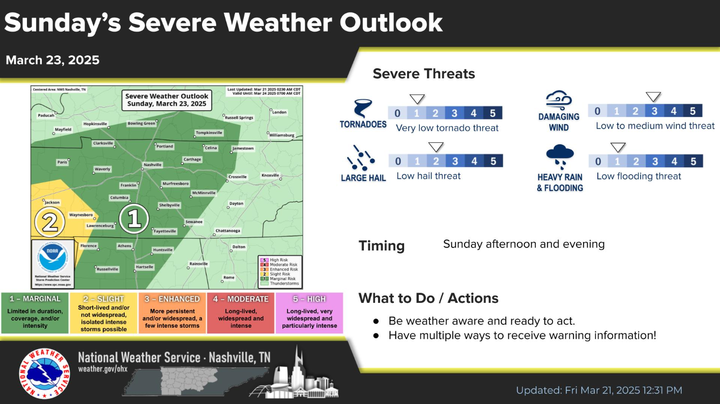
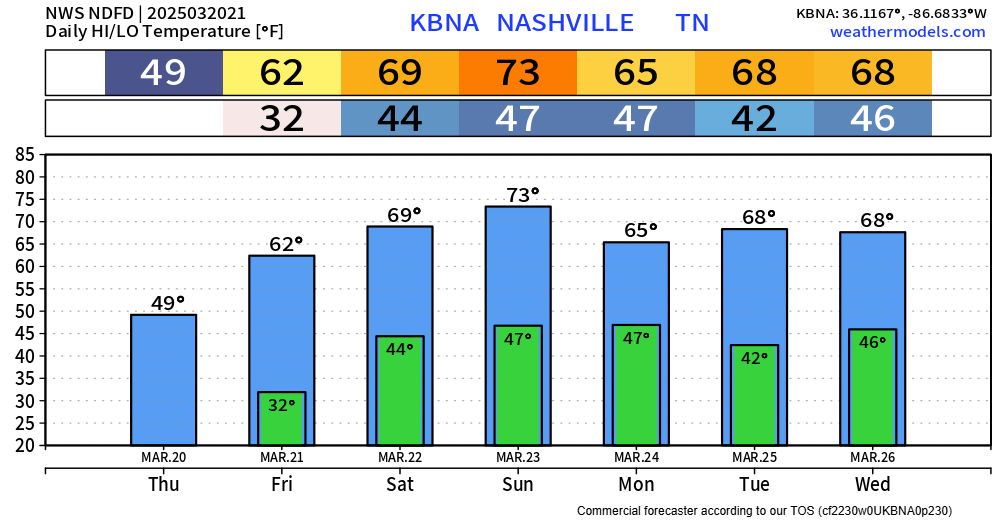
Any outdoor plans now thru midday Sunday look great. Warm temps + dry.
While storms are likely Sunday evening, most of them are expected to stay behaved. But a few may be worth keeping an eye on.

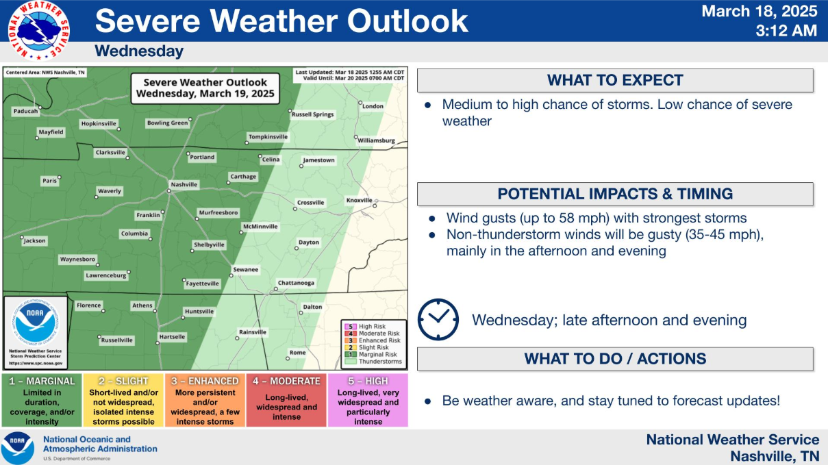
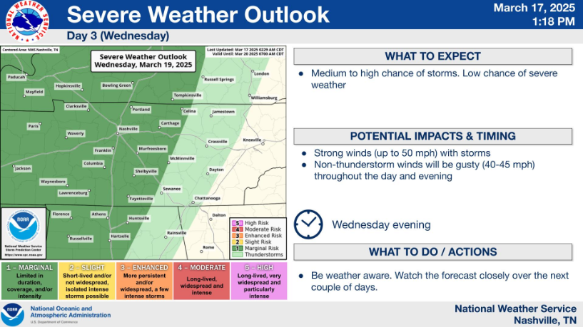
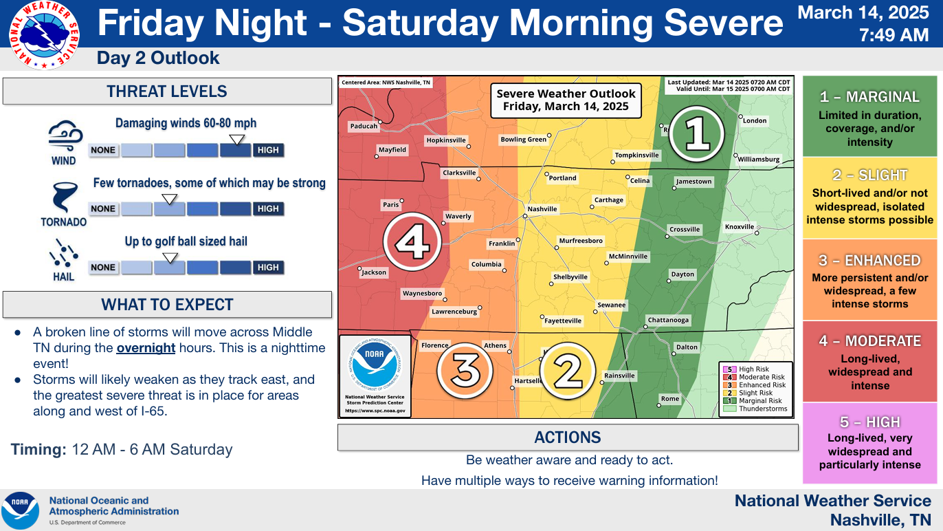
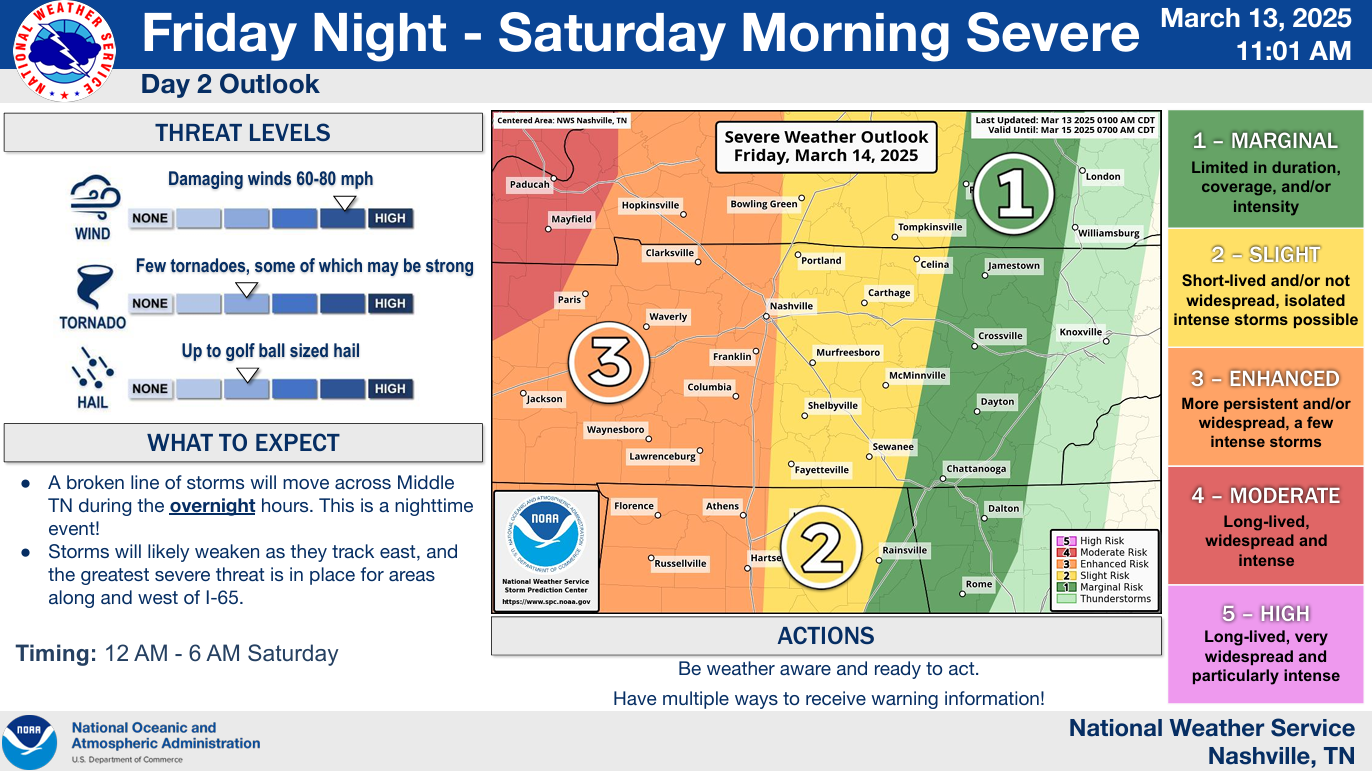
The Storm Prediction Center has our counties outlooked with a:

You must be logged in to post a comment.