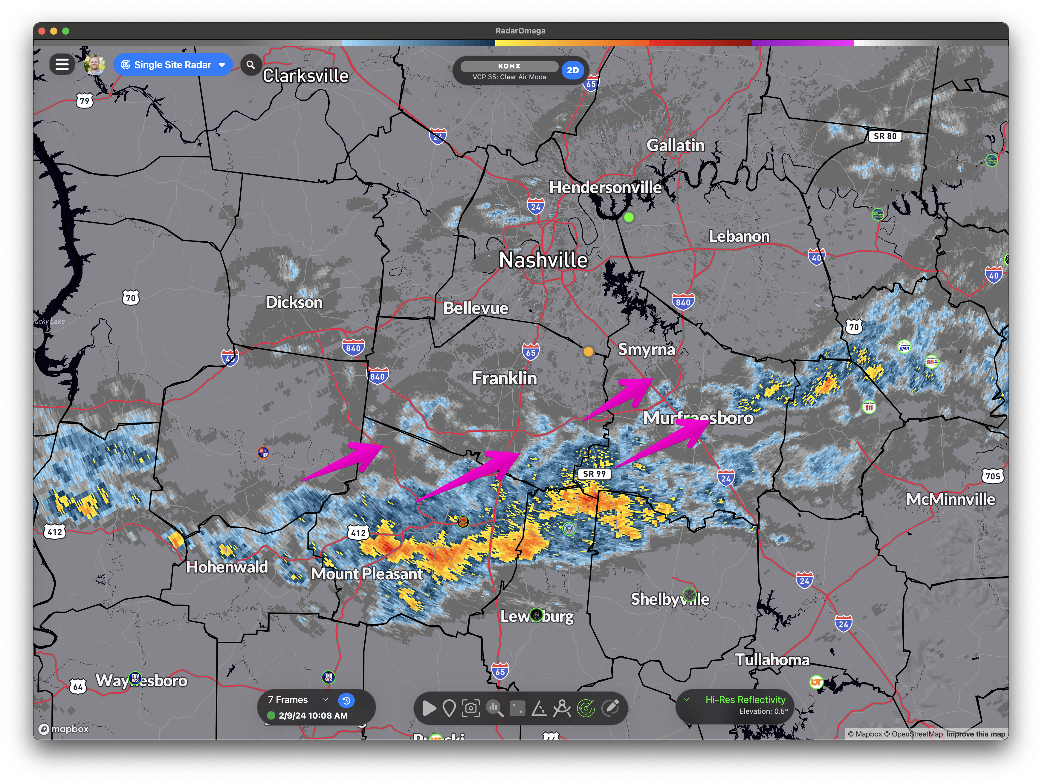
Radar Update 10:22 am: Heavier rain missing us juuuuust off to the SE. Sneaky cell headed our way tho from the SW. Off/On showers continue through the day, some brief moderate/heavy rain possible.
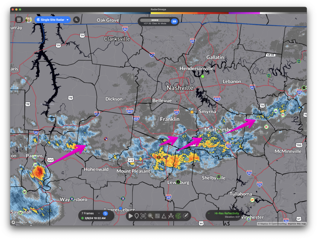

Radar Update 10:22 am: Heavier rain missing us juuuuust off to the SE. Sneaky cell headed our way tho from the SW. Off/On showers continue through the day, some brief moderate/heavy rain possible.
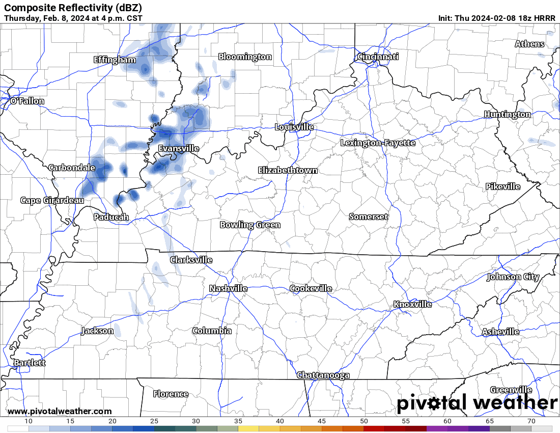
Rain off and on through the weekend. Drizzly, then downpours, then jack squat, off/on, creating difficulties for planners. No severe weather. Golfers pack a poncho. Good luck dodging the dripping. HRRR model attached. Drought continues to lose its grip. More info tonight when Elan logs on. (BTW, we are still working to crush bugs on this new platform. Please keep sending bug probs, we have a large squishing shoe. Future is bright, giddyup).
HRRR model keeps 99% of the rain south of us today.
First Saturday of the month. Monthly test of Williamson County tornado sirens is at 1:00 pm. Just a test.
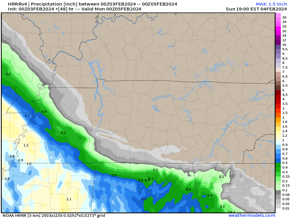
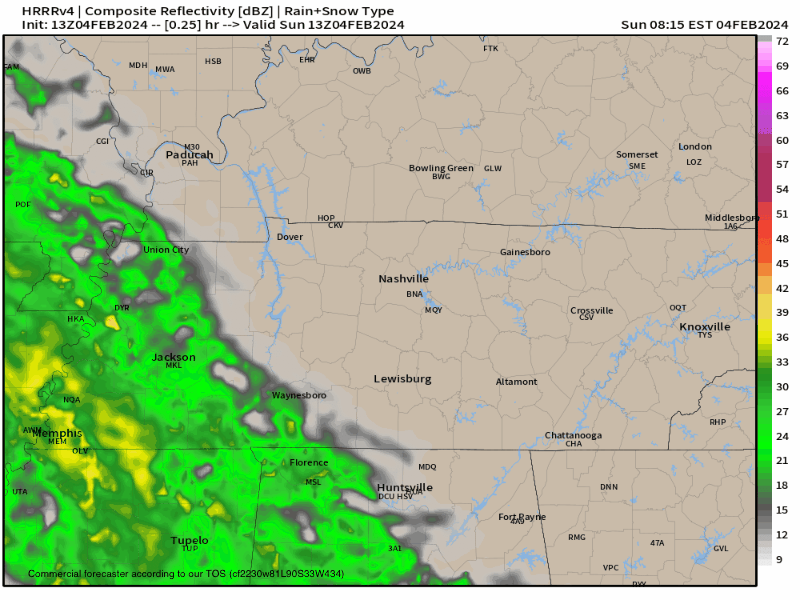
Latest HRRR model run keeps the rain Sunday to our SW. This’ll need an update tomorrow – rain gonna be pretty close.
Bless our mess. New website may be wonky as we debug it. Please report failures and bugs. We’ll squash them. We want this to work great for you.
Winter Weather Advisory 6 PM Saturday to 7 AM Sunday
When the weather balloon went up just after 5 AM, it was 14°; however, there was a large “inversion,” a fancy weather word that means it’s warmer overhead than it is down here on the ground. Temps from 5,000 feet all the way up to 10,000 feet were above freezing. Why am I boring you with that? Because it’s a good sign we’re going to warm up today. Sunshine is on the way. High 37°. Some ice and snow will melt.
Final Snowfall Totals range from 10″ in North Davidson County to 2″ in South Williamson County:
We got 8″ at the airport, which set a daily highest snowfall record for January 22. The snowstorm itself was the largest in Nashville in 28 years.
For a giant list of only some of the reports received by NWS all across middle Tennessee, click this link.
I went back through the models and forecasts over the last several days. Some takeaways:
You must be logged in to post a comment.