Category: Tweet

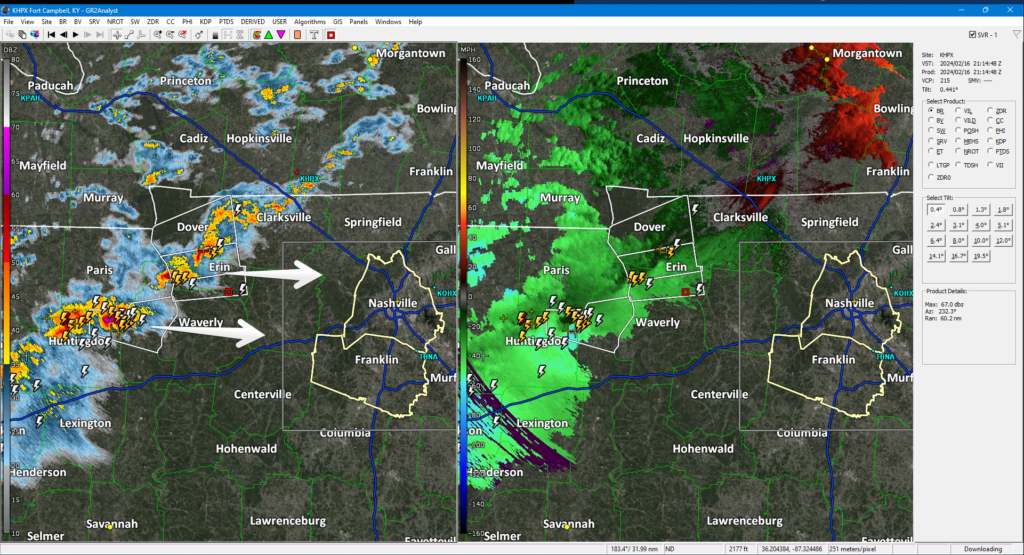
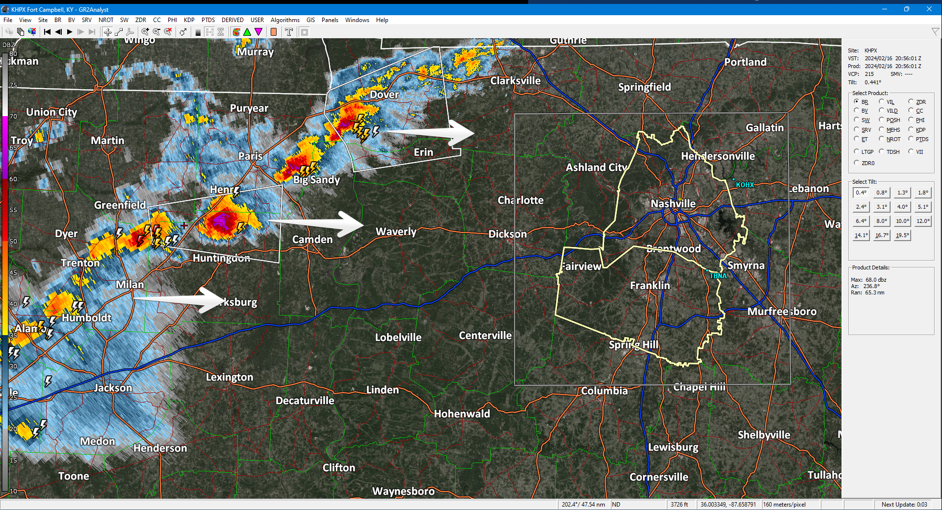
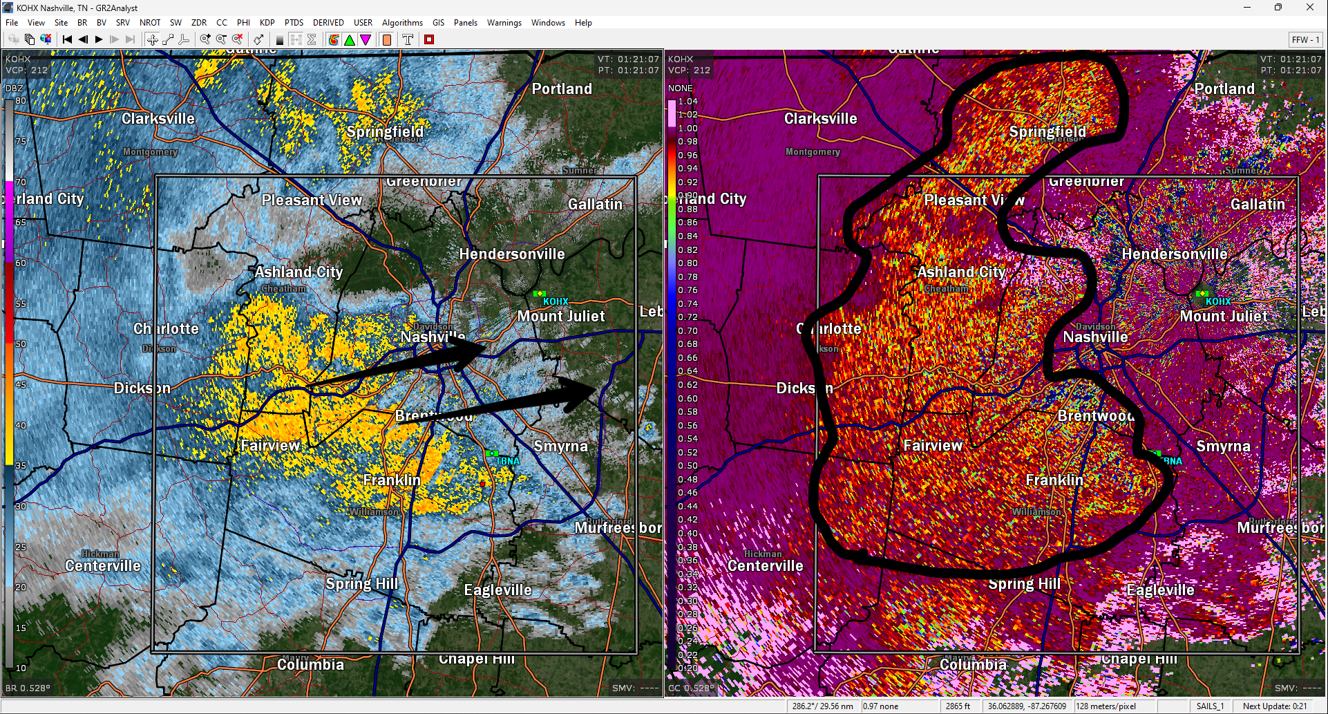
Approaching storm line healthy. Producing frequent lightning. Even rotating at mid levels. Expect here heavy rain, lightning, gusty winds, maybe small hail 5-6 PM, give or take an hour or so.

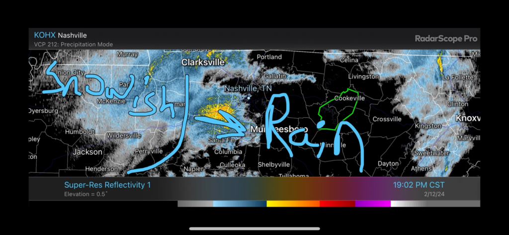
Brace yourself for a drastic temp change. 60°s this afternoon. 30°s before midnight with subfreezing wind chills lasting until late Sunday AM. read more

New HRRR model run, Friday timing. Estimates only. May change:

  • Rain arriving bt 4 PM – 7 PM
  • Rain to Sleet to Snow bt 9 PM – Midnight

Most snow to melt on impact. Little to no accumulation.

Bridges, Overpasses, and Areas at Higher Elevation may be slick late Friday night thru Sat AM. Expecting below freezing temps late Friday night until about 9 AM Sat. Bridges and overpasses are the exception because they cool down way faster than earth. read more

Very little/no snow expected locally tonight.

Deets: Notice the surface low (the red L below) that’s now just passed to our south. It’s racing to Knoxville then Carolina mtns.

This means:

  1. Temps are about to drop fast.
  2. But precip will pull east and away from us quick.
  3. The 700 MB chart shows the base of the trough getting here late, delaying local rain/snow transition.
  4. While flakes may fly, surface temps should be too warm for accumulation.

High elevations may get dusted. 99% of us nah. read more