
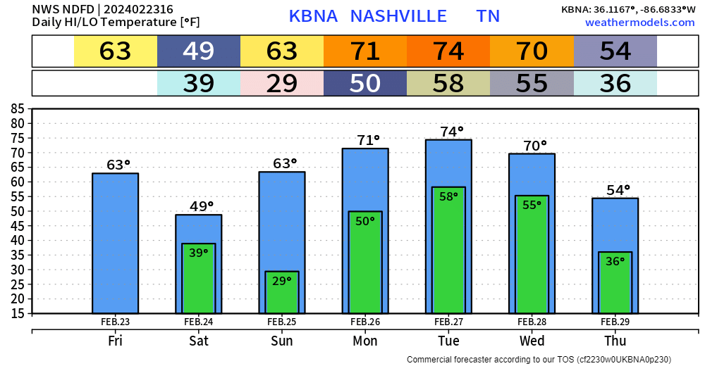
High at BNA got to 76º today. The record is 79º for this date.

High at BNA got to 76º today. The record is 79º for this date.
New Wind Advisory. South winds around 20 mph with gusts up to 40 mph expected. Advisory begins noon Tuesday and ends 6 AM CST Wednesday.
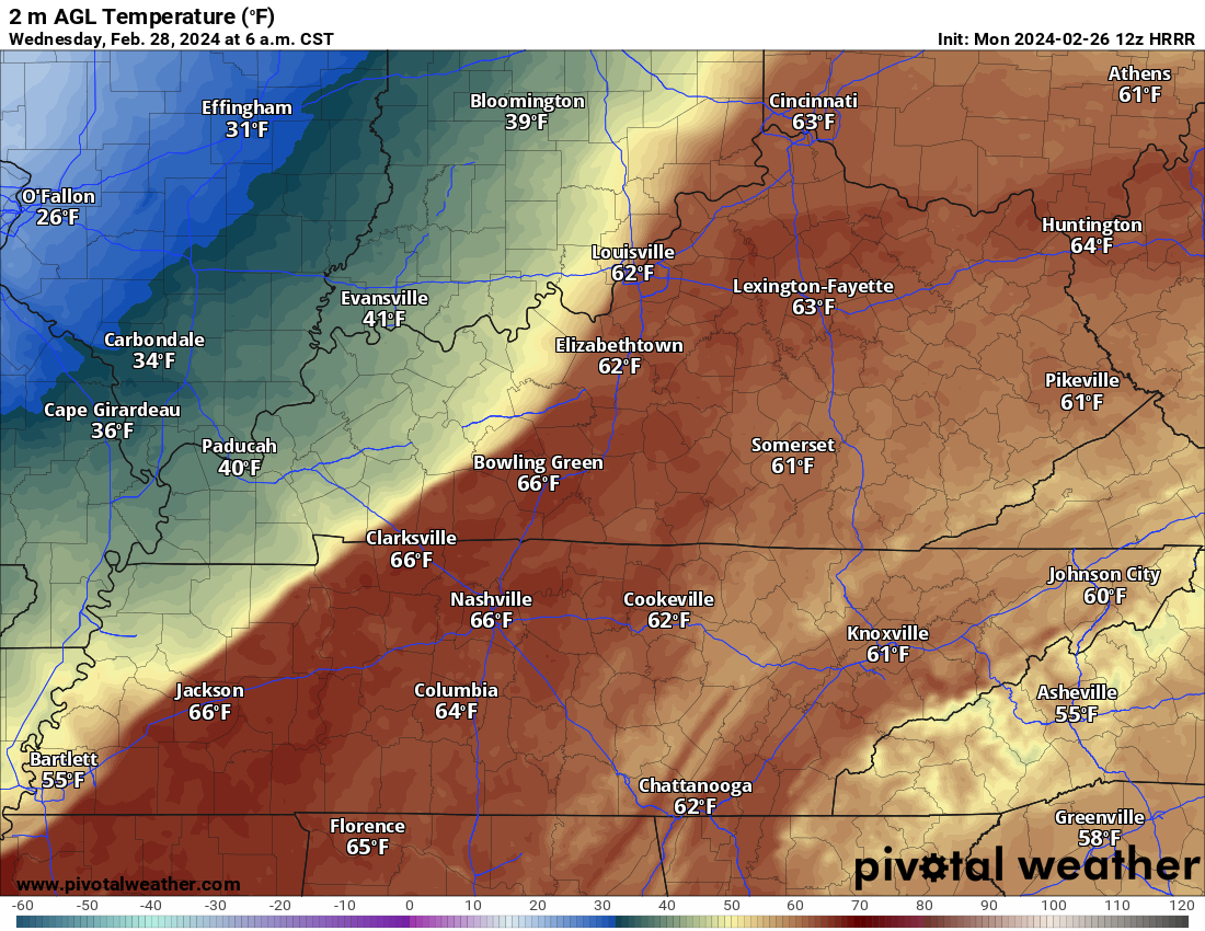
HRRR for 6:00 am Wednesday. Not hard to see the cold front. Temps will fall fast from the mid 60s to the low 40s once it passes during the morning hours.

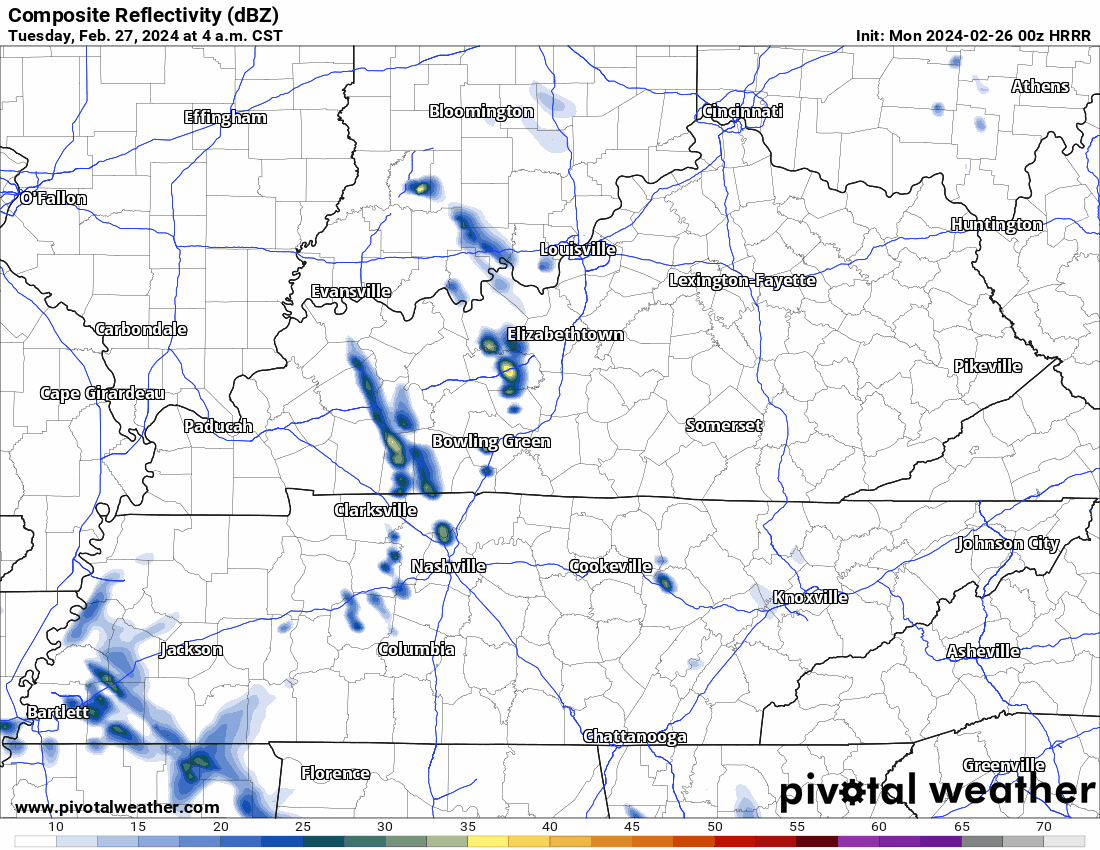
Rainouts now possible for unluckly local fields Tuesday. New (0z) HRRR model delivers narrow area of rainout-level rains (never rely on one model run). This morning didn’t think we’d see rainouts. Now, we might.
We good fam ⚽️ . Looks not great for NYRB tho.


We remain outlooked for severe thunderstorm potential Wednesday. Expect an update after SWAD (ongoing now at Trevecca).
Test -W
Andrew’s made a quick run to a meet and greet at the Nolensville Farmer’s Market. Go by before 1:00 and say hi!
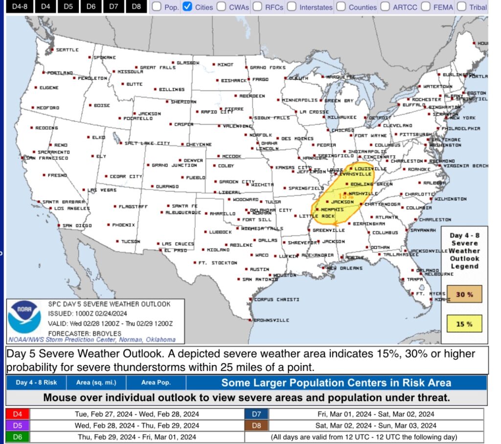
Temps 👇🏽. Want to get right in to severe potential Weds 2/28/24.
SPC outlooked Wednesday, Feb 28, 2024, for severe weather potential.
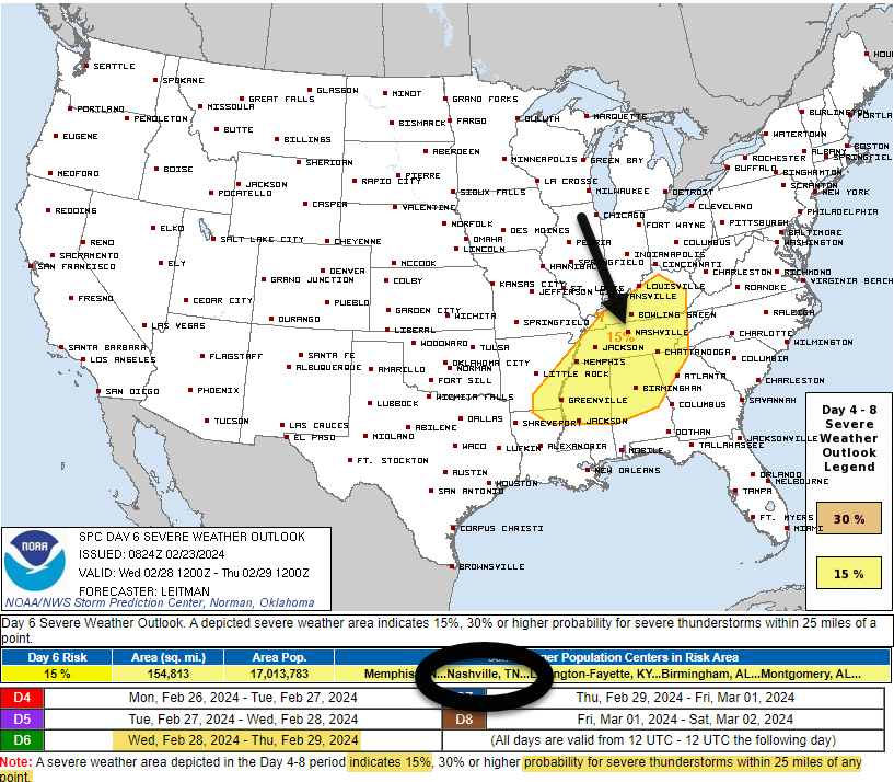
This outlook means 15% probability of a severe thunderstorm (defined: hail, and/or damaging straight line winds, and/or tornado) within 25 miles of you.
Housekeeping: well y’all crashed our site again. We’ve been in process of migrating to a wayyy more robust server. Should complete this weekend. So we’ll let the website smolder now and will go OG and cover this event on X.
You must be logged in to post a comment.