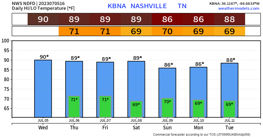
For about the next week we’re looking at your basic summertime pattern.

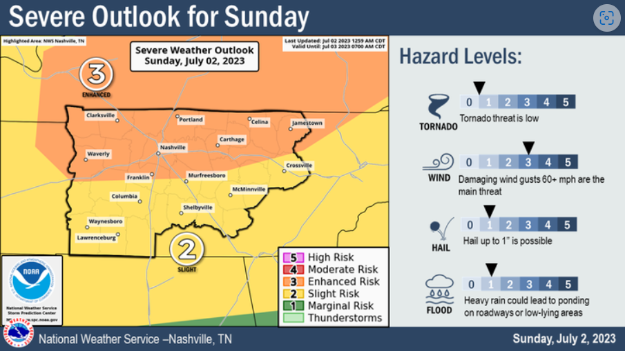
Storm Prediction Center has removed us from severe probabilities today, Wattery chances still possible, although low chances.

For about the next week we’re looking at your basic summertime pattern.
Storm Prediction Center has removed us from severe probabilities today, Wattery chances still possible, although low chances.

Wish I had a better forecast to share for the 4th, but unfortunately that’s not the case.
Before Wattery chances pick up, it’ll be hot. Not last week hot, but still hot. Heat index values will near 100°.
We finally are not outlooked for severe weather today. We should stay dry. Much needed and well deserved. Heat index only in the mid 90’s, also improvement.
Anddd that won’t last long, as the Wattery returns for the 4th.
There’s a chance of severe weather today, which means getting information will be vital. If you reach your “rate limit exceeded”, here are some alternative ways to receive new information. This is based off my personal experience and some ways may not work for everybody.
High temps again in the upper 90’s today, with heat index values pushing 🥵109°🥵 = Heat Advisory from 11am – 7pm.
If you have to be outside, take it easy with frequent hydration breaks. Or pool.

Dangerous heat conditions will accompany us today.
Both counties are under an Excessive Heat Warning from now until 8pm Friday.
“dangerously hot conditions with heat index values up to 112° expected”

We have three consecutive days of severe weather chances and/or dangerous heat. Let’s discuss.
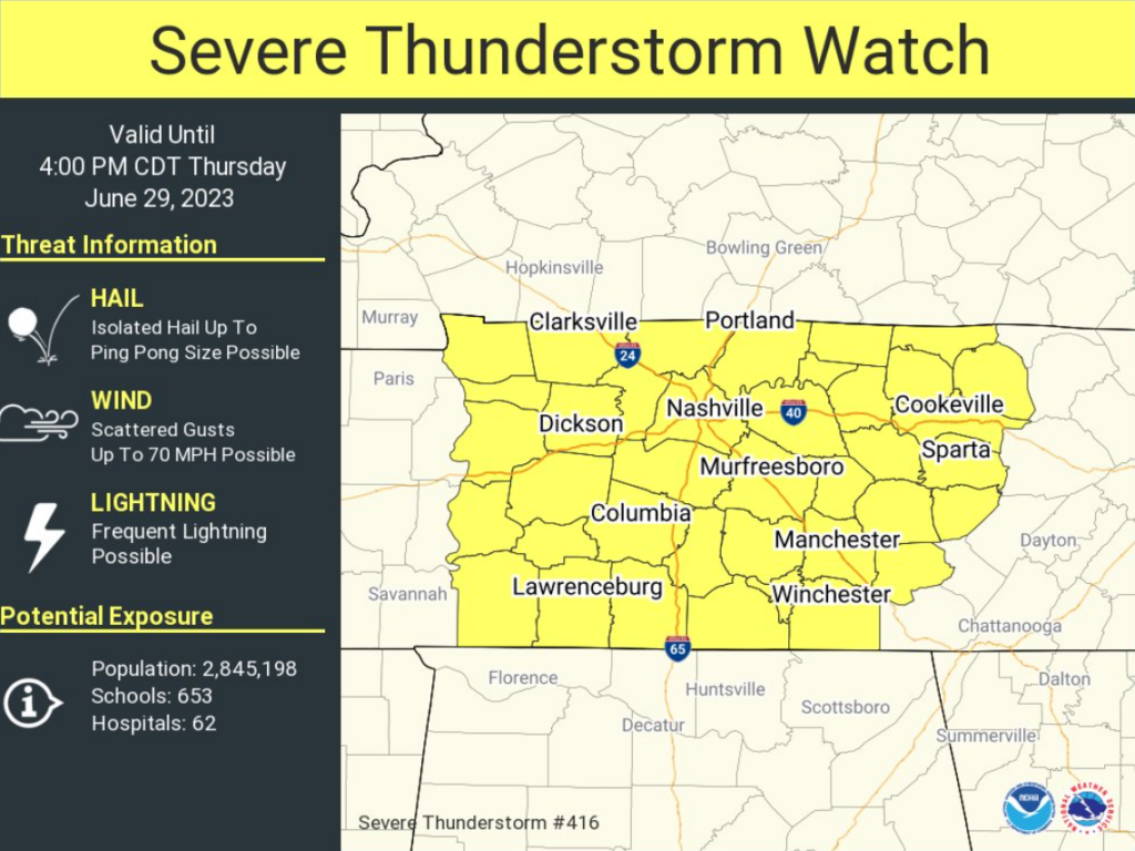
Both counties are under a Severe Thunderstorm Watch until 4pm today. Main concerns are damaging straight-line winds and hail. Not concerned with tornadoes. Updates are constantly flowing, stay connected to our Twitter for frequent updates.

You may see “haze” in the forecast. It’s from the Canadian wildfires.
Likely more noticeable in Davidson than WillCo. No Air Quality Alerts in effect, but people with respiratory issues still may need to take it a little easier outdoors.
If you have yard work, (crunchy) grass to mow, today and tomorrow are the days. No rain chances.
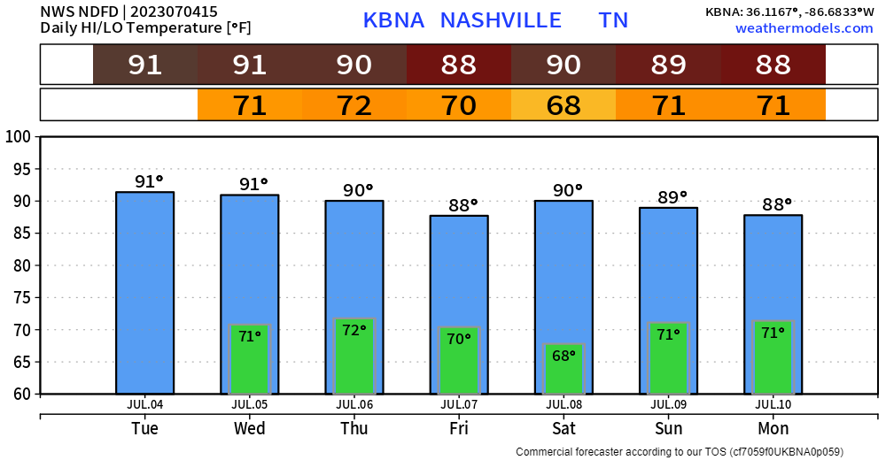
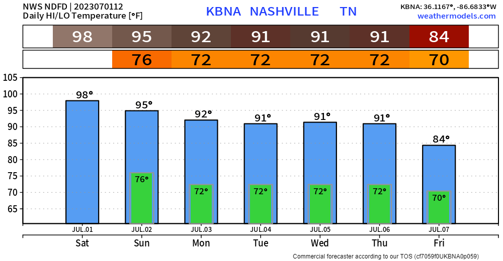
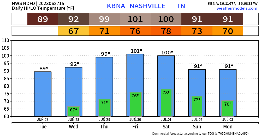
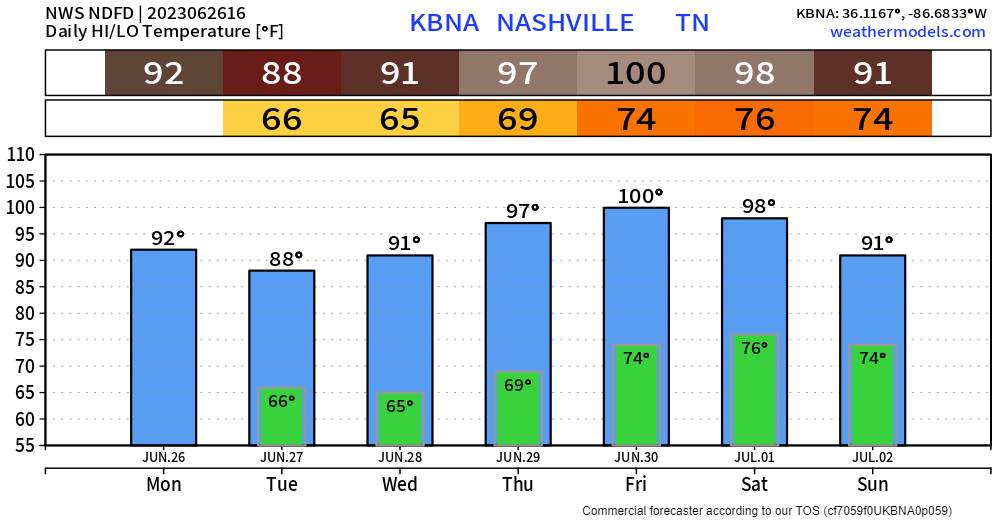
Thursday thru Saturday high temps will be flirting with the century mark.
An Excessive Heat Watch has already been issued for Thursday. I imagine one will be issued for Friday and Saturday. “Dangerously hot conditions with heat index values up to 113° possible.”
Well, I don’t bring much good news.
I suppose I could bring up the fact that it’ll be dry today thru Wednesday.
But some rain would make me say hooray.
I reckon I could say it’ll only be high 80’s/ low 90’s until Wednesday.
You must be logged in to post a comment.