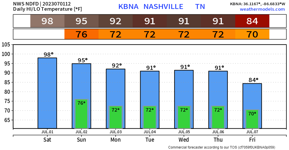
High temps again in the upper 90’s today, with heat index values pushing 🥵109°🥵 = Heat Advisory from 11am – 7pm.
If you have to be outside, take it easy with frequent hydration breaks. Or pool.

We’ll bake unless storms.

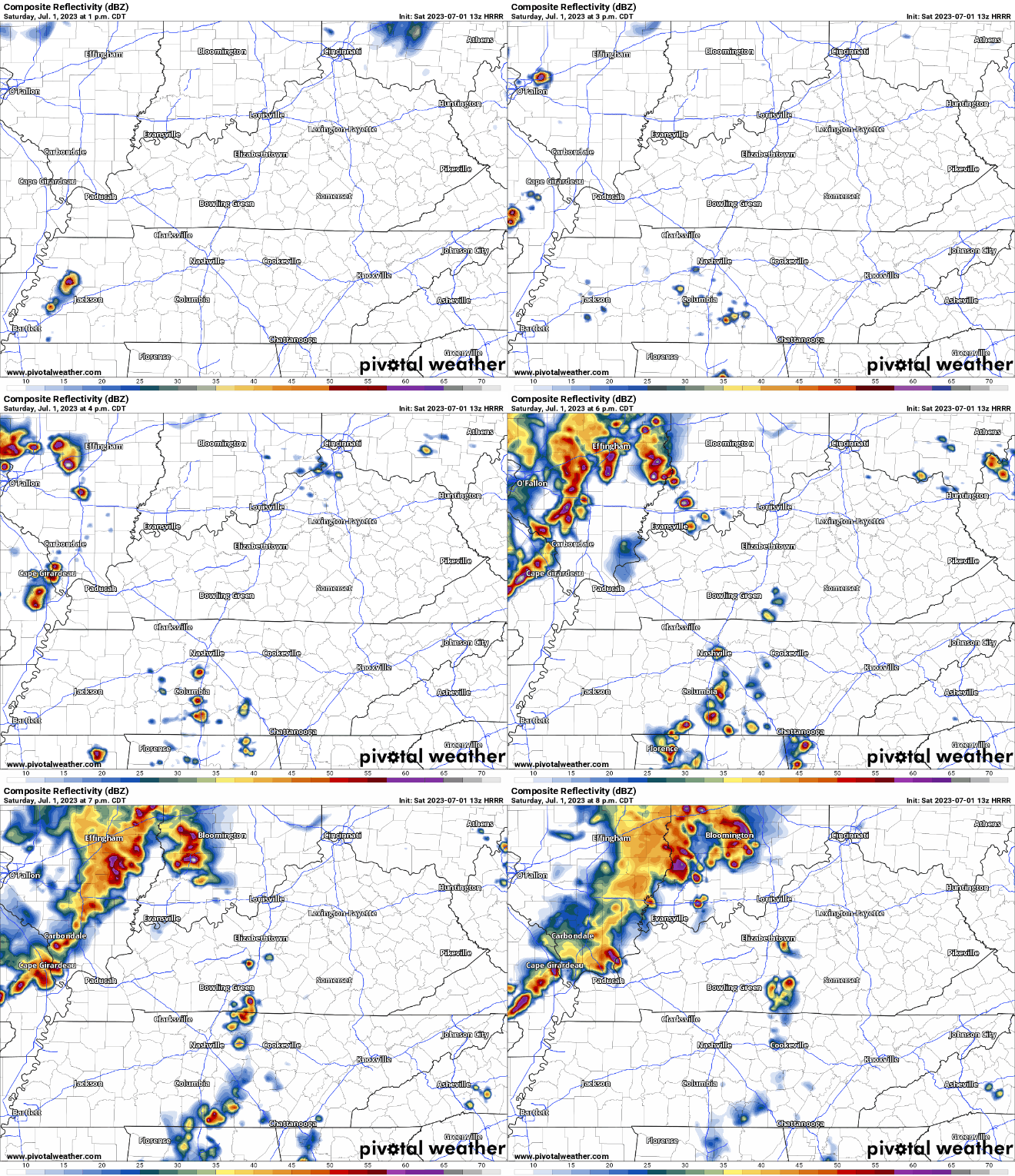
HRRR model (above, but could be wrong) thinks our best chance of seeing anything will be in the afternoon thru early evening. Impossible to know exactly when and who gets storms, everyone has a chance, the Wattery is a fair game.
With these storms, there’s a shot at severe weather with them. Storm Prediction Center has outlooked us with:
- 15% chance of damaging straight-line winds and severe hail within 25 miles
- we are *not* concerned about tornadoes
Stay connected and keep an eye on the radar if you have plans to be outside this afternoon and evening. Need a radar to gaze at? We got one right here: Radar – Nashville Severe Weather
Sunday more of the same, a few degrees “cooler” but probably not enough to notice. Another round of possible afternoon/evening storms that could be strong to severe.
Monday and the following days will be very summerlike. Heat index values around 100°, daily Wattery chances. Welcome to July.
Too far to tell any specifics about the 4th. For now, hot and a shot at rain, unclear timing tho. We’ll be seein’.

Quick References:
Weather changes constantly.
Follow @NashSevereWx on Twitter for any changes to this forecast.
We are 100% community supported. No ads. No subscription fees. Keep it free for everyone.
Categories: Forecast Blogs (Legacy)


You must be logged in to post a comment.