
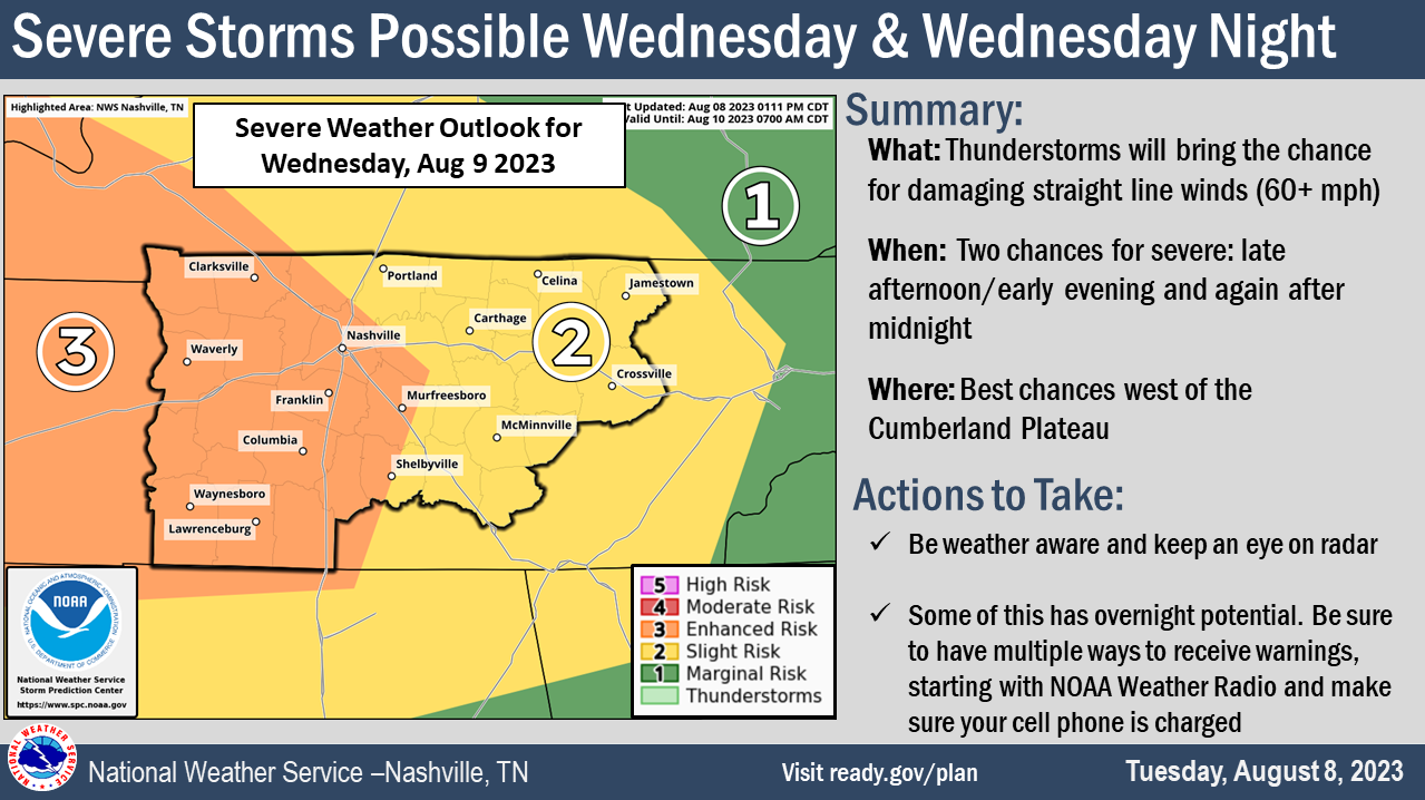

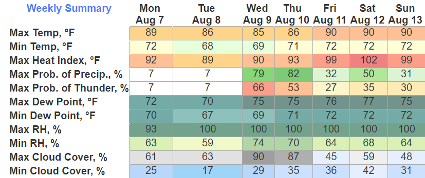
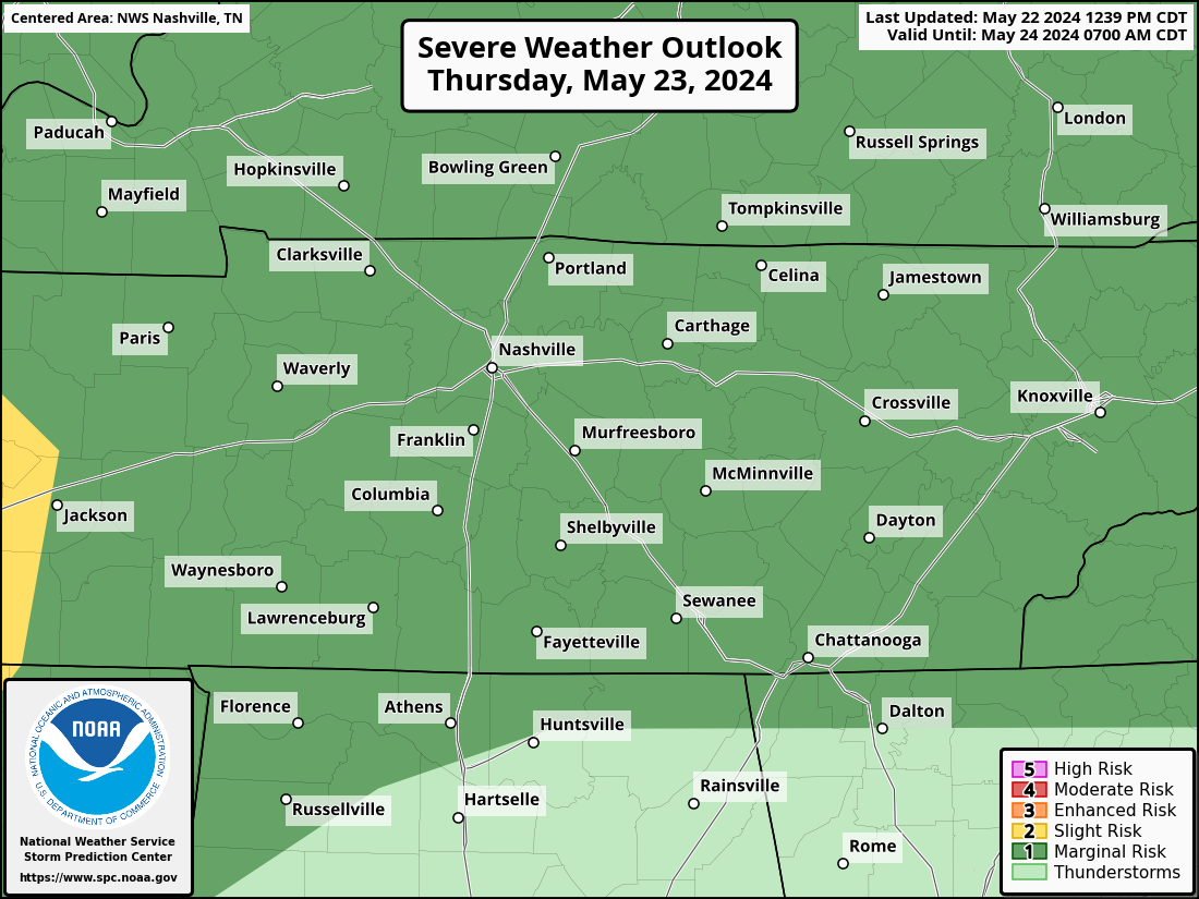
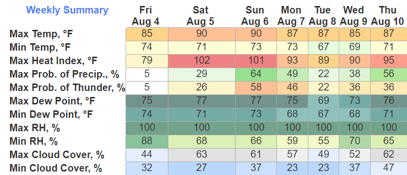
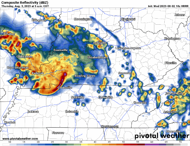
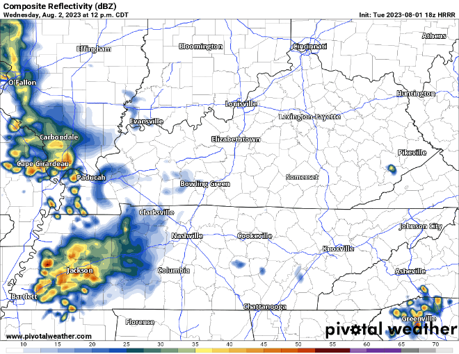
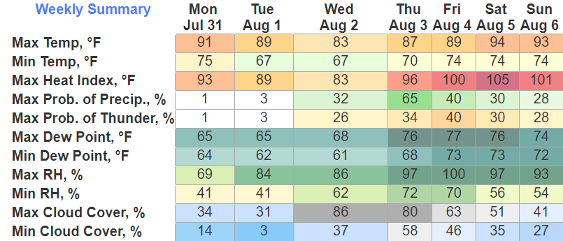
Rest of today and Wednesday morning will be calm. Let’s dive into the severe threat.
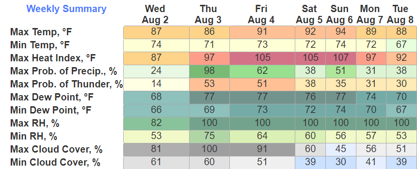
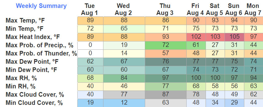
The Storm Prediction Center has outlooked us with probabilities of “x” within 25 miles tomorrow.
- 30% chance of damaging (58mph+) straight-line winds
- 5% chance of severe (1″+) hail
- 2% chance of a tornado
There is also a 15% chance of flash flooding within 25 miles.

You must be logged in to post a comment.