
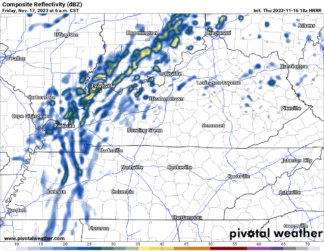
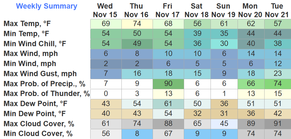
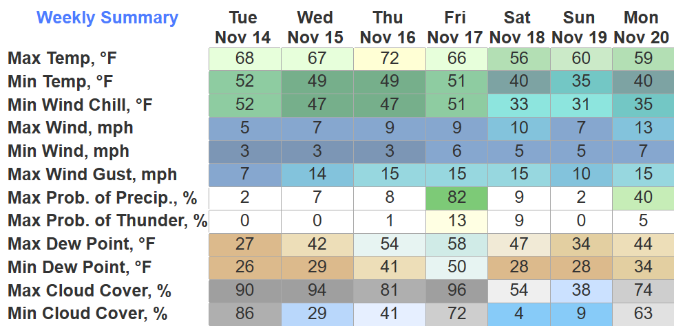
Two main messages for Monday. Let’s discuss.
Winds Ahead of the Rain
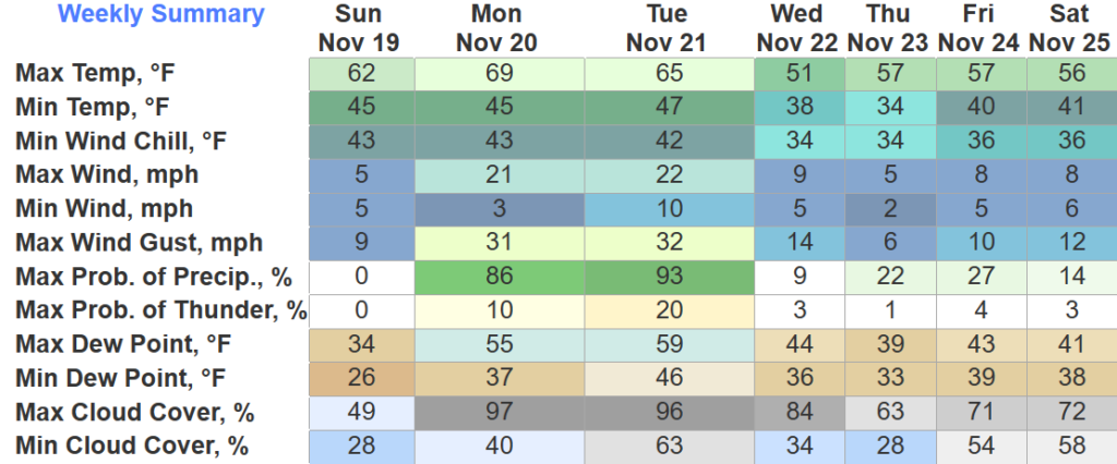
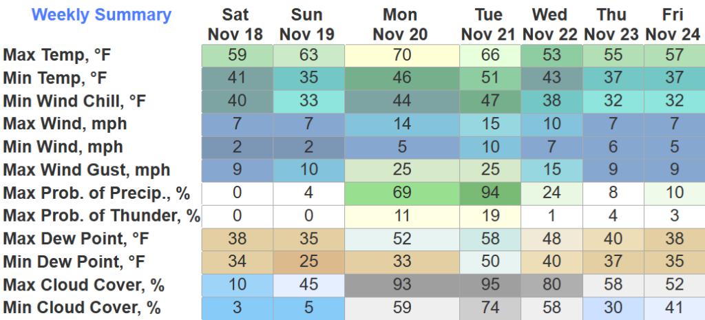
Winds *before* the rain tomorrow will be gusty.

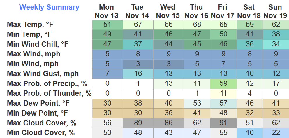
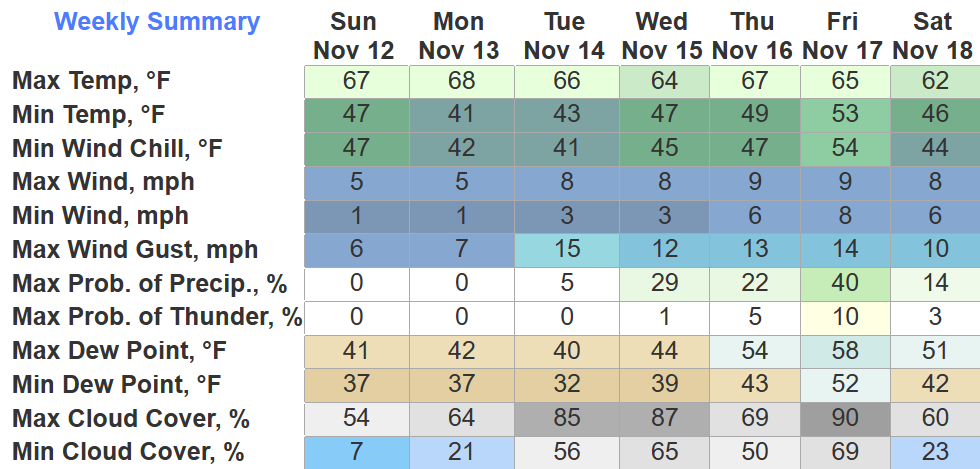
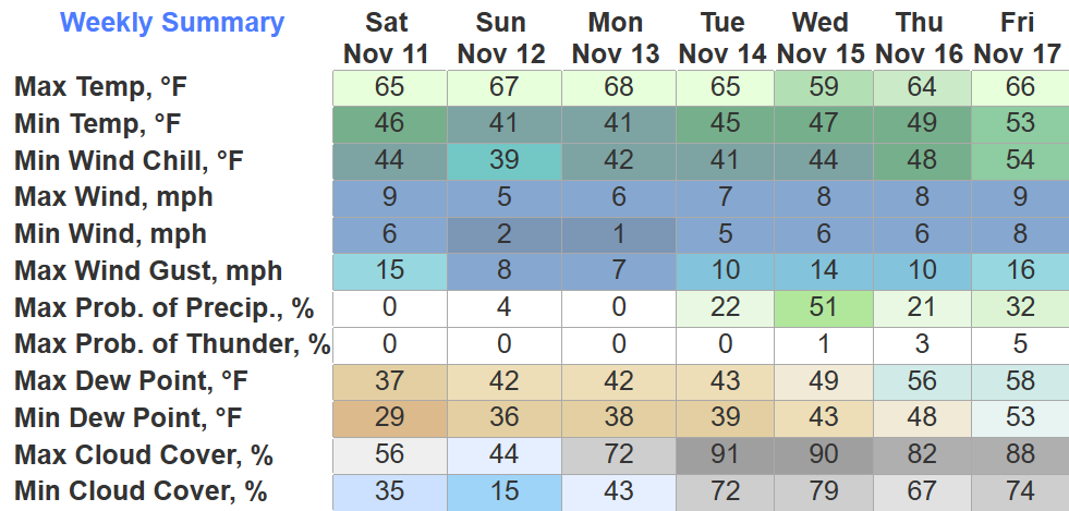
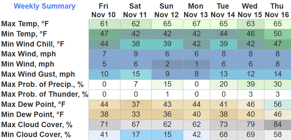
Gusts up to 30-45mph are possible Monday afternoon into Monday night. A Wind Advisory will probably be issued at some point. Secure outdoor furniture, X-Mas decorations, etc.

You must be logged in to post a comment.