
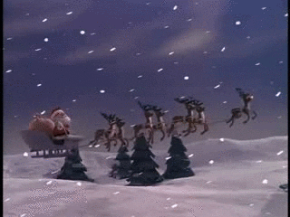
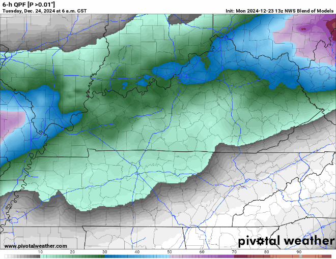
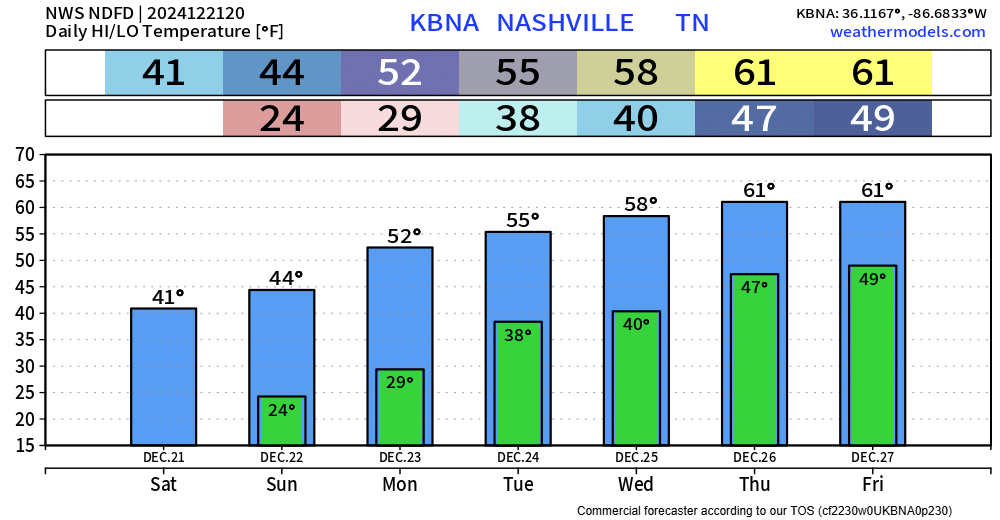
Santa should have no problem delivering gifts tonight, light winds, partly cloudy skies – the red nose won’t need to guide any sleigh tonight.
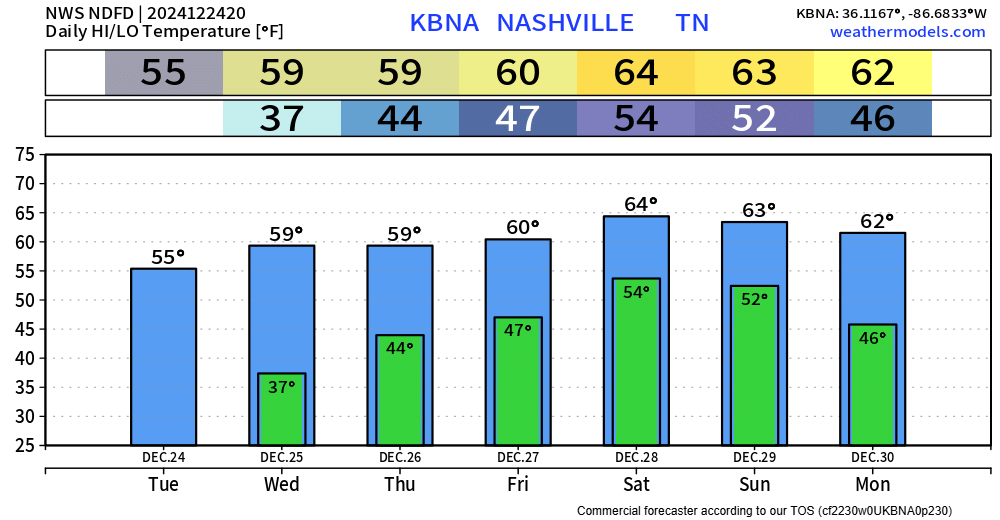
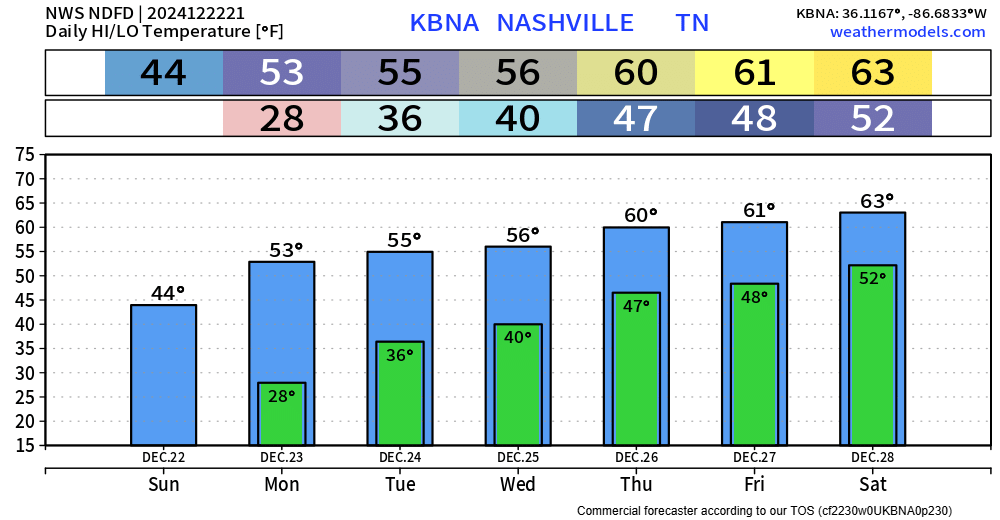
Christmas Day looks nice weather-wise. High temps near 60°, can’t totally rule out a quick shower – but the overwhelming majority of us will likely stay dry.


You must be logged in to post a comment.