Current Observations and Radar (refresh to update)


Watching for A Little More Rain Tonight
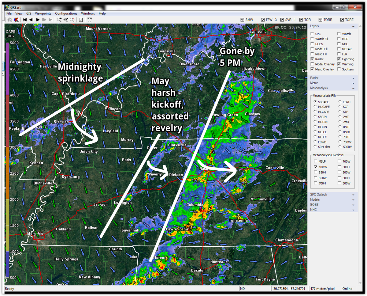
The shortwave arrived this afternoon on-time and as-expected, and started spreading light rain in widely-spaced pockets around Middle TN.
That’ll continue tonight. As the base of the trough arrives, we expect a little rain, and we can’t rule out infrequent lightning, but the associated rain will be very light — and most of it should go east of us.