
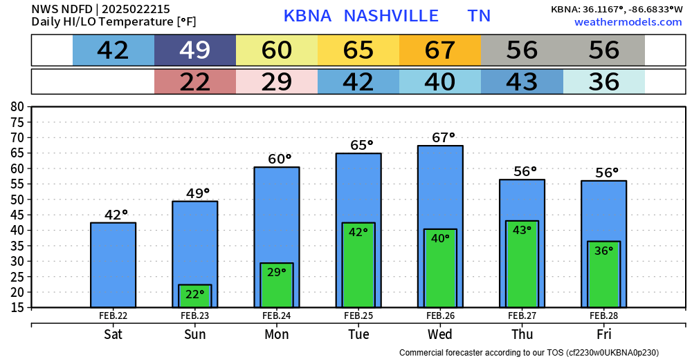
Headlines:
A Wind Advisory will be in effect from noon Tuesday to 6p Wednesday for wind gusts up to 45 mph expected.
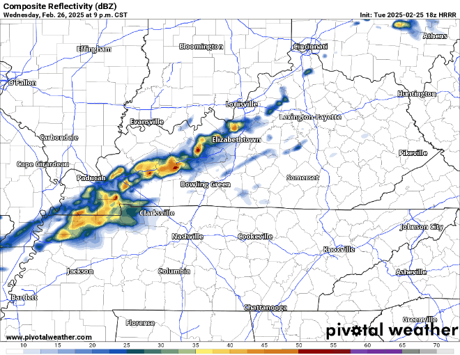
While thunderstorms are likely Tuesday PM, most should stay below severe criteria.
Let’s dive into the details.

Headlines:
A Wind Advisory will be in effect from noon Tuesday to 6p Wednesday for wind gusts up to 45 mph expected.
While thunderstorms are likely Tuesday PM, most should stay below severe criteria.
Let’s dive into the details.
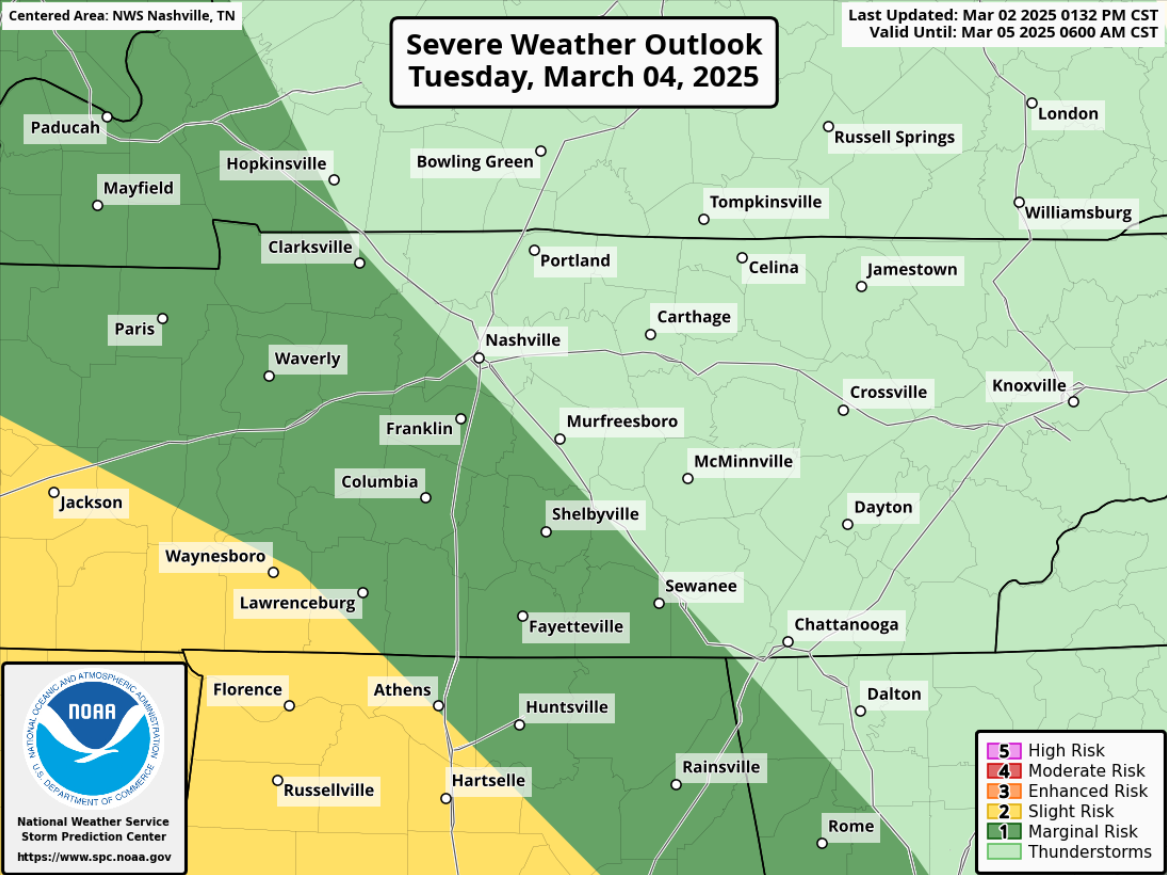
Still watching Tuesday for severe storm potential – but the overall chances have come down.
The Storm Prediction Center has outlooked areas S and W of I-24 with a 5% chance of severe weather within 25 miles. This could (probably will) change between now and then.
Outdoor burning continues to be discouraged, with gusty winds and low relative humidity values expected thru this evening.
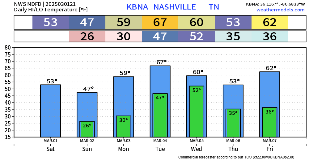
Skipping ahead to Tuesday.
Not much has changed. We continue to be outlooked with a 15% chance of severe weather within 25 miles.
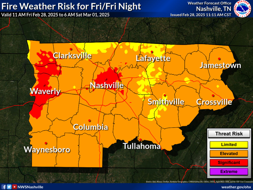
With warm temps, low relative humidity, and gusty winds today – some elevated fire danger will exist. Under these conditions, fire can spread quickly. Outdoor burning is discouraged.
Jumping ahead to Tuesday.
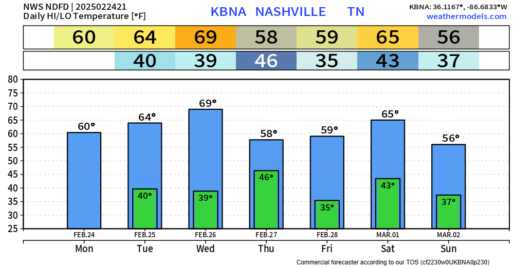
Although this will be a fairly mellow coaster ride, we’ll feel some temperature swings in the upcoming days.
We’ll be at the “top” on Friday with highs nearing 70° – then take a little ride down, bottoming out with highs in the mid 40s on Sunday. 60s return quickly.

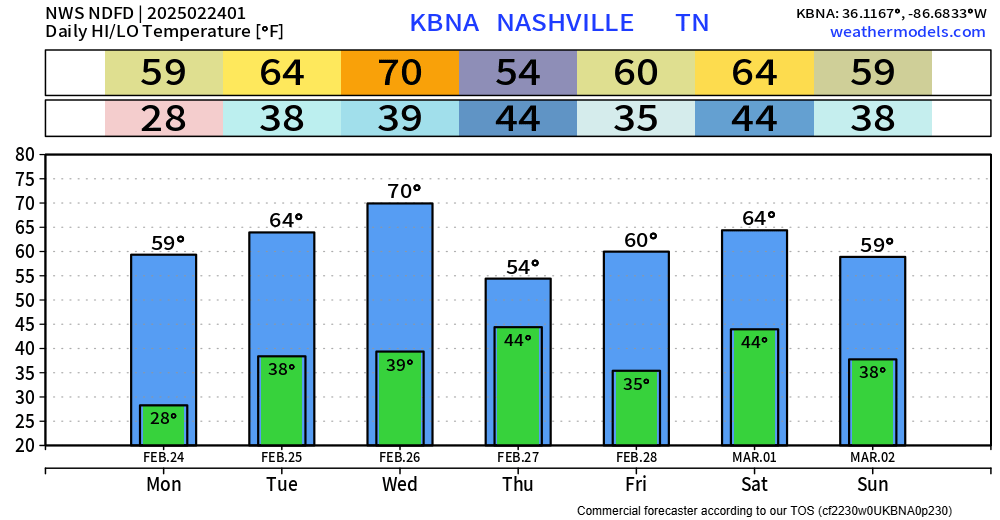
We yet again blew past our forecasted high, getting all the way up to 80° – breaking our old daily record high of 79° set back in 1917.
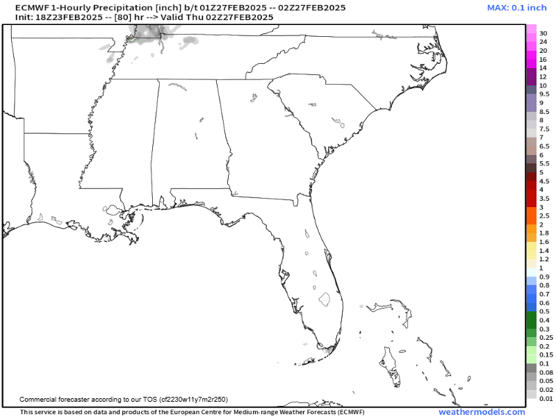
Some of us may see a quick shower during the early early morning hours of Thursday. “Highest” chances are in N. Davidson Co. (ofc Joelton), but even those chances are still quite low.
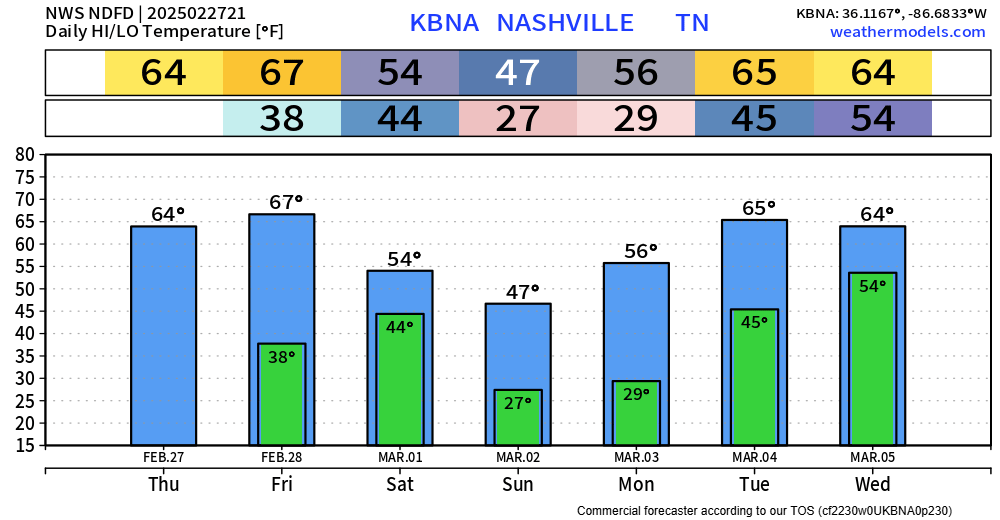
Temperatures today absolutely smoked the forecasted high of 64° – BNA got all the way up to 75°, three degrees shy of the daily record high.
Temps are expected to return to the mid 70s on Wednesday – another Spring-like day.
A nice & calm week, weather-wise, lies ahead.
Temps above-average all week – some days more than others.
Only rain chance to speak of this week will be Wednesday night/early Thursday morning. These will be some quick showers, won’t need much use from the windshield wipers. Rainfall totals around 0.1″.
70° by Wednesday. Late Weds / early Thurs a cold front sweeps out the warm temps, only for us to warm up again.
A little rain Thursday morning with the front passage, not much, no big deal.
Weekend looks weather boring.
Last week was quite busy weather-wise – and we’ll get a much-needed break with some calm days ahead.
Temps in the low 40s this afternoon will allow for some legit melting. We’ll dip below freezing again tonight, so any wet pavement will turn into icy pavement.
You must be logged in to post a comment.