
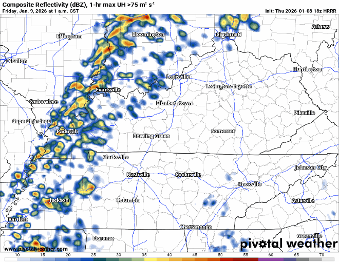
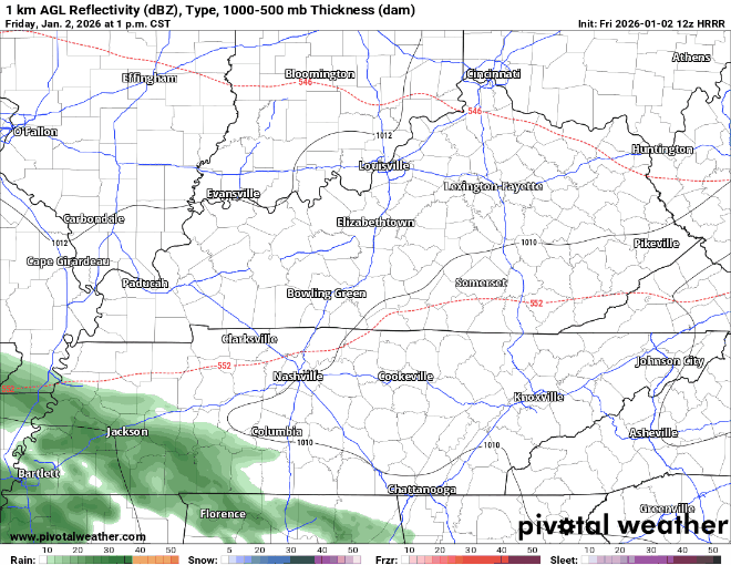
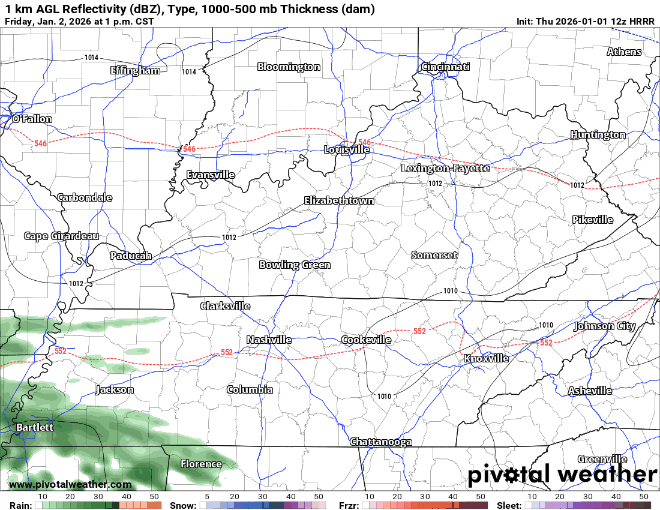
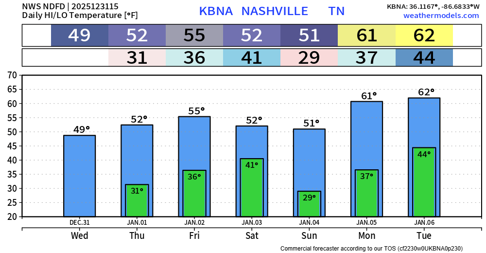
Some of our thinking has changed for this upcoming event, particularly regarding the round of storms arriving early Friday morning.
“Round One” – 3a thru 8a Friday Morning
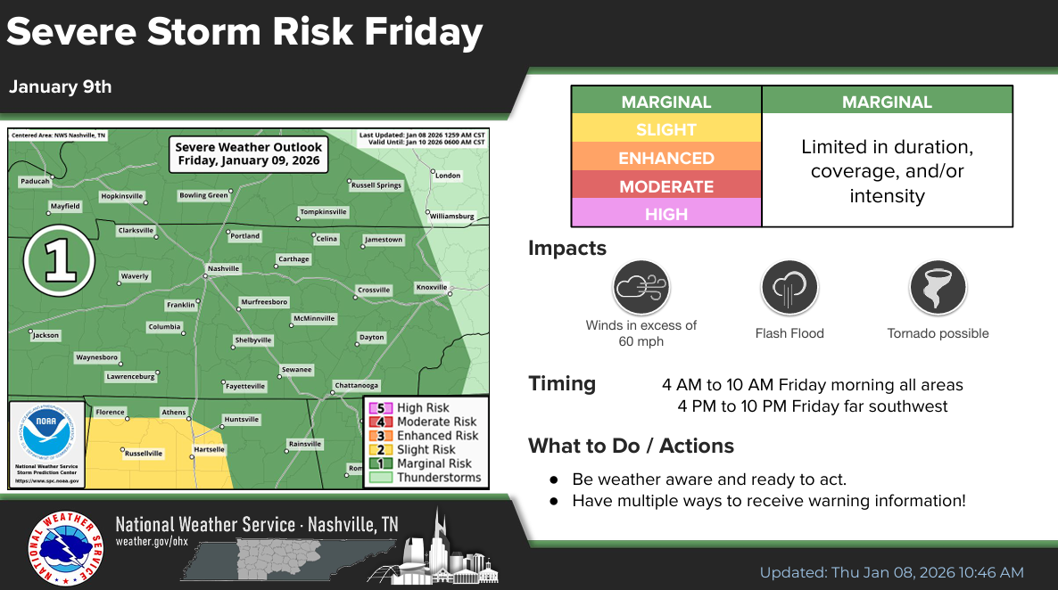
Now that the high-res models have come into range, it appears that this first round of storms may end up carrying a low-end severe threat.


You must be logged in to post a comment.