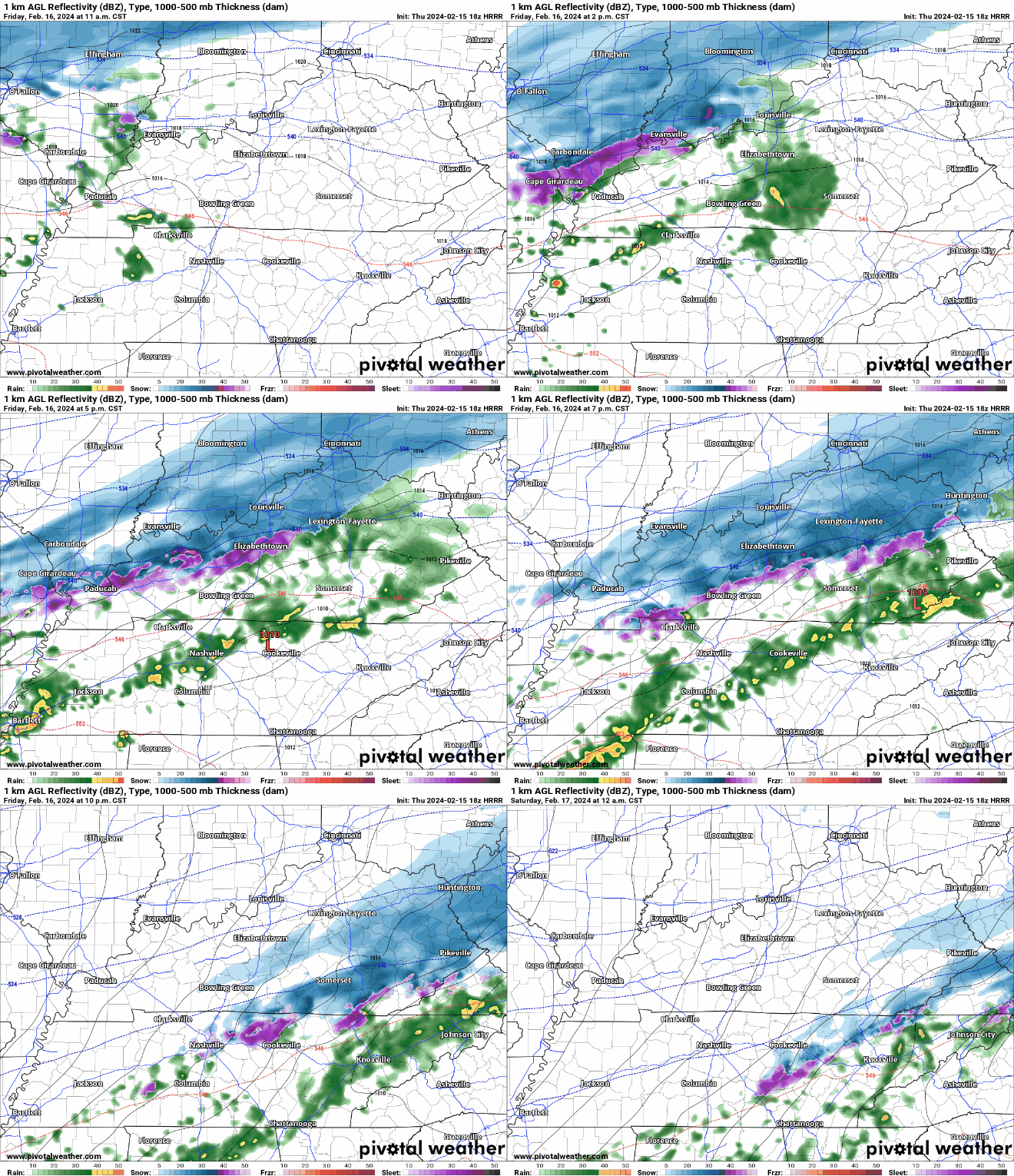
New HRRR model run, Friday timing. Estimates only. May change:

  • Rain arriving bt 4 PM – 7 PM
  • Rain to Sleet to Snow bt 9 PM – Midnight
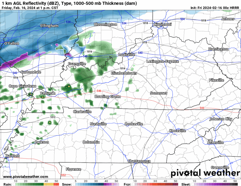
Most snow to melt on impact. Little to no accumulation.

Bridges, Overpasses, and Areas at Higher Elevation may be slick late Friday night thru Sat AM. Expecting below freezing temps late Friday night until about 9 AM Sat. Bridges and overpasses are the exception because they cool down way faster than earth. read more

Rain Friday Afternoon, Splat:Melt Flurries Friday Night, Cold Saturday

Beautiful day today with BNA nearly getting to 70° today.

Rain moves in tomorrow.

HRRR model (above) shows:

  • rain moving in early Friday afternoon
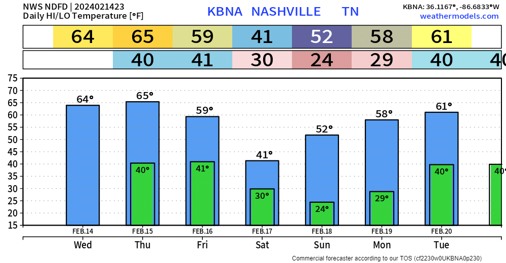
  • cold air moves in from the NW, causing our temps to go from the low 60s Friday afternoon –> low to mid 30s Saturday AM
  • that cold air will be chasing the precip exiting our region, may cause rain to briefly change over to snow
  • expecting any snow that falls to melt on contact with the ground, no accumulation is expected
  • bridges and overpasses may be slick Saturday AM

Saturday will be dry but will also be the coldest day we’ve had in a while. High temperatures may not make it to 40°… read more

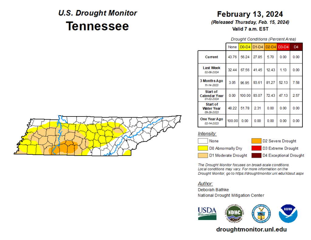
We’re still droughty, just less droughty. Takes time to catch up from our big rain deficit.

Lovely Week Until Friday PM

Plenty of sun propelled our temps all the way up to the mid 60s. Nice evening if going out to dinner.

Tomorrow will be a near copy and paste of today. Sun and high temps back in the mid 60s.

Friday…not quite as nice. read more

Nice Week Until Rain + Cooldown Friday/Saturday

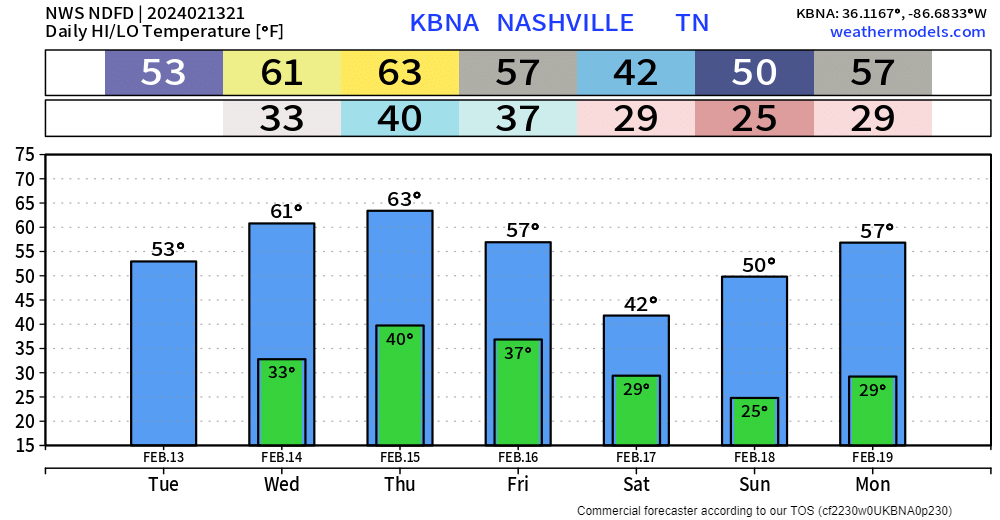
After quite the interesting night, today turned out nicely with high temps getting up into the low to mid 50s.

Wednesday and Thursday will be lovely with high temps reaching into the low 60s. Cold mornings to deal with tho. read more

Very Little, If Any Accumulating Snow Expected Tonight

Changeover from rain to a mix of rain/sleet/snow currently happening in some areas.

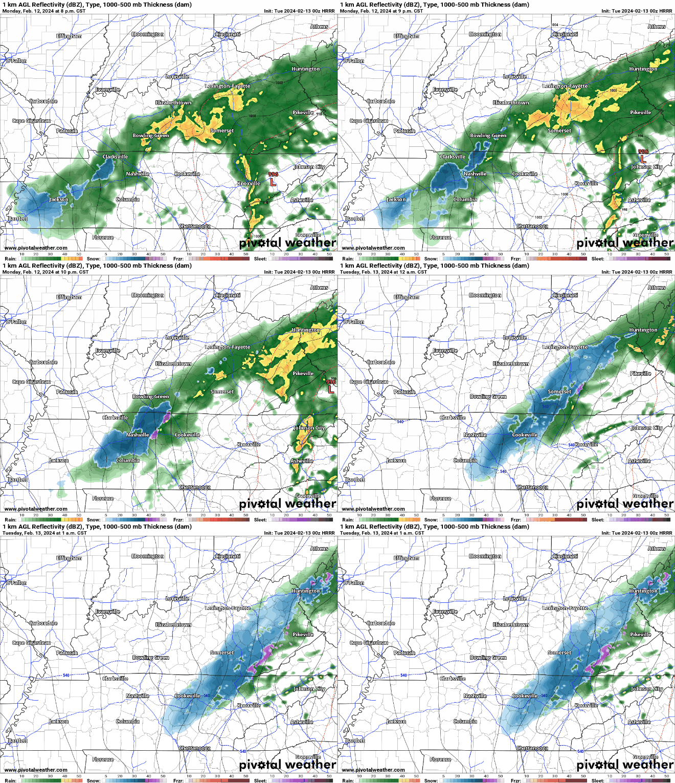
HRRR model (above) suggests that a mixture of frozen precipitation may fall for a few hours tonight, but we have reason to believe that very little, if any of it will stick. read more

For many of us the wind is picking up and the change over to some kind of freezing precip is occurring. Temps dropping. Careful on bridges and overpasses tonight.

Radar suggests a wintry mix is falling along and W of 65. Likely sleet mixed in with the rain. 7:21 pm

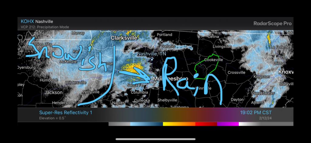
Rain and Snow(ish) moving in. Currently 45°. Not much hope for sticking south of I 40. Radar as of 702pm.

Very little/no snow expected locally tonight.

Deets: Notice the surface low (the red L below) that’s now just passed to our south. It’s racing to Knoxville then Carolina mtns.

This means:

  1. Temps are about to drop fast.
  2. But precip will pull east and away from us quick.
  3. The 700 MB chart shows the base of the trough getting here late, delaying local rain/snow transition.
  4. While flakes may fly, surface temps should be too warm for accumulation.

High elevations may get dusted. 99% of us nah. read more