HRRR for 6:00 am Wednesday. Not hard to see the cold front. Temps will fall fast from the mid 60s to the low 40s once it passes during the morning hours.

Rainouts now possible for unluckly local fields Tuesday. New (0z) HRRR model delivers narrow area of rainout-level rains (never rely on one model run). This morning didn’t think we’d see rainouts. Now, we might. read more

We good fam ⚽️ . Looks not great for NYRB tho.

Good News ...

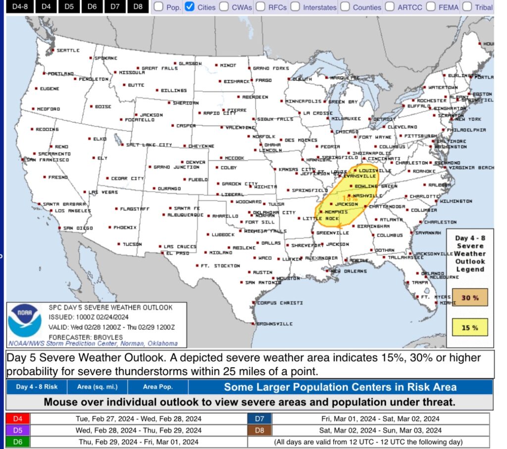
Removed: the 15% probability of severe weather for Wednesday. Rain Tues and thunderstorms Weds, but severe weather now appears less likely.

What changed: recent model runs show a dry airmass Monday thru Weds. When Weds’ troublemaking cold front arrives, storm-fueling moisture and instability will be low. Bad storms need moisture and instability. Without them, meh. read more

Spring-Like First Half of the Week, Strong to Severe Storms Possible Wednesday.

A bit chilly today, but it could be worse. Lows will dip into the upper 20s tonight, brr.

Good news is that we will quickly warm up to start off the week.

Mid 60s on Sunday, getting into the low to mid 70s on Monday and Tuesday. read more

We remain outlooked for severe thunderstorm potential Wednesday. Expect an update after SWAD (ongoing now at Trevecca).

Test -W

Andrew’s made a quick run to a meet and greet at the Nolensville Farmer’s Market. Go by before 1:00 and say hi!

Temps 👇🏽. Want to get right in to severe potential Weds 2/28/24.

SPC outlooked Wednesday, Feb 28, 2024, for severe weather potential.

This outlook means 15% probability of a severe thunderstorm (defined: hail, and/or damaging straight line winds, and/or tornado) within 25 miles of you. read more

Rain (Maybe A Lil’ Stormy?) Thursday Afternoon/Evening

Splendid day today, unfortunately the same cannot be said about the forecast for tomorrow.

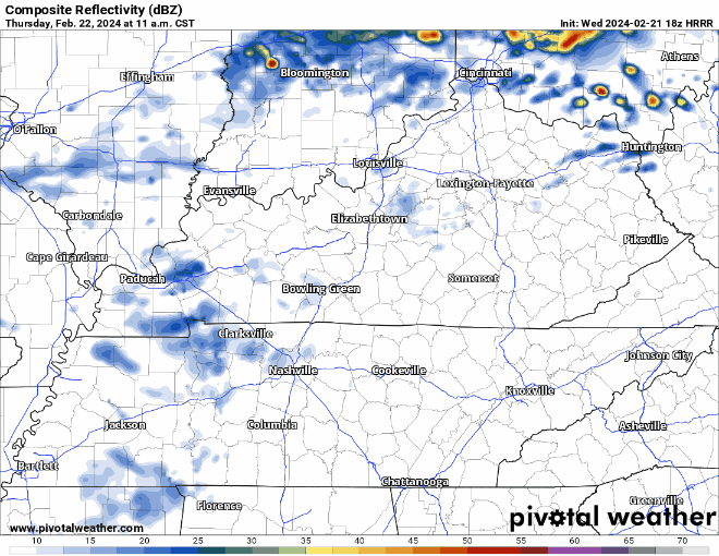
The HRRR model, displays what it thinks the radar *could* look like tomorrow.

  • scattered showers begin late Thursday morning and continue thru the afternoon, NBD
  • heavier rain, and maybe a few storms push in later, current ETA ~7 – 9 pm (subject to change)
  • at the time, our severe threat remains very low, however…
  • “So maybe a strong thunderstorm here or there producing small hail and gusty winds below severe thresholds, but do not expect an organized strong convective event as of this time.” – NWS Nashville
  • weather can change, so we’ll keep an eye on it and keep you updated
  • rainfall totals look around 0.2 – 0.3″

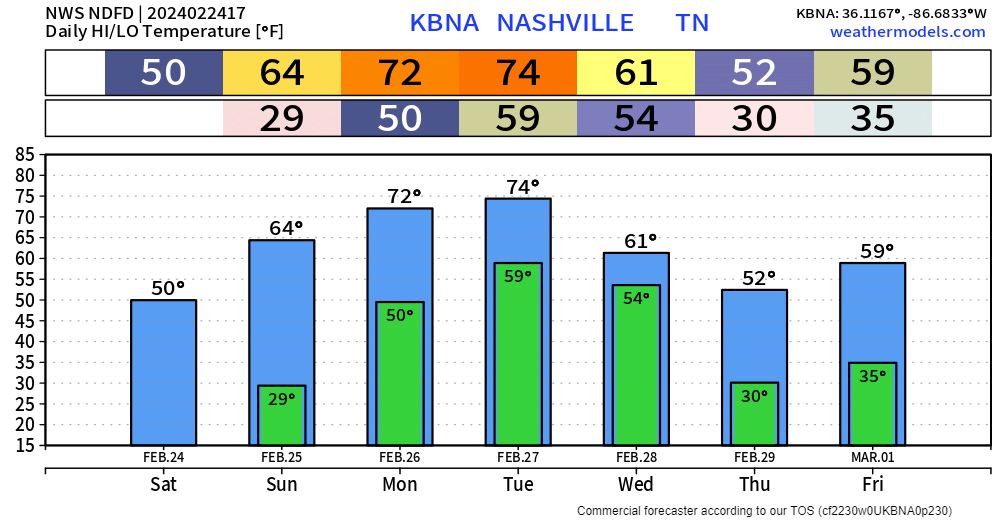
We’ll dry out Friday and should get away with a dry weekend except maybeee some light, quick showers Saturday morning. read more