Yesterday’s uncomfortable humidity is gone … for a few days. Comfortable air will hang around today and Thursday.
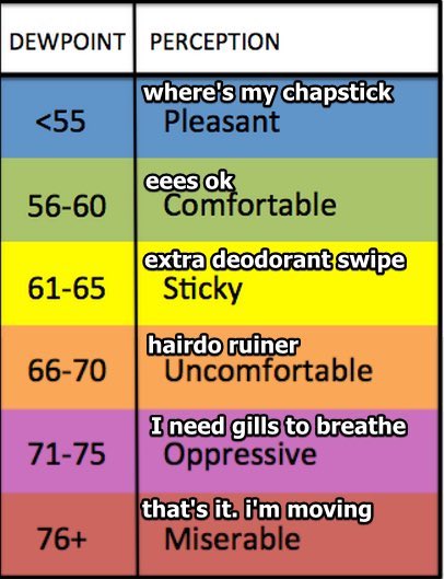
Humidity turns Uncomfortable Friday and hangs on for a while.
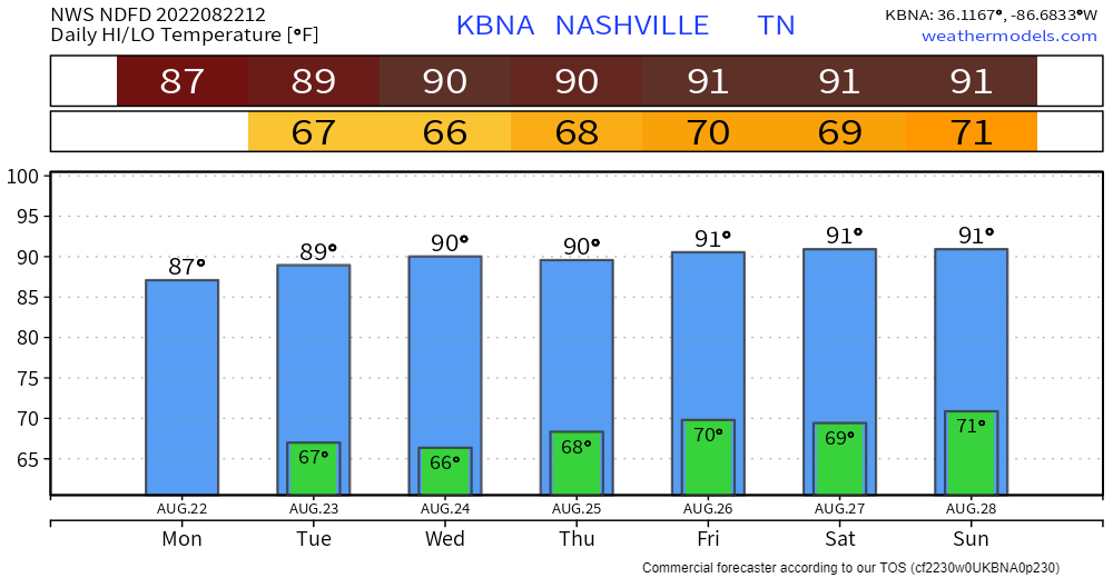
Model data high temps for the next seven days says It’s Still Summer:
Doubt much’ll happen today.
 .
.Quiet Weds, Thurs, and most of Friday while dewpoints drop from Uncomfortable to Comfortable.

Humidity returns to Uncomfortable Friday night through the weekend. Another swampy airmass supportive of random pop up showers and storms. Late afternoons and early evenings the most likely times. Wattery Szn runs through September?
(yes please, we need to sleep)This blog has no concerning SPC/WPC outlooks for flash flooding, tornado, hail, or widespread damaging straight line winds. How-Ever! There will probably be rain and lightningstorms?
Only a few storms around regionally this afternoon and early tonight. Models think storms will stay west of us today like they did yesterday (we will see about that). Few clouds will allow mid nineties temps. High humidity will send the heat index to 102°.
Hot, probably quiet weekend.
Rain/storm coverage looks to be considerably less today than yesterday which will likely allow temperatures to get a few degrees warmer than yesterday, too. Sunday should be similar, with only isolated to widely scattered rain chances and temperatures running into the low 90s.
 Forecast, Etc. Clear Eyes, Lightning Safety, Can’t Lose.
I took my kid to the orthodontist yesterday and greeted the two lovely reception staffers with a sincere Hello Teeth People! They said we are more than that! Indeed! They shined light through the office while they straightened teeth. Also they had some great teeth hygiene analogies that has got me flossing more. May your Friday encounter these lights, not storms, but you may encounter a storm.
Rain is not expected today. The HRRR has a few showers widely scattered around Middle Tennessee late tonight. Nothing consequential.
More humidity starting Thursday and lasting through the weekend (at least). The Wattery may choose you with a downpour or lightningstorm, so for most of you reading this you likely won’t see anything. Typical August weather, you need to be prepared for an afternoon or early evening downpour or  .
.
First can I please say this was harsh. There are now weather vacancies in Hungary.
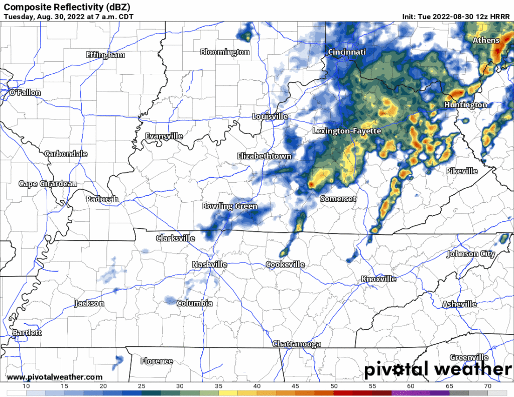
All the rain is south of us today. It may flood today in northern Louisiana into west central Mississippi so if you’ve got fam down there heads up.
Boring, “normal” week ahead.

Temps normal for late August.
Humidity kinda low for late August, dewpoints in the low 60s.
It probably won’t rain here Weds afternoon and Thursday, but rain then is possible. Rain this week is expected to slide south of us through Mississippi-Alabama-Georgia with some flooding risk down there. Models think there’s a 10% probability some of that rain will sneak north and splash us Weds, with around a 30% to 40% probability Thursday (see below).