Spring-Like Weekend, Maybe Storms Mid Next Week?

Big warm up starts today as highs will get up into the upper 70s, then low 80s for the first half of the new week.

We should be able to get away with a dry weekend, only hiccup may be an isolated shower Sunday afternoon, but majority of models keep us dry. read more

Spring In Full Force: Sun, Warm Temps, Storms

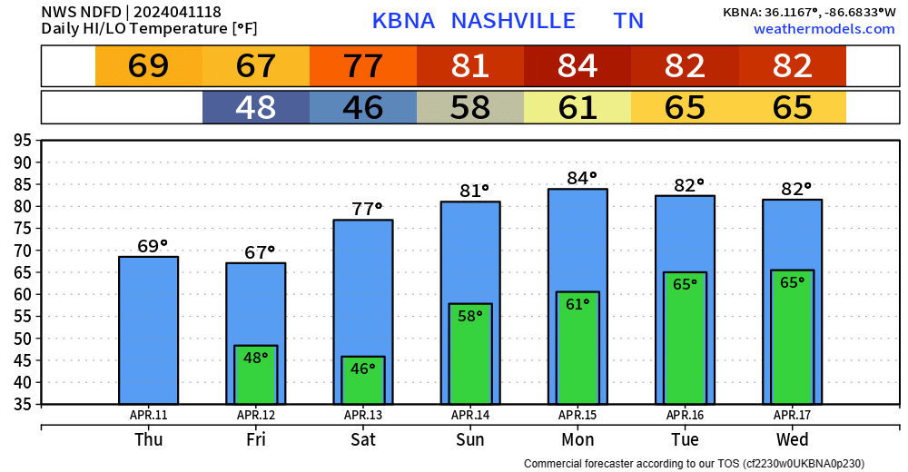
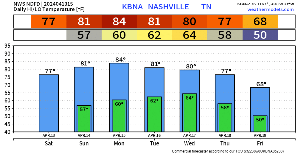
Winds will die down tonight, leaving us with crisp temps in the mid to upper 40s. Big warm-up starts Saturday, with a high of 76° and mid-80s by early next week.

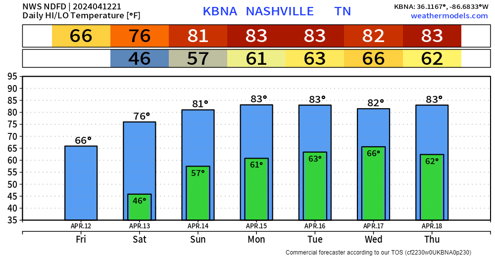
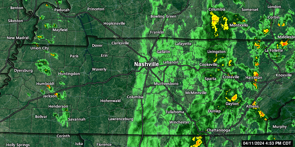
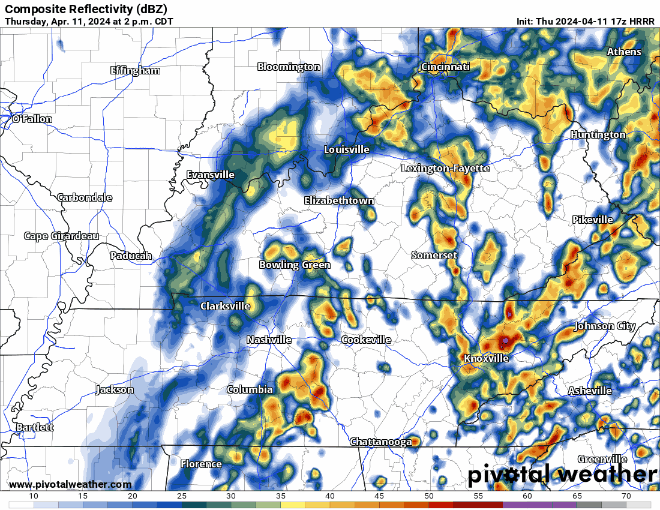
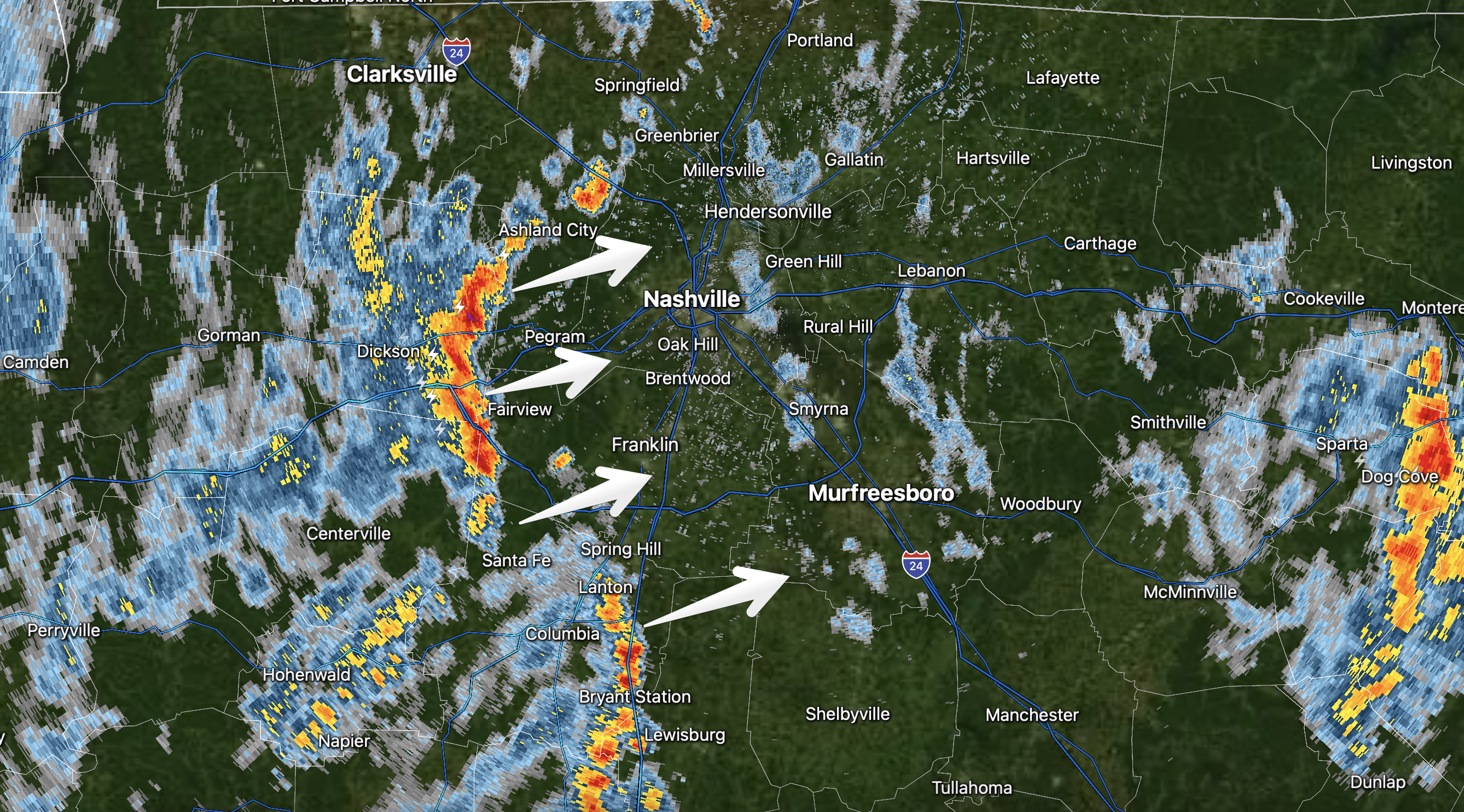
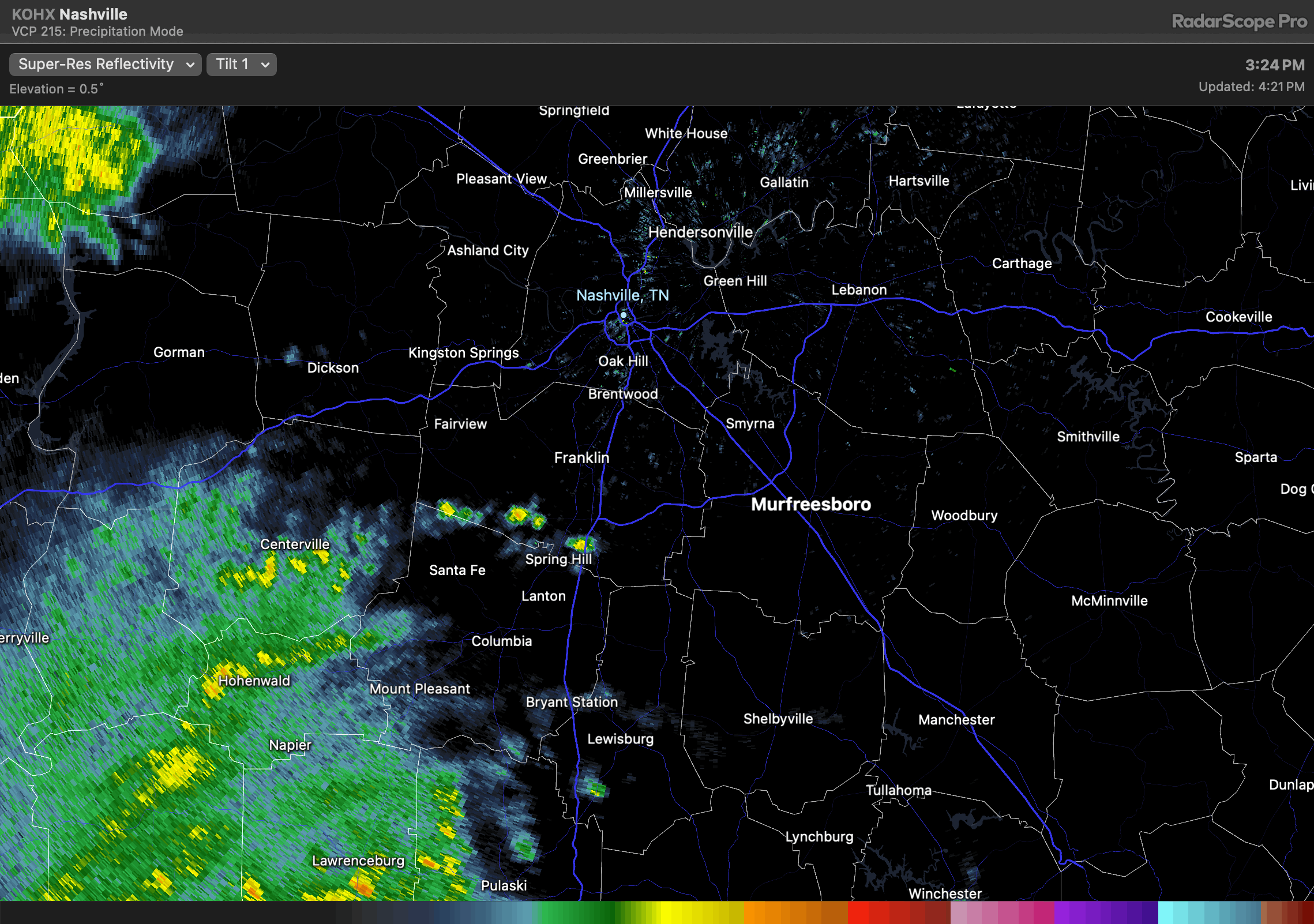
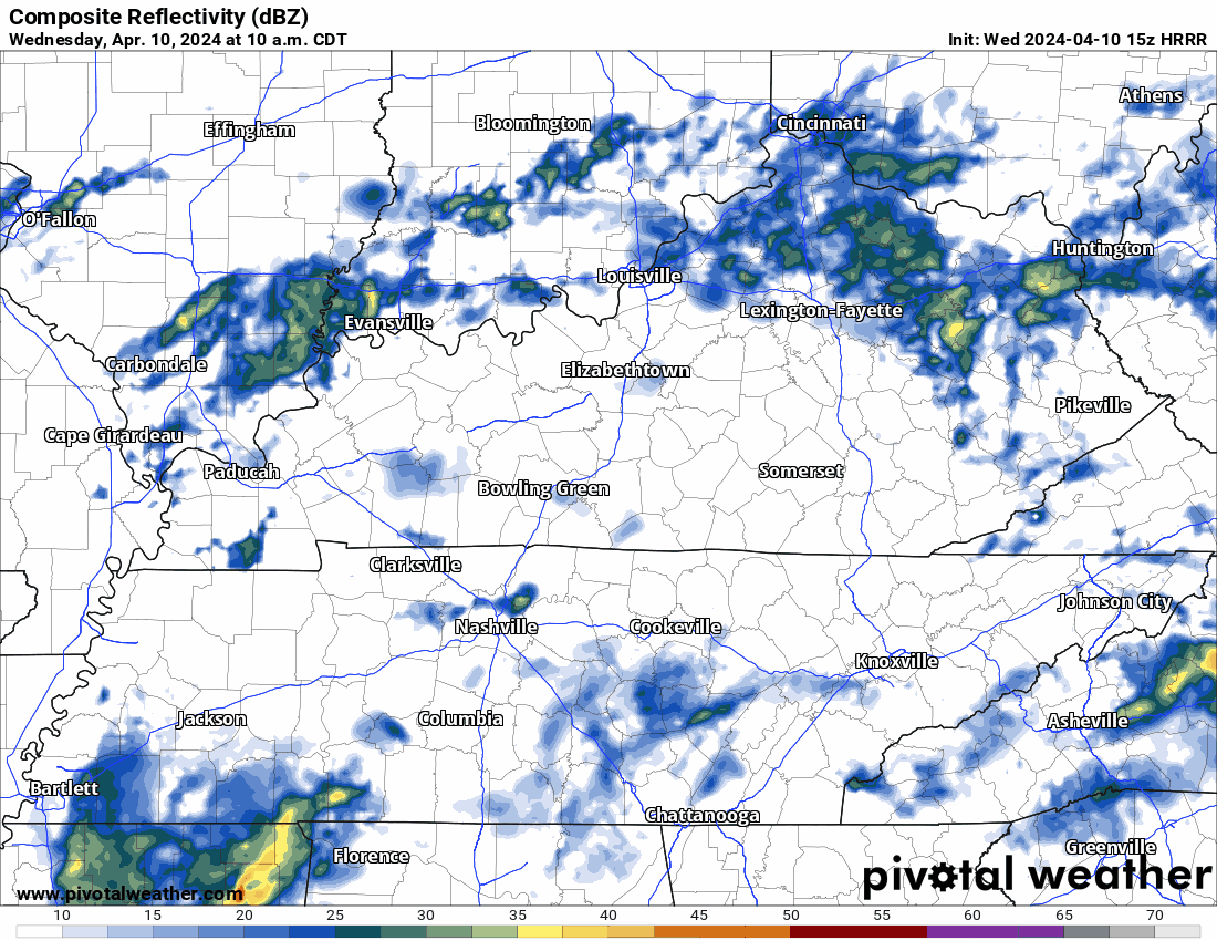
Since it’s Spring and all…we live among the battle of the air masses. So, our next storm system moves across the central US just as we start warming up. The system should arrive here around Wednesday and could hang around until the weekend. While we are not currently outlooked for severe weather, it will bear watching. We can’t turn our backs to the western sky this time of year. read more

731 PM one thunderstorm is tossing CG lightning heading along and south of I-840. Other scattered rain showers ready to make some of that chilly rain no one likes. Ok maybe some of y’all like it. No severe, no worries. read more

5:54 pm, maybe not quiiite done with the thundershowers. A few more cells have developed west of us and may come through later. Moving NW to SE. Non-severe.

A Lovely Weekend Awaits.

Just a few more showers to deal with today. Maybe a rumble of thunder, but no severe weather concerns.

Majority of the rain should be gone by sunset.

Friday thru Monday look fantastic.

Getting almost hot by Monday, with high temps in the md 80s. Rain chances return Tuesday or so. read more

Incoming storms are non-severe, but will produce brief heavy rain and lightning. Get wherever you’re going if you have lunch plans. 12:06 pm

One More Day of Rain Before A Beautiful Weekend

We’ve been able to dodge a good bit of the rain today, but more is expected to move into the area tonight and tomorrow. Along with it, some gusty winds are possible overnight, not a bad idea to secure any outdoor furniture. read more

rain spinning in to S wilco might put the nail in the rolly ball practice/game coffin to tonight. radar at 425pm.

The HRRR expects rain to move up into our two counties by the afternoon. May slide east or west so local results may vary. If you have plans tonight, keep an eye on the radar.

On/Off Rain Thru Thursday, Low-End Chance of Severe Weather Wednesday and Thurs.

Mostly dry evening in store, a shower or two can’t be ruled out though. A rain jacket or umbrella will suffice for any outdoor plans this evening.

Wednesday we’ll deal with more rain/storm chances, a couple of storms could be on the strong to severe side. read more