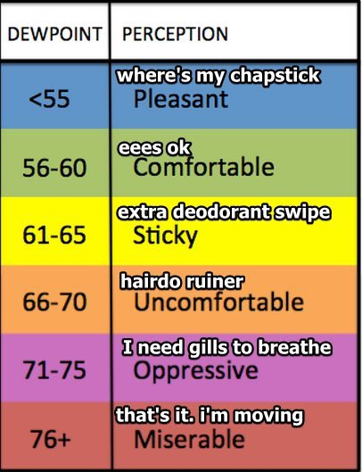
Bad humid today and tonight. Dewpoints in the low 70s.
Isolated pop up storm possible mid/late afternoon. In a random, mysterious spot.
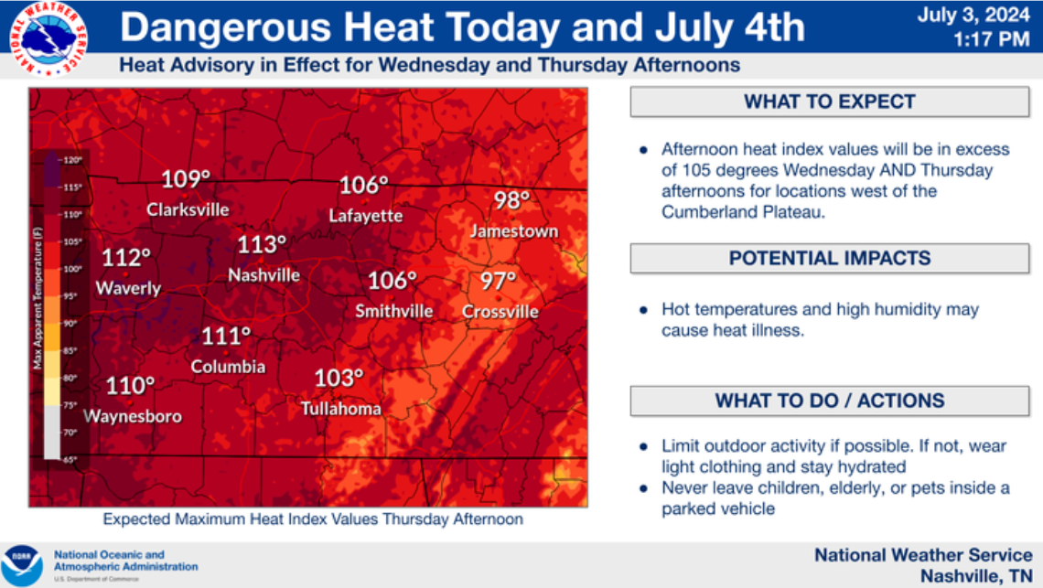
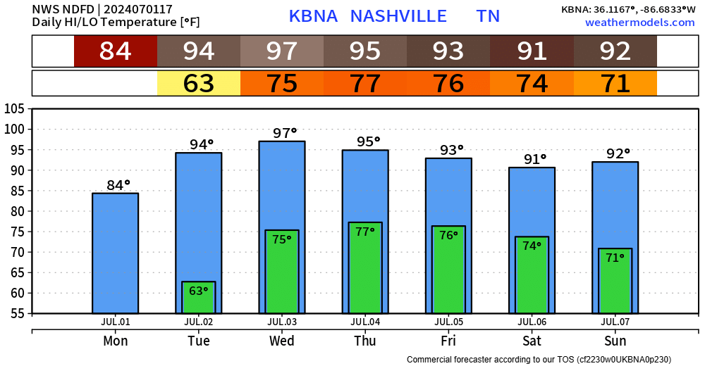
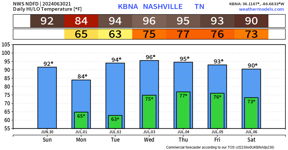
High today 97° + high dews = 104° max heat index. Heat Advisory in effect. Dewpoints will drop Friday night into the weekend. Still humid. Just not as bad as today. read more
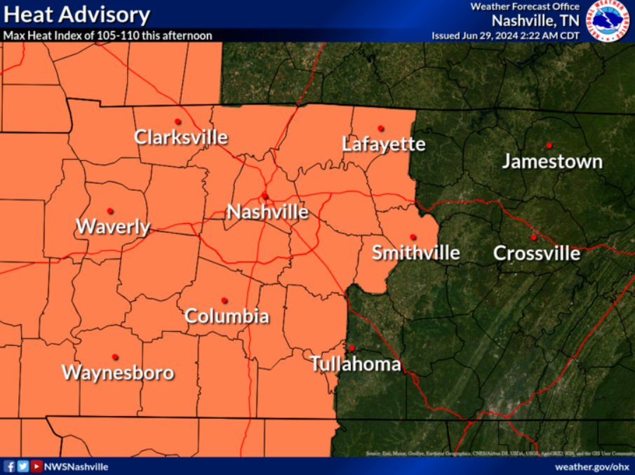
Heat Advisory will be in effect today and tomorrow during the afternoon and evening, heat index values (“feels like temps”) are expected to be in the 105 – 110° range.
Scattered shower/lightning storms will be possible today and tomorrow (more likely on the 4th), a few could be strongwith straight-line winds.
First up, the heat.
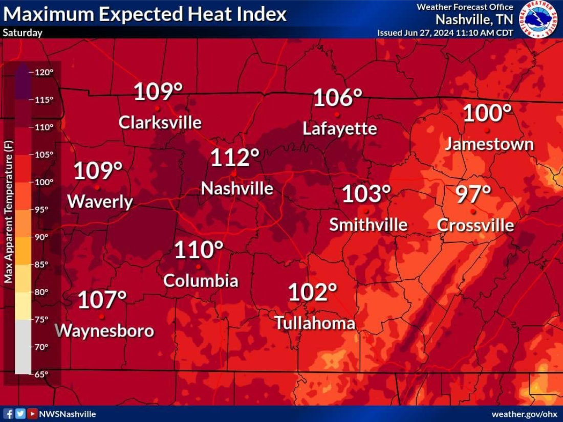
The nasty one-two punch of air temps in the mid to upper 90s, and dewpoints in the mid 70s will lead to these heat index values shown above today and during the 4th.read more
Heat index values up to 110° will be possible this afternoon and evening.
Air temperatures in the mid to upper 90s, combined with dewpoints in the mid 70s, will make for a sweat fest.
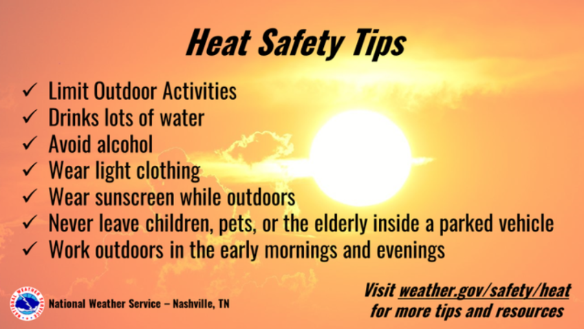
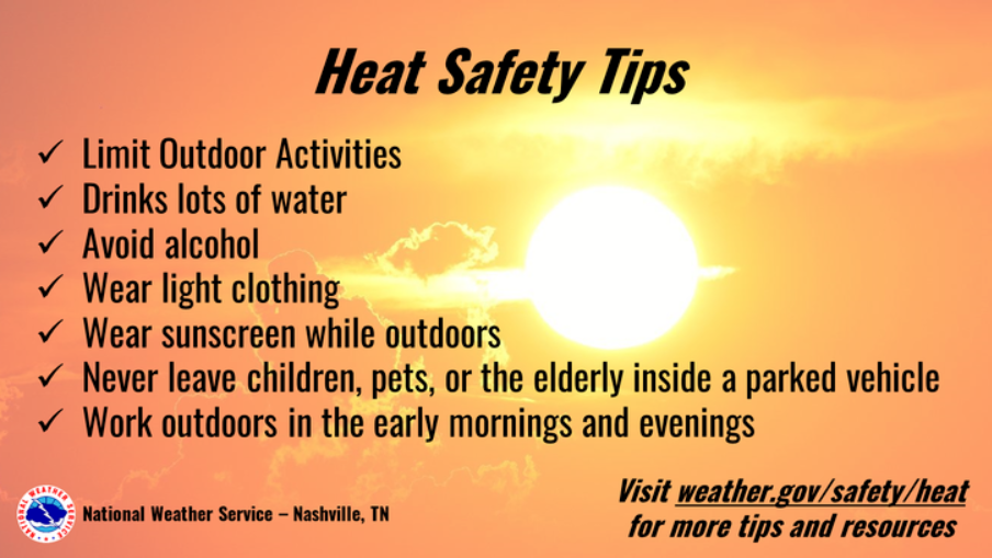
If you must be outside, be sure to take it easy. Take breaks in the shade (or even better A/C) and drink plenty of water. Never leave kids or pets in a car.
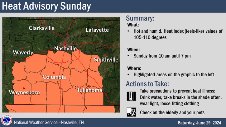
In addition to our Heat Advisory today, Williamson Co. (Davidson excluded) is included in another Heat Advisory from 10am to 7pm on Sunday.
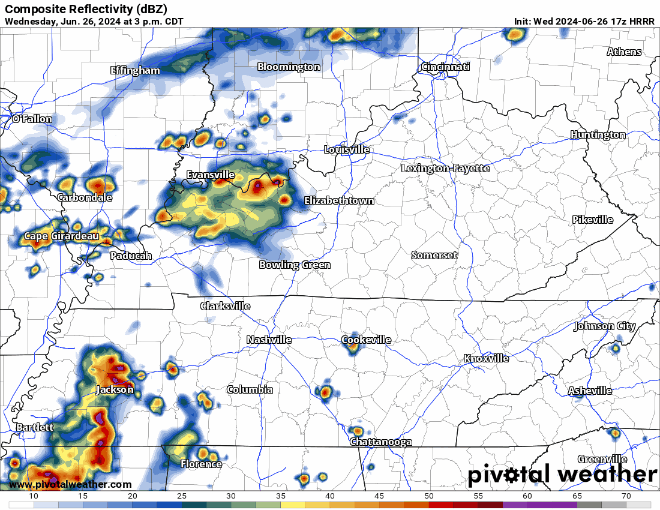
Very low chance of us seeing a shower/storm today to help cool us off. In the off chance we do, heavy rain, lightning and gusty winds will be possible.
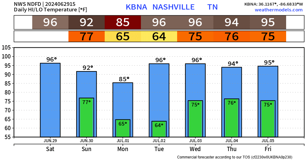
Better chance Sunday, still not great though.
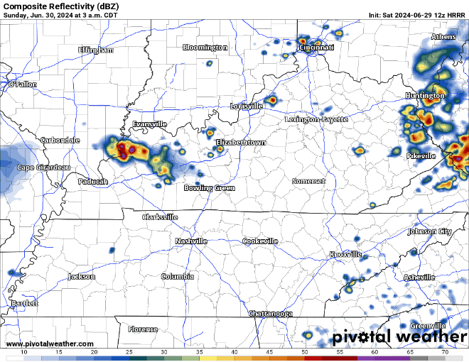
HRRR model shows a batch of showers/storms moving thru around sunrise Sunday, with a dry rest of the day. This could change, but good news for any outdoor plans.
Monday will feel great compared to…every other day in the forecast. Temperatures quickly turn right back up.
"...heat index values above 100 including for the 4th of July Holiday. Starting Tuesday night we will also see very warm overnight lows in the mid to upper 70s, this will bring little to no relief to those without air conditioning. Forcing will be weak during the week but with the high dew points popup afternoon and evening thunderstorms will be possible each day staring Wednesday." - NWS Nashville AFD read more
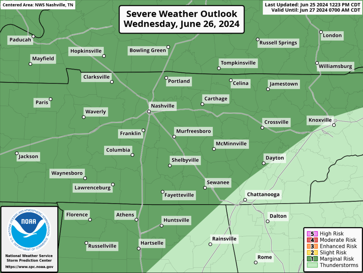
The low but nonzero chance of a strong to severe thunderstorm Wednesday continues to exist.
The Storm Predicition Center still has both of our counties highlighted in a 5% chance of severe weather within 25 miles. read more
Subscribe to Blog via Email
Privacy & Cookies: This site uses cookies. By continuing to use this website, you agree to their use.
To find out more, including how to control cookies, see here:
Privacy Policy


You must be logged in to post a comment.