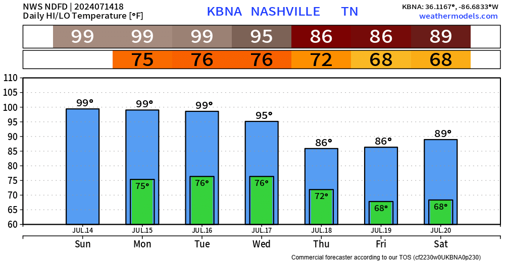
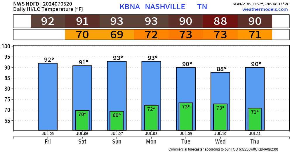
The next 3 days will pretty much be a rinse and repeat, but hopefully we actually get rinsed by some rain.
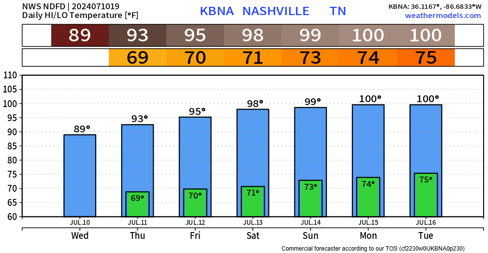
Today, Monday and Tuesday all carry the chance of reaching the 100° mark, but regardless of upper 90s or the century mark – it’ll be hot.

The next 3 days will pretty much be a rinse and repeat, but hopefully we actually get rinsed by some rain.
Today, Monday and Tuesday all carry the chance of reaching the 100° mark, but regardless of upper 90s or the century mark – it’ll be hot.
Finally have some good news to share, but first I’ll get the bad news out of the way.
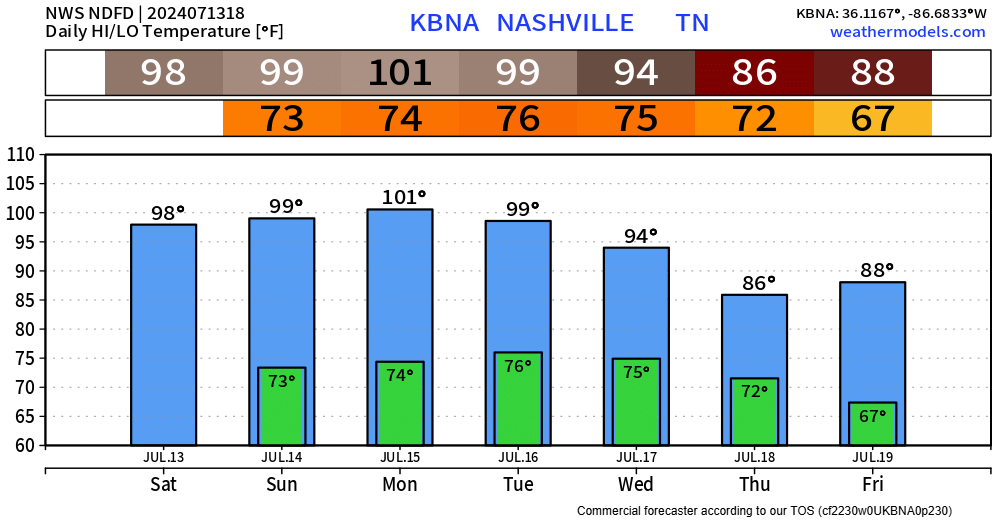
The next 4 or 5 days will be brutally hot.
High temps will be flirting with the 100° mark thru Tuesday.
It can be a bit challenging here to actually get to 100°, but we may make it. Our best chances will probably be Sunday or Monday. 99° or 100°, either way you’ll sweat.
It’s hot. High temps will be in the upper 90s thru Wednesday, maybe reaching the century mark on a day or two, but not much difference between 99/100 – it’s just hot.
Overnight lows in the mid 70s won’t bring much relief either.
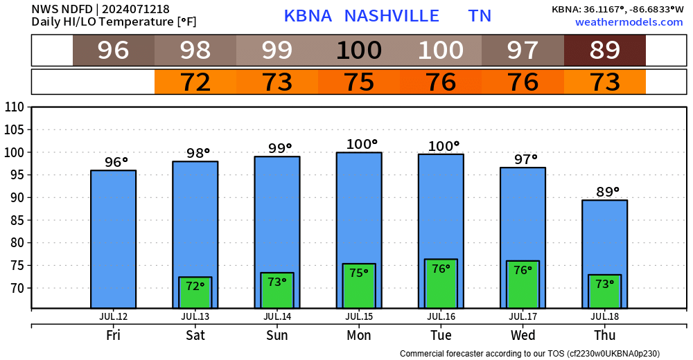
Not much else of a way to put it. The next 6 or so days look downright hot.
I suppose today will be the “coolest” day to do any yardwork?
Dewpoints in the upper 60s thru Monday, when they turn up a notch into the low 70s for Mon – Wed.
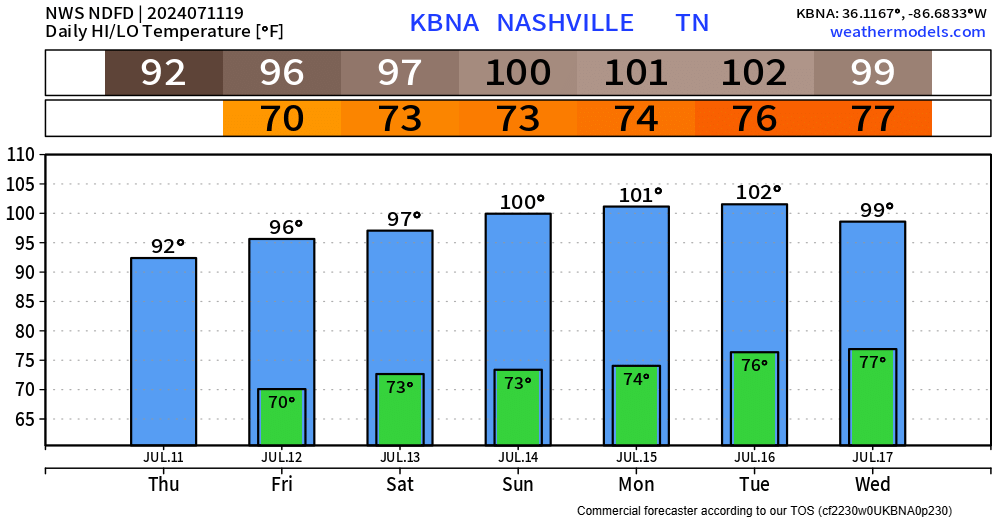
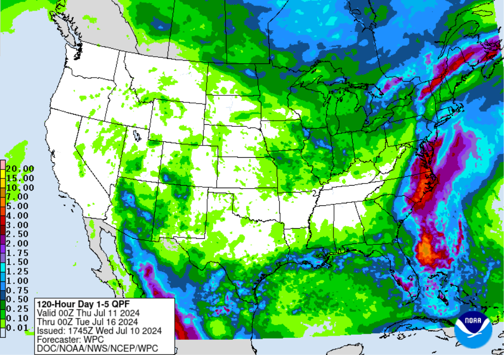
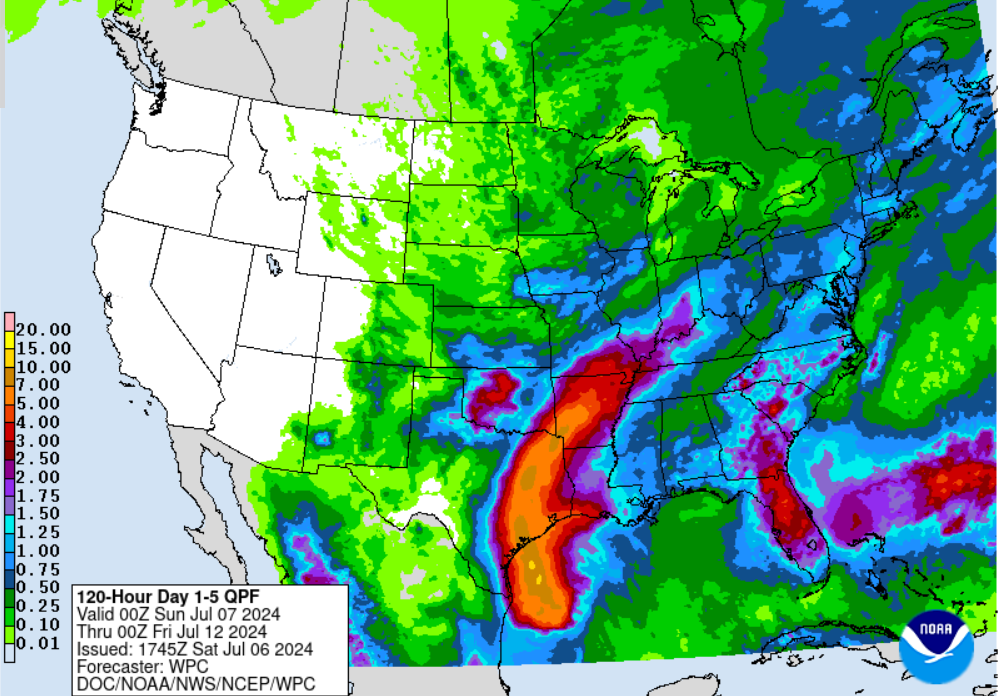
Good news is that most of us at least got a little rain yesterday.
Bad news is that there is very little chances at rain, if any, in the next 5 or so days.
Dewpoints will be in the mid 60s for the remainder of the week, making the heat not too sweaty.

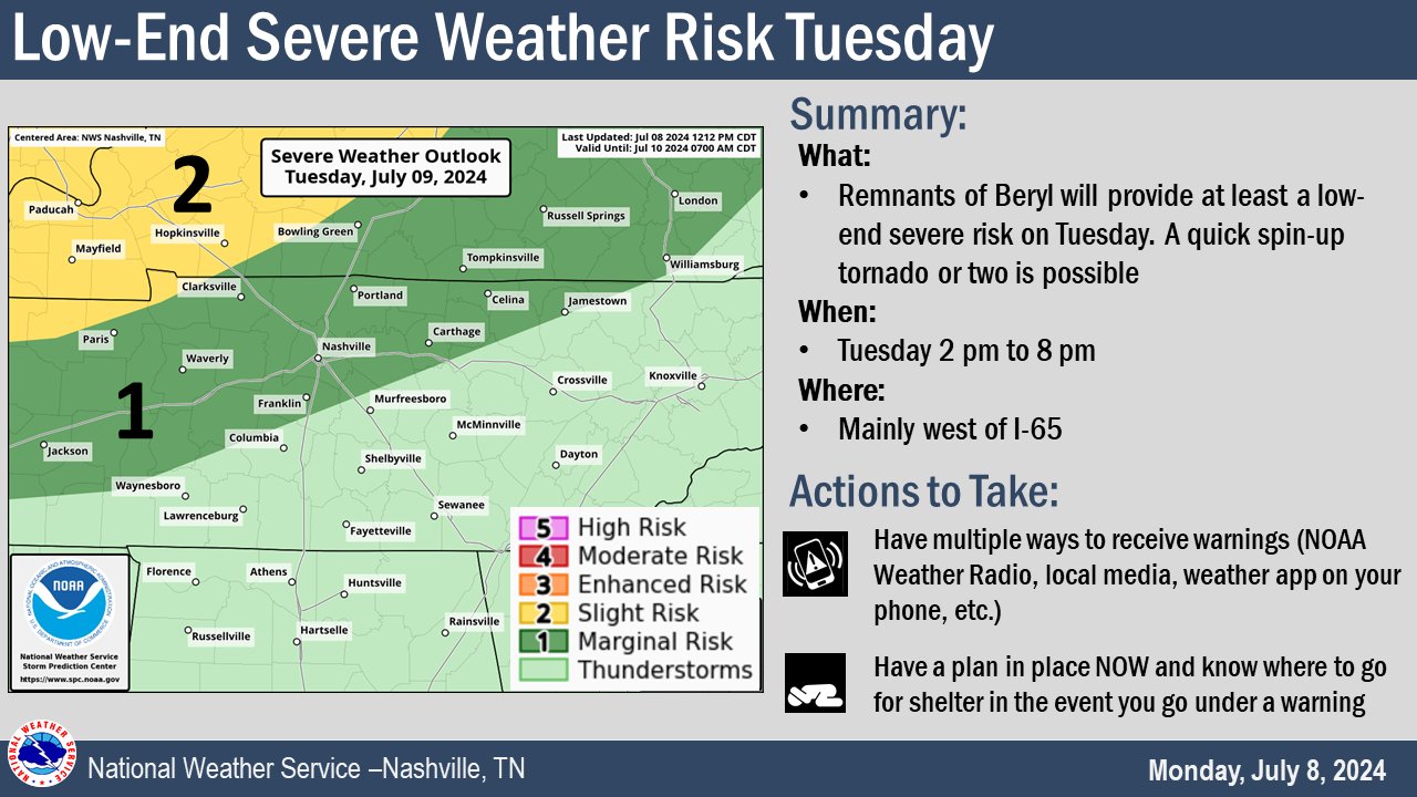
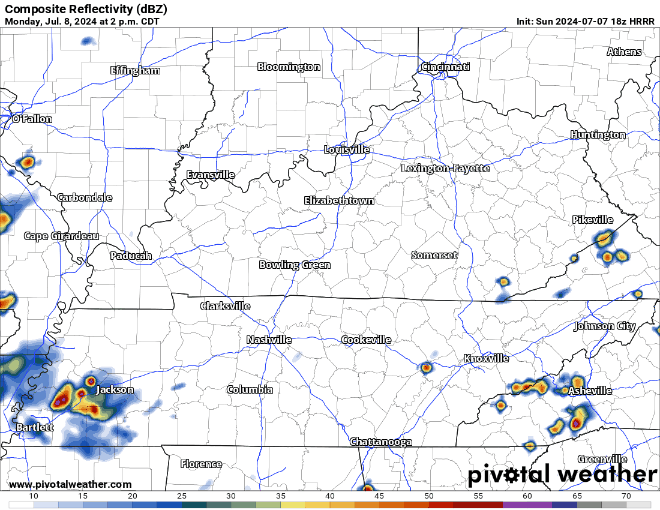
What’s left of Beryl is a low end severe threat for us. SPC calls it a 5% chance of a tornado occurring within 25 miles of you. Lower chances SE of Nashville.
There is also a low risk of damaging straight-line winds with storms that occur where you are.
Hot temps and moist dewps have returned today. Low chances of seeing any rain this afternoon and evening.
The Storm Predicition Center currently has our counties outlooked with a 2% chance of a tornado within 25 miles, and a 5% chance of damaging straight-line winds within 25 miles – higher probs to our NW.

No sound the alarm type of changes, but there have been several noteworthy changes to our forecast with Beryl.
First things first, a tad warm today, but dewpoints have stayed in the upper 50s/low 60s, making temps somewhat tolerable.
High temps still in the low 90s today and Sunday, but will be somewhat tolerable thanks to dewpoints in the mid 60s.
70°+ dewps return Monday, along with rain chances, most likely in the afternoon + evening.
Still a relatively hot weekend, but the dewpoints have relaxed a tad – causing our heat index values to feel pretty close to what the actual air temp is.
Thanks to a high-pressure system – we won’t have any rain chances to deal with this weekend.
You must be logged in to post a comment.