Storms are gone. Any threat over. Few showers may streak by later. Temps dropping fast all day. Grab a coat!

Storms are gone. Any threat over. Few showers may streak by later. Temps dropping fast all day. Grab a coat!
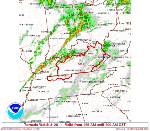
New Tornado Watch until 8 AM just north of us. Storm ETA 6-7 AM.
Details – watch area below.

🟠 NWS Nashville TN Issues a Tornado Watch for Macon TN, Montgomery TN, Robertson TN, Stewart TN, Sumner TN, Trousdale TN.
Sleep well. Tornado Watch is very far north of us. Expires at 5 AM (CST). We will watch our line as it comes in, much (!) weaker than it is now. Anxiety level near zero 🙌🏽.
Dirty cars likely due to our 4-6 AM rainfall carrying dust and smoke particles from wildfires. Smoke model from this morning below.
Storm line ETA 6-8 AM Weds morning. Not expecting severe weather BUT will monitor closely. Any little uptick in instability could create strong storms. Anxiety level low. HRRR model below. Very cold temps behind this line. Dress warm tomorrow.
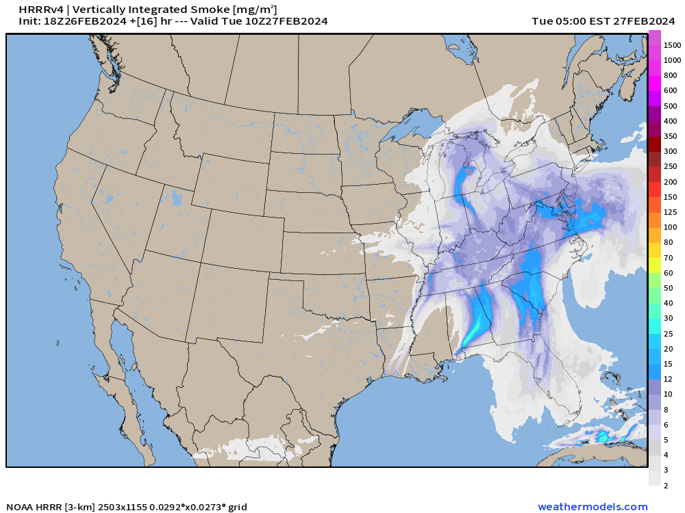
Dirty cars likely caused by smoke and dusty particles trapped aloft and redirected to earth by early morning rains.

The muddy, dirty residue on your cars from the morning rain was caused by people who post “viral“ order of operations math on social media.
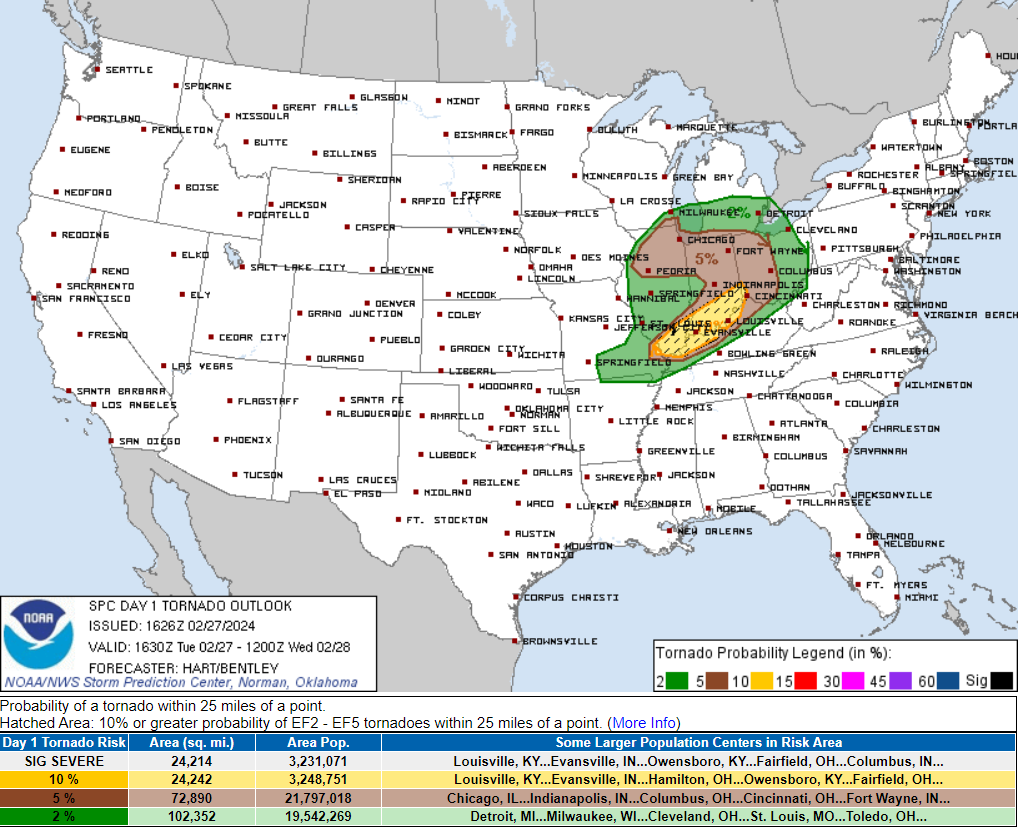
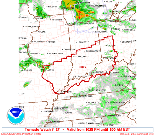
Tonight/Overnight, severe weather ingredients set up well away to our north. Tornadoes are a concern for the Ohio River Valley:
Local concern is currently low. What’s left of that system will weaken as it approaches us Wednesday early morning around 6 AM – 8 AM (rough ETA, for now).
South winds gusting to 40 MPH thru Weds AM. High today 77°, record for 2/27 is 80° set last year.
Weak storm line ETA 6-7 AM Weds. Severe unlikely.
Temps crash cold after that line. Dress for winter Weds.
Few thunderstorms not a concern this early morning / 438 AM
You must be logged in to post a comment.