
Tonight/Overnight, severe weather ingredients set up well away to our north. Tornadoes are a concern for the Ohio River Valley:
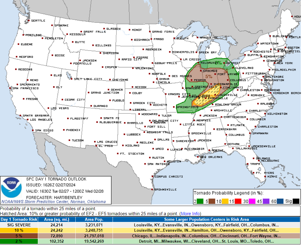
Local concern is currently low. What’s left of that system will weaken as it approaches us Wednesday early morning around 6 AM – 8 AM (rough ETA, for now).
But don’t take our word for it:
By the time the front reaches the I-65 corridor and the Metro area, the front should outrun any surface-based instability and really knock off any storm intensities. Rainfall totals have really dropped off with very few reaching one half inch.
NWS-Nashville, AM Forecast Discussion, 2/27/24
This means we do not expect local severe weather. Just a very windy early morning:
We’ll monitor this system for any changes. System will have substantial shear and wind energy. As long as dewpoints and instability are lacking, we should be OK.
Very cold temps will pour in behind the front. Dress warm Weds.
Categories: Tweet