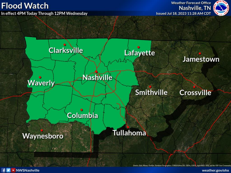
Both of our counties are under a Flood Watch until noon Wednesday.
“Many areas will exceed 2 inches of rainfall. The exact location are uncertain, but some sports could have torrential rainfall exceeding 5 inches causing significant flash flooding.”

Both of our counties are under a Flood Watch until noon Wednesday.
“Many areas will exceed 2 inches of rainfall. The exact location are uncertain, but some sports could have torrential rainfall exceeding 5 inches causing significant flash flooding.”
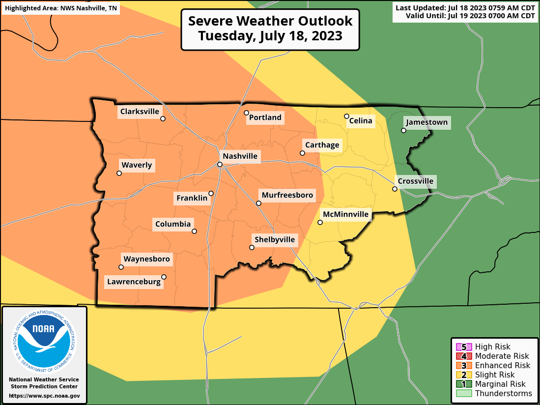

The Storm Prediction Center has outlooked us with the following probabilities, all within 25 miles.
Additionally, the Weather Prediction Center has outlooked the majority of our counties with “at least 40%” of flash flooding occurring within 25 miles, with the rest of us with “at least 15%” also within 25 miles.
Smoke from wildfires in Canada has made its way down here and caused some hazy conditions.
This looks more like a scene from an apocalypse movie, but nope, it’s Nashville.
This haze and smoke will linger, leaving us with an Air Quality Alert today. Take it easy if you have respiratory issues. Smoke will clear by Tuesday.
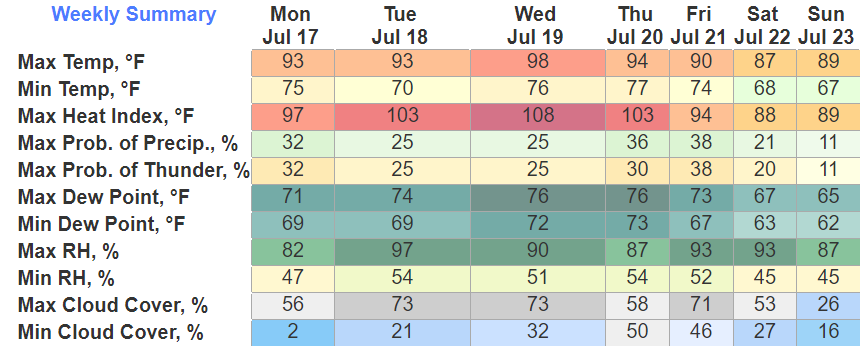
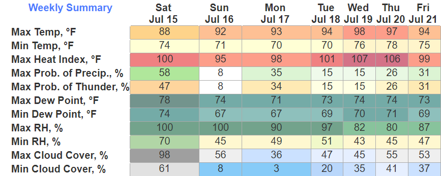
Today will be the only guaranteed dry day of the week, albeit chances the rest of the week will be fairly low.
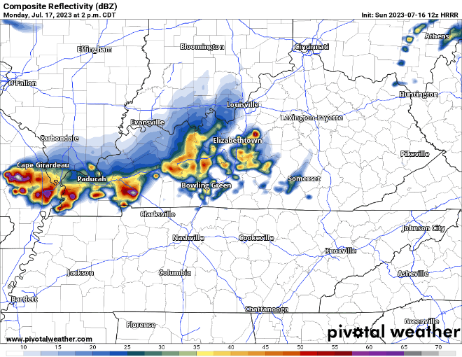
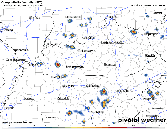
HRRR model (above) shows a line of broken showers/storms moving thru the area tomorrow afternoon. No severe weather expected, but a few storms could be on the stronger side with some gusty winds. When thunder roars, go indoors.
Solid line of good soaking rain that came thru this morning. A majority of us should stay dry the rest of the day, but there is a chance.
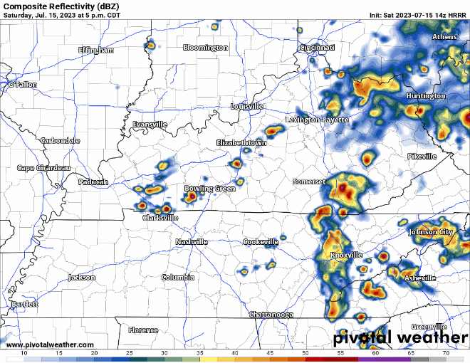
HRRR model (above) shows a cluster of showers/storms moving down I-24 this evening. Timing looks a bit unfortunate as it could impact Queen B and other outdoor activities. Lightning and heavy rain wouldbe possible with this.
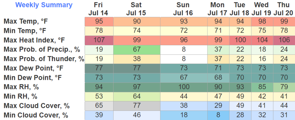
Almost a copy and paste from yesterday. Wattery chances, some of those storms could throw a fit and reach severe limits with some damaging straight-line winds. All storms carry the chances of heavy rain, gusty winds and frequent lightning.
Daily rain/storm chances for…awhile.
Storm Prediction Center has us outlooked today with a 5% chance of damaging straight-line winds and severe hail within 25 miles.
Similar to yesterday, the HRRR model does not show much activity for us today. However, it’s important to stay connected, you do not want to be caught out in a storm.

A bit of a tough forecast the next few days. Daily rain chances, impossible to know exactly when and where.
Storm Prediction Center has places west of I-65 outlooked with a 5% chance of damaging straight-line winds within 25 miles today. This is of course, dependent on if storms actually pop-up. HRRR and NAM3k models both show nothing today. Models are guidance, not gospel, so it’ll be important to stay connected if you have outdoor plans.
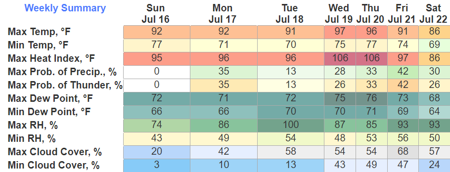
One, probably two more dry days ahead of us. Rain chances return Wednesday but most of the activity looks to stay to our west. The humidity goes up tomorrow so if you have anything outside you need to get done, today is your day.
Not too often you get a big donut for rain chances in July, but today and tomorrow (ok I know it’s 1% but close enough) are examples of it.
Our dry streak will be short-lived as rain chances return Wednesday and stick with us the rest of the week. Along with rain chances returning, the humidity will also return as heat index values climb into the 100’s.
You must be logged in to post a comment.