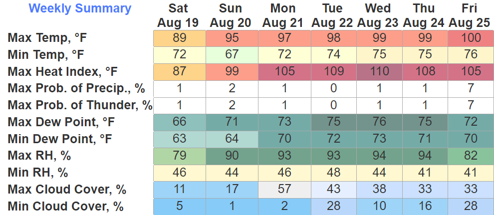
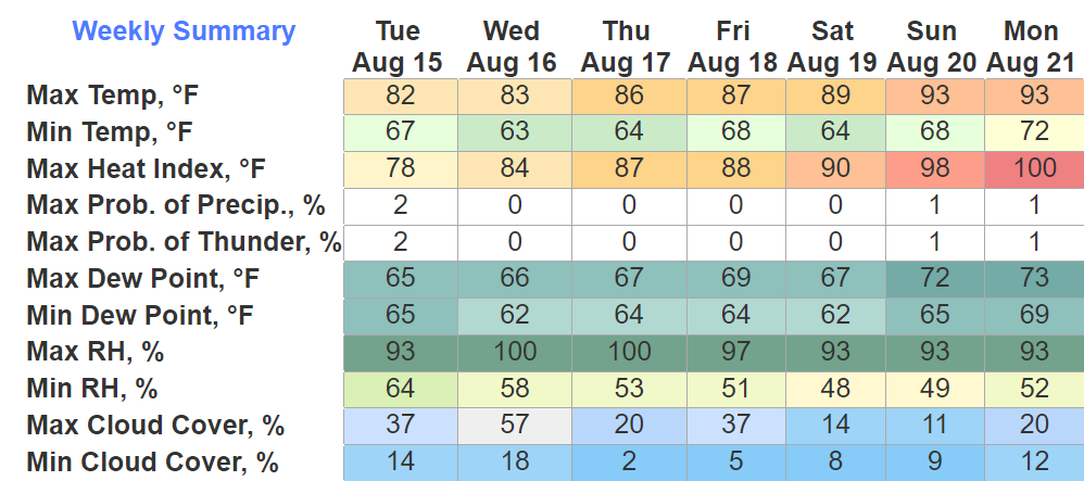
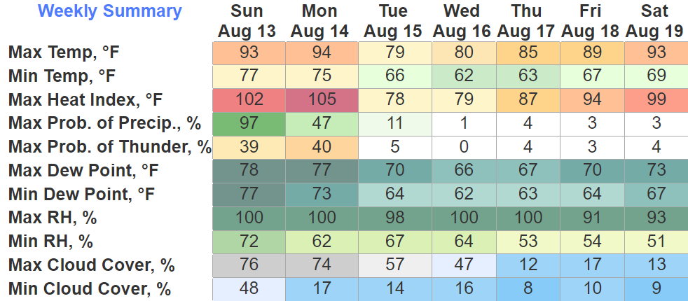
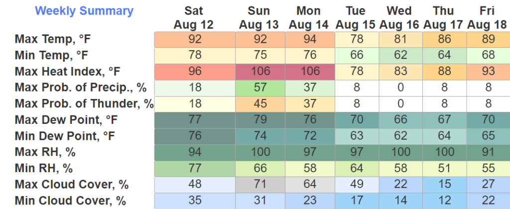
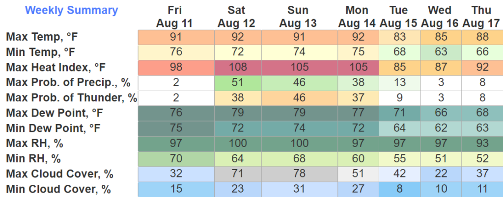
It was a storm we’ll tell our grandkids about one day. With a gust of wind we plummeted into a nasty season of spending 88 hours below freezing, some of those below zero, with punishing wind chills. Rolling blackouts, broken pipes and hazardous travel were part of the narrative for many of us this Christmas. But, better days are here.
Category: Featured Blog
Winter Weather Advisory Until Noon, Warmer Weather Soon
Both of our counties are under a Winter Weather Advisory until noon today. Isolated snowfall amounts of one inch are possible in some isolated areas, but most places will be around half an inch.
We shouldn’t see any major travel impacts, but any snow that falls will stick, so take it easy on the roads and give yourself some extra time today. Snow should end around noon, and we may see temps briefly get above freezing, which will help with melting.
A Cold Christmas Brings A Warm New Years
Relief From The Cold Is On The Way
As of 8:30am, BNA is reporting double digits temps (10°) for the first time in ~32 hours. Temps will rise to the low 20’s, along with some sun, will hopefully help some road conditions improve, but several roads will still be hazardous, continue to take it easy. The “warmer” temps should also help to relieve some stress on the power grid.
Dangerous Cold Will Stick Around, Then A Warm Up
Well, it snowed. Which has left some roads a mess, if you have to go out today, take it nice and easy. Also, the kiddos are probably going to want to play in the snow, however, this is not ideal playing-in-the-snow weather. In fact, it may be tongue stuck to flagpole cold. I wouldn’t try and see for yourself though.
Wind Chill Warning + Winter Weather Advisory Starts Tonight, Potentially Life-Threatening Cold
Wind Chill Warning + Winter Weather Advisory, Dangerously Cold Temps and Light Snow
Dangerous Cold Temps + Light Snow Arriving Thursday Night
Today, Wednesday, and the majority of Thursday will be not too bad as high temps try to reach 50°. If you have something to do outside, I’d probably get it done now.
Thursday it should start raining sometime midday/afternoon. Then the arctic air arrives around 9p, give or take a few hours. Temperatures will plummet into the single digits overnight. High temperatures will struggle to make it into the teens on Friday, while wind chill values will not make it above zero throughout the day Friday and into midday Christmas Eve. A Wind Chill Advisory was issued for wind chill values of ten-fifteen degrees below zero, due to guests as high as 35-40mph. Temperatures will stay below freezing for “`~84 hours Thursday night into midday Monday. Anyone planning on going to the Titans game X-mas Eve needs to plan to really bundle up, as feel like temperatures will be in the single digits the entire game.


Especially if you are heading out of town, but even if you aren’t, the time to prepare is now.
Dangerously Cold Temps Christmas Weekend, Snow Chances Are Iffy
Today through the majority of Thursday will be “nice” as temps reach the upper 40’s, maybe even low 50’s. Dry. Not too shabby.

Thursday night, temperatures are expected to plummet into the single digits/low teens. Temperatures will likely stay below freezing until midday Monday. This will leave us with dangerous conditions. It’s time to start preparing now, especially if you are heading out of town.