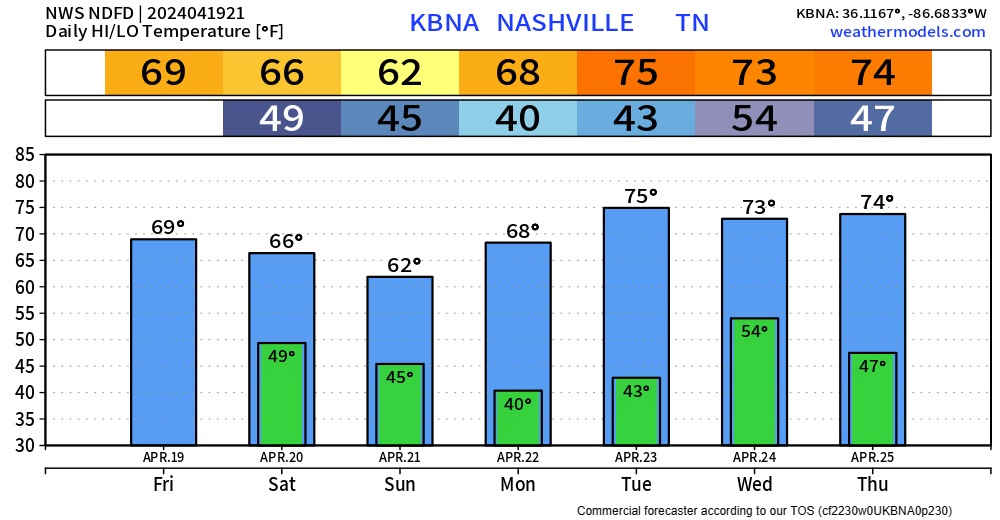
Nice weather during the day Thursday, high temps in the mid 70s. Some may say that it’s fantastic.
A warm front is to blame for some scattered rain chances Friday morning.
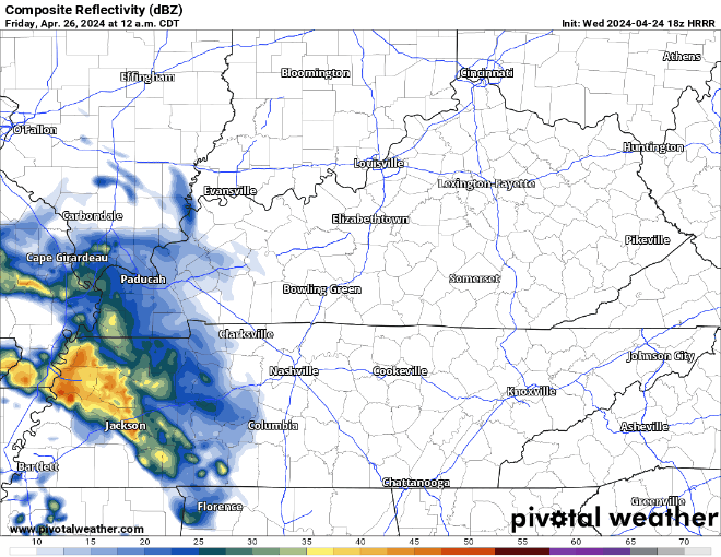
HRRR model shows the mostly light rain moving thru Friday morning. Rain jacket may be needed for the walk into school or work. Most of the rain should be gone by lunchtime. read more
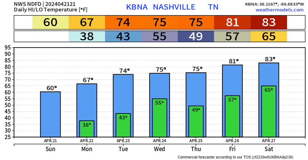
After some frost this morning, there are no more chances for the foreseeable future. I don’t want to guarantee we are done for the Spring, but long-term models suggest that just might be the case. There aren’t any historical records on latest frost, but the latest freeze recorded in Nashville was April 25, 1910. read more
Temps will dip down into the mid 30s tonight, so NWS Nashville went ahead and issued a Frost Advisory from 1am ’til 8am Monday. Protect any loved plants.
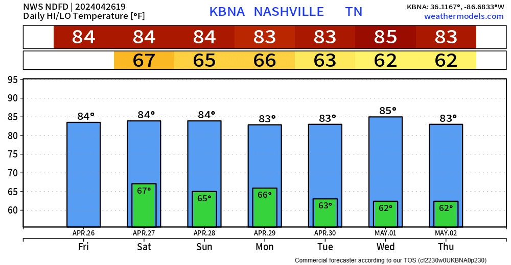
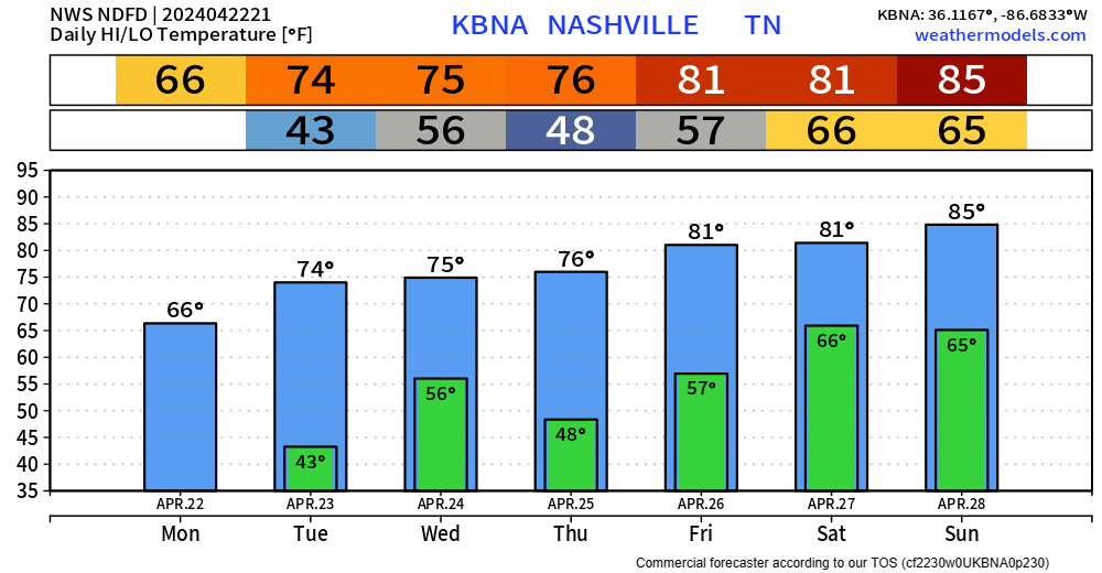
Thankfully, we’ll warm up throughout the weekend, with a return to the 80s by the end of the week. read more
Maybe a few sprinkles this evening, but nothing more. A little chill as the sun goes down as temps will make it down to around 50° tonight.
Maybe a stray shower or two Saturday morning, but that’ll be it as we are left with a dry rest of the day. Highs only making it to the mid 60s.
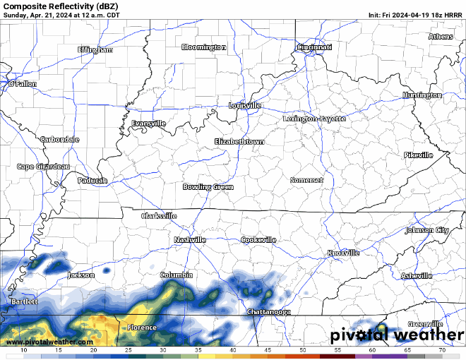
Sunday is the coolest day of the upcoming forecast, with some light rain possible in the morning. Doesn’t look like a rainout tho.
HRRR model (above) shows some light, NBD showers quickly moving in and out early Sunday morning.
Monday will be a nice sunny start to the week with highs in the upper 60s.
"A weak front will bring a small chance for showers late Tuesday and Tuesday night. The next significant rain chance will come late in the week. It looks like an active, stormy pattern may form for next weekend." - NWS Nashville AFDread more
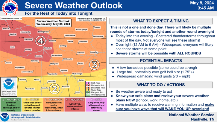
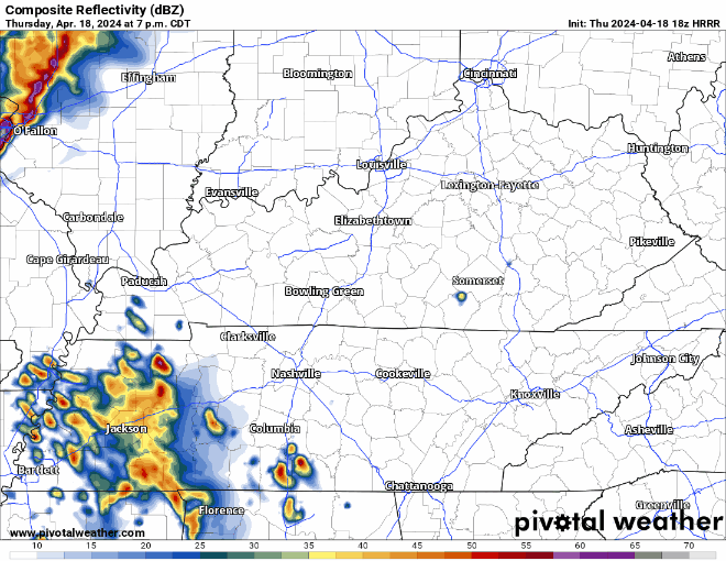
A couple of storms have popped up to our southwest as expected and will continue to throughout the evening. These storms could contain heavy rain, lightning, gusty winds and small hail.
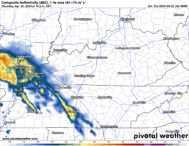
The HRRR model above advertises those evening storms coming from the SW, and then a line of weakening showers/storms coming thru in the early hours of Friday morning. Model guidance has been pretty consistent with thinking this line weakens a lot before it arrives, but still could contain some strong winds, small hail, and lightning. The tornado threat is very low, but it isn’t zero. read more
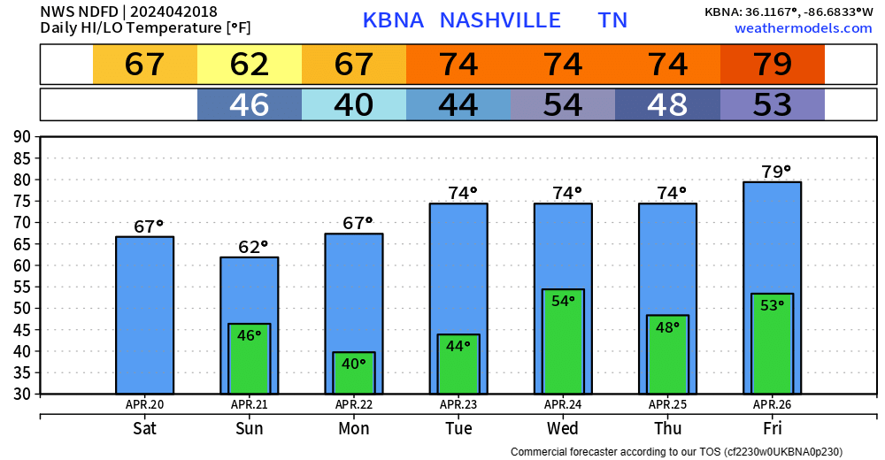
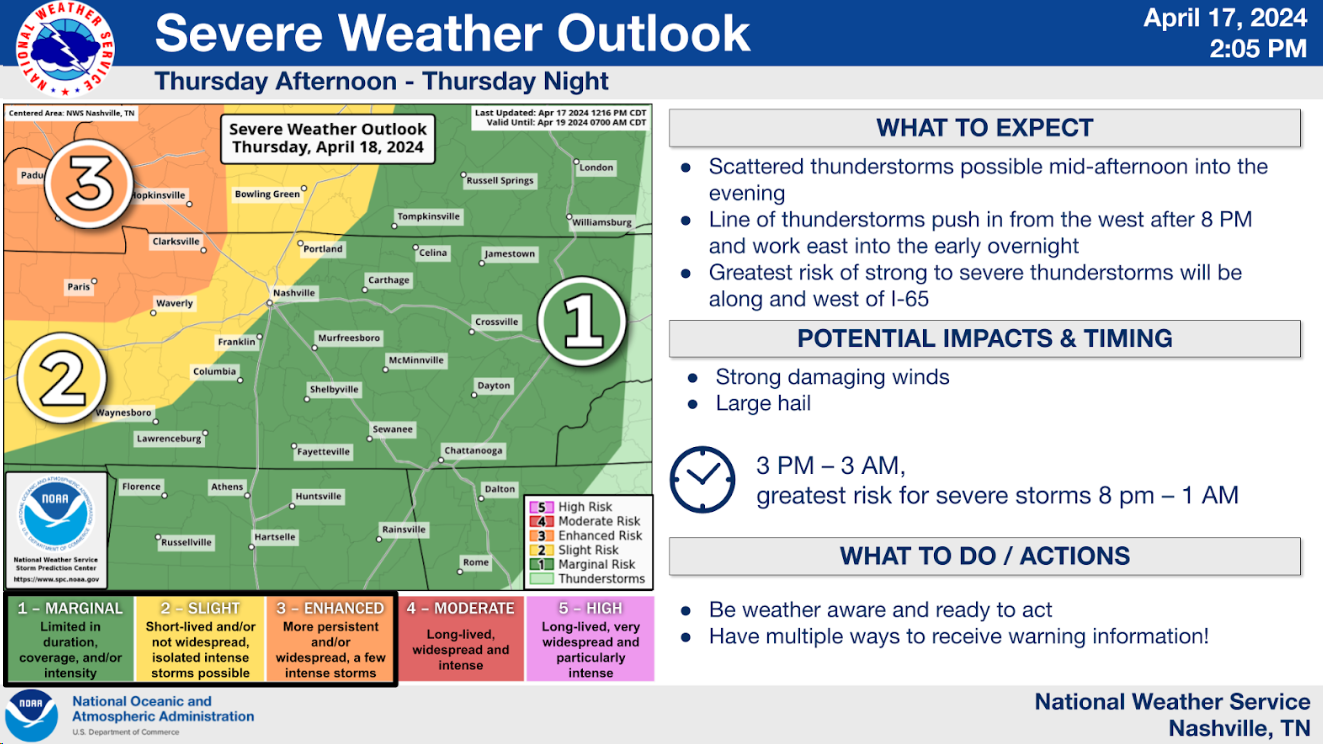
Another very warm day is in store Thursday, high temperature expected to end up around 86°. Record high at BNA is 88°, could get close to at least tying.
Thursday evening into the overnighthours, a line of storms with heavy rain, lightning and gusty winds are expected drop down I-24, therefore nicknamed an “I-24 Special”, although it is debatable if they are actually special. read more
Subscribe to Blog via Email
Privacy & Cookies: This site uses cookies. By continuing to use this website, you agree to their use.
To find out more, including how to control cookies, see here:
Privacy Policy


You must be logged in to post a comment.