BNA briefly made it to 33° around the 3 o’clock hour, but a lot of other places stayed below freezing. Nashville spent 82 consecutive hours at or below freezing, but the clock may still be running at your place.

BNA briefly made it to 33° around the 3 o’clock hour, but a lot of other places stayed below freezing. Nashville spent 82 consecutive hours at or below freezing, but the clock may still be running at your place.
Another night of very cold temperatures.
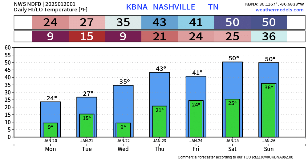
The official low for Nashville is 7°, but many locations outside of Nashville will likely see temperatures closer to 0°.
Thankfully, winds will be fairly calm, so wind chill values will be very close to the actual air temperature. Regardless, it’s still going to be downright cold.

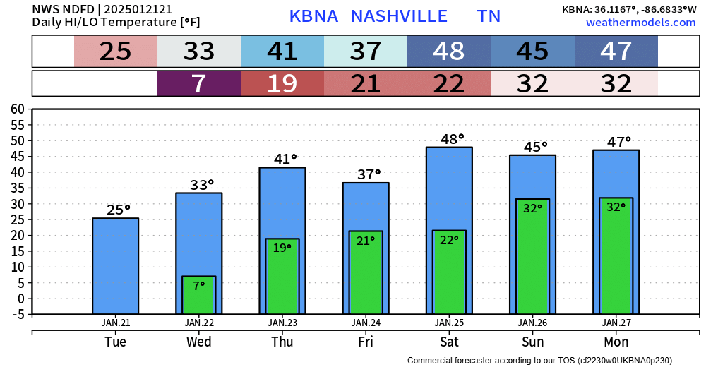
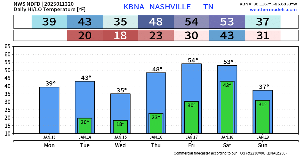
Although we won’t get as cold as last night, it’ll still be very cold tonight.
Official low for BNA is 15°, local backyards may be closer to single digits. Winds will be calmer tonight, so wind chill values won’t differ much from actual air temperatures.
Temps will plumet tonight.
Monday morning, most of us will wake up with temperatures in the single digits, with wind chill values (“feels like”) as low as -5°.
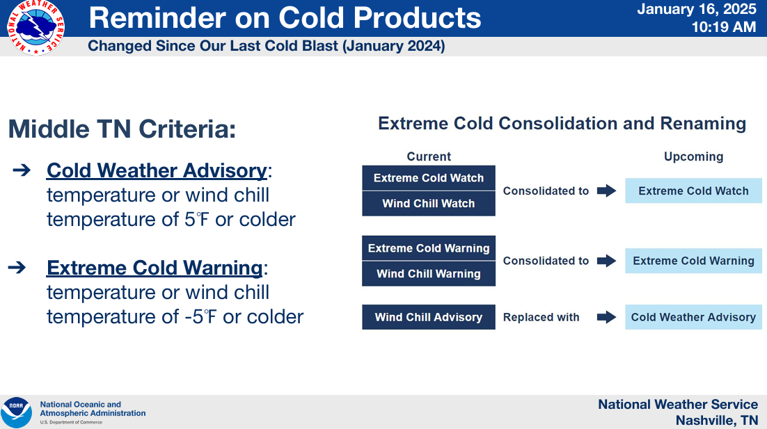
Thus, we are under a Cold Weather Advisory from now until noon Monday.

Temperatures are beginning to fall and will soon dip below freezing. If the forecast holds true, they will not rise above 32° until around 10am Thursday morning. That’s about 104 hours at or below freezing. Your mileage may vary.

Rain expected to move in tonight, sometime around 9p – give or take a couple of hours.
Should continue on/off thru about midday Saturday, but some sprinkles can’t be ruled out Saturday afternoon and evening.
Still expecting some showers to move thru starting late Friday night, continuing on/off thru midday Saturday. No thunderstorm worries, just some rain.
HRRR model gives its take below.

Most of the rain should be outta here by about noon on Saturday.

Before we jump straight to next week, we still do have rain chances beginning Friday night, continuing into Saturday.
The Euro model (below) thinks rain doesn’t move in until late Friday night and is out of here by midday Saturday.
Headlines:
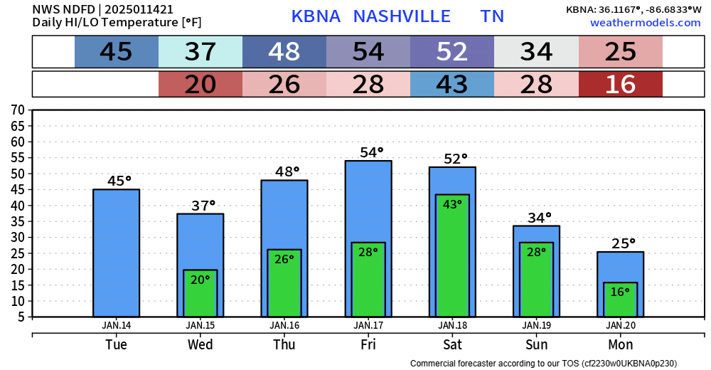
Main highlight of the upcoming forecast will be the brutally cold temperatures arriving early next week. ‘
“As we move into next week, models continue to favor another very cold week with ensembles showing temperatures as much as 25 degrees below normal.” – NWS Nashville AFD
Tonight, Tuesday night, and Wednesday night – low temps will all bottom out around 20°. Prepare to bundle up for the bus stop, commute to work/school.

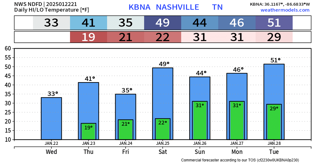
Temps will slowly warm up throughout the week, getting back into the 50s by Friday and Saturday.
You must be logged in to post a comment.