For those that read the blog yesterday, the Euro won. Great rest of the day for any outdoor activities – including graduations (Go Cougs).
Friday a copy and paste from today weather-wise. Good day to be outside.

For those that read the blog yesterday, the Euro won. Great rest of the day for any outdoor activities – including graduations (Go Cougs).
Friday a copy and paste from today weather-wise. Good day to be outside.
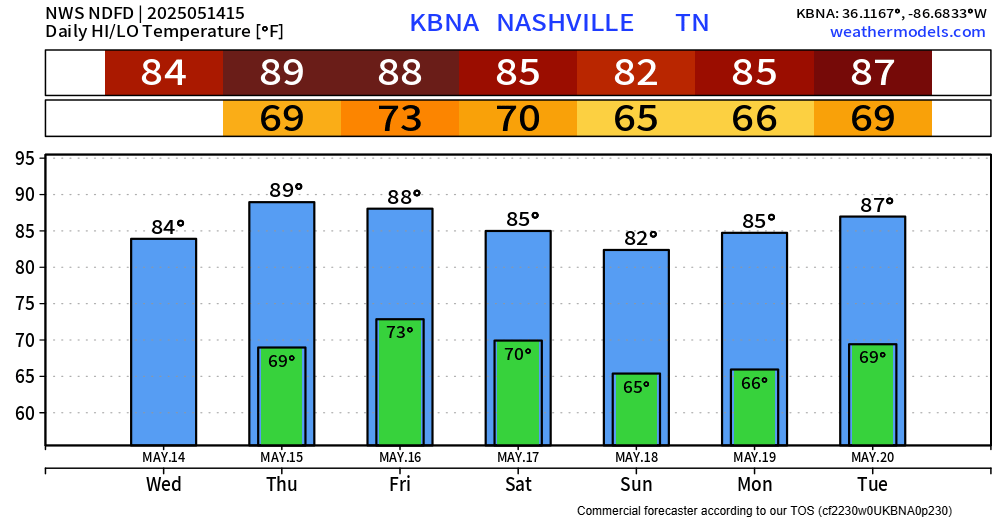
A lot nicer weather today, much deserved I’d say.
Tomorrow will be much of the same, with the exception of maybe a few showers.
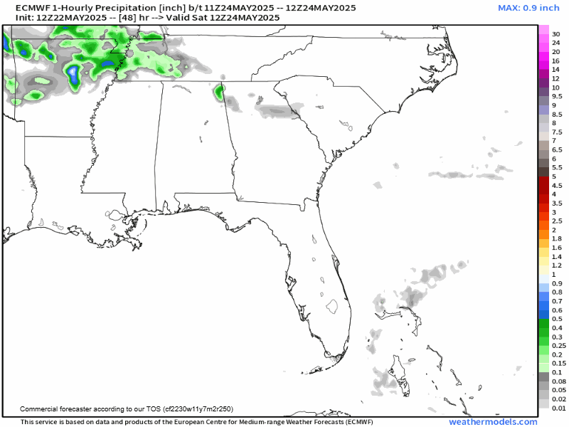
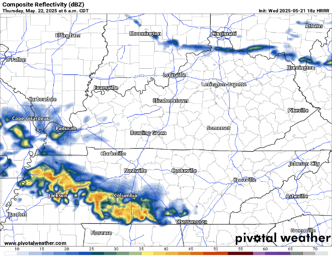
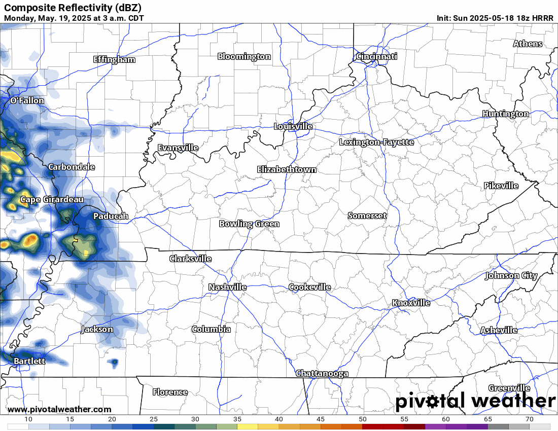
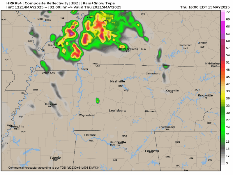
The HRRR (below) thinks we see some showers during the first half of the day – and then a few more Thursday evening.
Note: NOAA Weather Radios will be down for today due to maintenance. This means it will not go off if a warning is issued for you. Have other ways to receive warnings if they are issued such as the Wireless Emergency Alerts on your phone, mobile apps. Do not rely on sirens as a way to get warnings, as they are only meant to be heard outdoors.
Note: NOAA Weather Radios will be down for today and Tuesday due to maintenance. This means it will not go off if a warning is issued for you. Have other ways to receive warnings if they are issued such as the Wireless Emergency Alerts on your phone, mobile apps. Do not rely on sirens as a way to get warnings.
Monday:
A few storms could bubble up before lunch and hang around through the afternoon. They’ll be hit‑or‑miss—so you might stay dry, or you might catch a quick downpour with small hail. Keep the umbrella and the radar handy, just in case. No big tornado vibes here, but gusty winds could knock small limbs around.
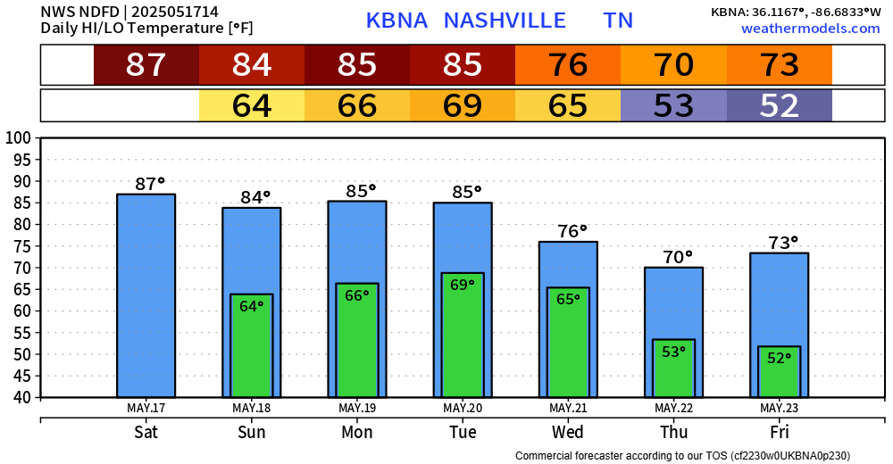
Nice weather today and most of Sunday. Although a few of us may see a quick shower/storm Sunday afternoon, I think majority of us get by with a dry weekend. Highs in the mid 80s.
Not much of a break from storm chances as they return to the forecast on Monday.
Morning round of storms has mostly stayed off to the north – and probably will stay that way. I could see us being dry thru this afternoon, or later. Although can’t totally rule out an isolated storm.
Today will be hot and (probably) dry. Very, very, very low chance of storms thanks to a “cap” in place – which is just a layer of warm, stable air aloft. Highs near 90°.
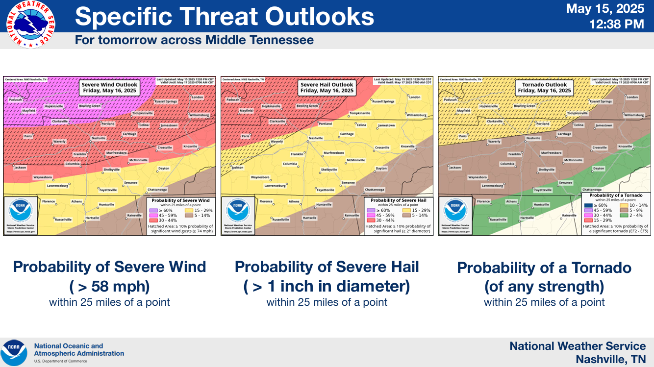
Friday morning we could see some showers/storms move thru, most likely between 3a – 9a. Gusty winds, small hail and lightning not out of the question with these. Allowing some extra time for the AM commute not a bad idea.
A storm may pop this afternoon but the HRRR is clear. Storms more likely east of us. Small hail and gusty winds the potential hazards. We are not severe outlooked.
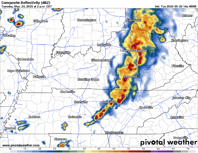
2. HRRR has storms Thu PM rush hour. May go north, maybe not. We’ll watch this. No severe expected here. Lightning, heavy rain instead.
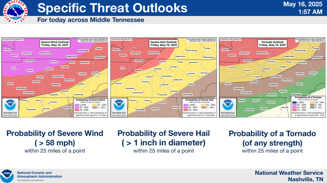
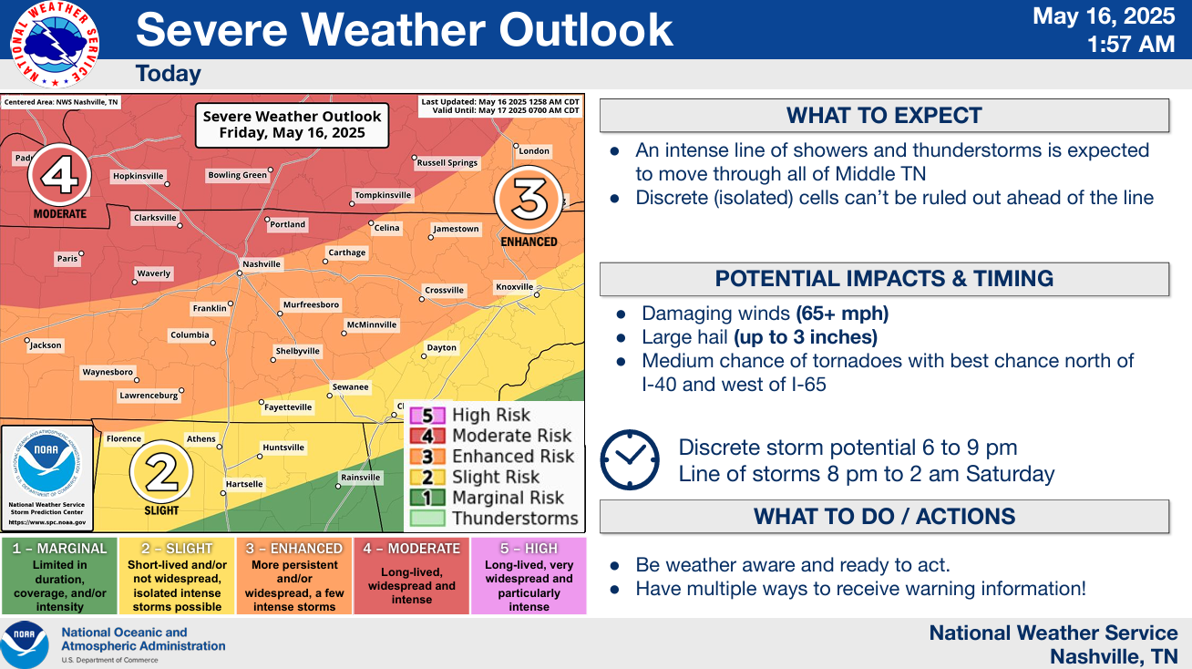
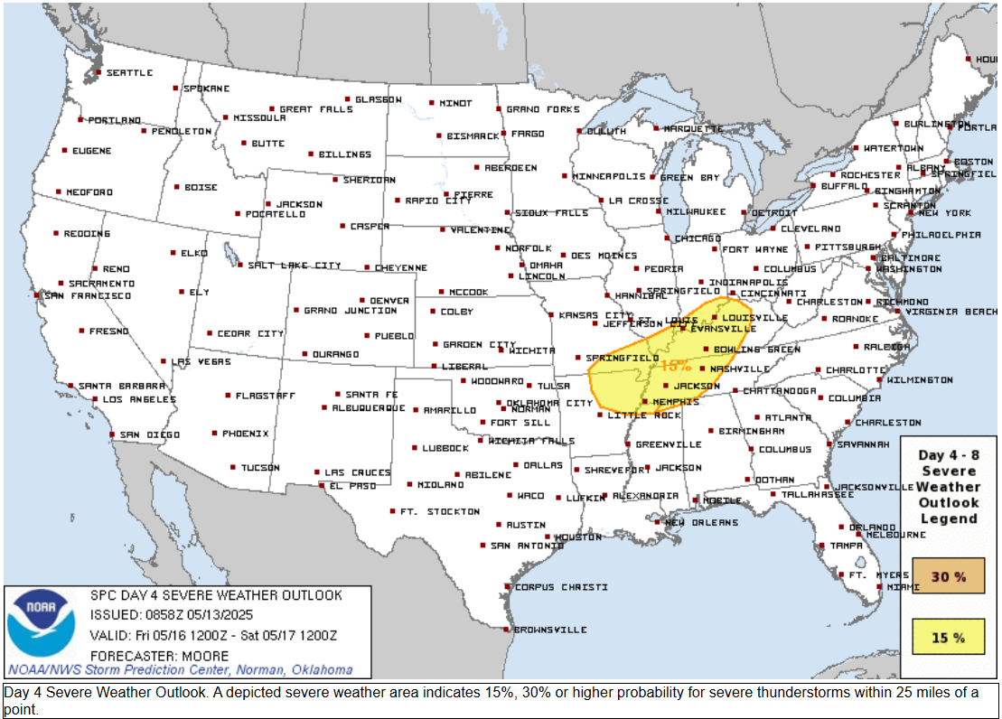
3. Severe weather possible Friday.
You must be logged in to post a comment.