
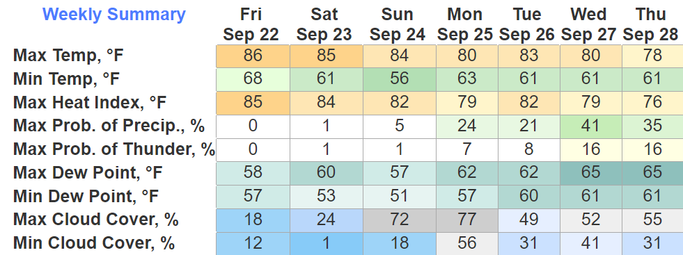
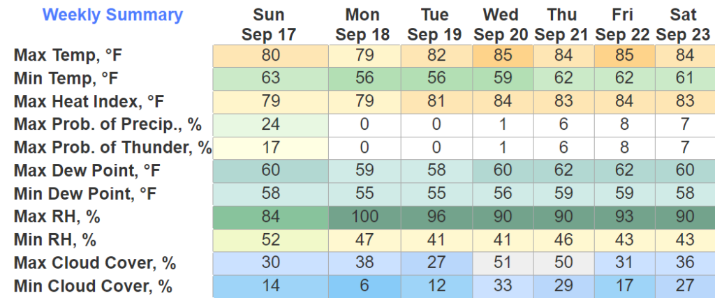
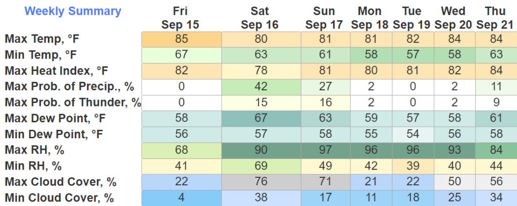
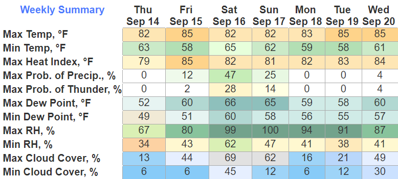
Whether you are hanging around downtown, making the Pilgrimage to Harlinsdale, or whatever your heart desires, the forecast is looking solid.
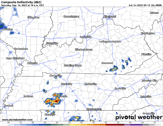
Tonight, Saturday and Sunday all look solid. Only hiccup could be some showers Sunday, but models are in a general consensus that we stay dry until Monday.


You must be logged in to post a comment.