While there are no shortages of rain chances this week, overall, it doesn’t look like a lot of rain – so there’s good news.
On/off (mostly off) light showers will continue to move thru for the remainder of today (Sunday). NBD, just a nuisance.
Unfortunately we just cannot shake these rain chances.
Rain will be on/off (mostly on) thru early this afternoon before transitioning to being more scattered in nature for the remainder of today. Thankfully we won’t have any severe weather to deal with, but you could hear the occasional rumble of thunder. No good news for rolly ball games.
Well, good news is that we should be rain-free for the remainder of the day – knock on wood.
Rain returns Saturday morning, lasting thru the afternoon. Not a good forecast for rolly ball games.
Not expecting any severe weather, but we could see an embedded thunderstorm or two. Most evening plans should be mostly dry – besides a possible quick shower or two.
As new model data continues to come in, thinking on timing and coverage of rain/storms has changed a bit from previous days.
Still think most of us stay dry today (Wednesday) with the exception of maybe a quick shower or two for a few folks. No severe weather expected, and any shower/storm would collapse fairly quick.
TL;DR:
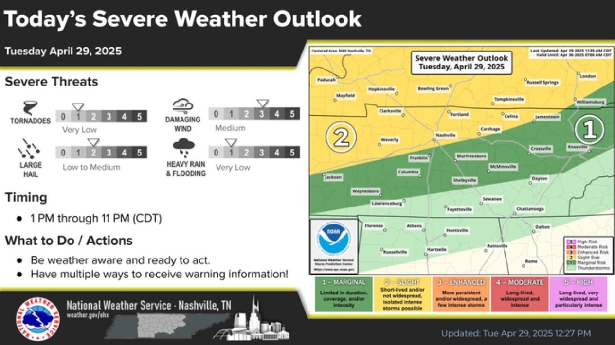
Rain chances will return Tuesday afternoon, although most of the activity is expected to stay to our north.
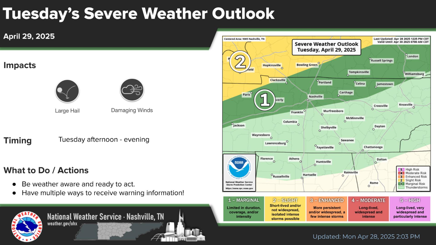
However, with any storm that does make it this far south, we’ll have a very low chance of a strong to severe storm, with gusty winds and hail being the concerns.

While you probably won’t need a light jacket, you probably could use a rain jacket today.
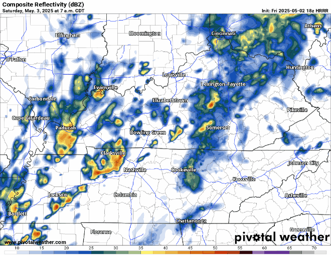
Scattered showers/storms will continue to move thru our area until tonight. Impossible to know exactly when and where, it’s more a Wattery type deal. Rain gear nearby will be helpful. HRRR tries its best below: