
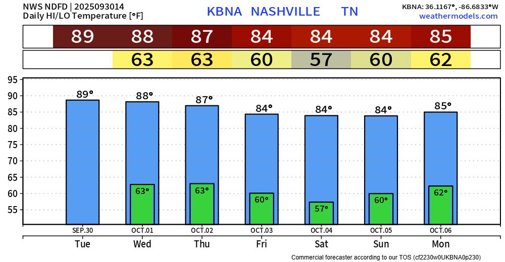
Above-average temperatures remain in the forecast over the next week or so. Getting closer to average by the middle of next week, but still slightly above. Thankfully the dewpoints will be manageable.

Above-average temperatures remain in the forecast over the next week or so. Getting closer to average by the middle of next week, but still slightly above. Thankfully the dewpoints will be manageable.
October is normally our driest month out of the year, and this particular October looks no different.
The CPC released their monthly outlook for October. It shows above-average temps and below-average precip favored.
If you read yesterday’s blog – it’s very similar to today’s. My feelings won’t be hurt if you continue about your day and skip reading the rest.

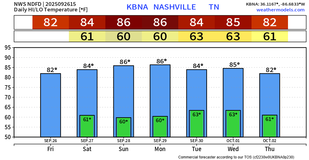
High temps will continue to be ~10° above average over the next couple of days, getting too close to 90°.
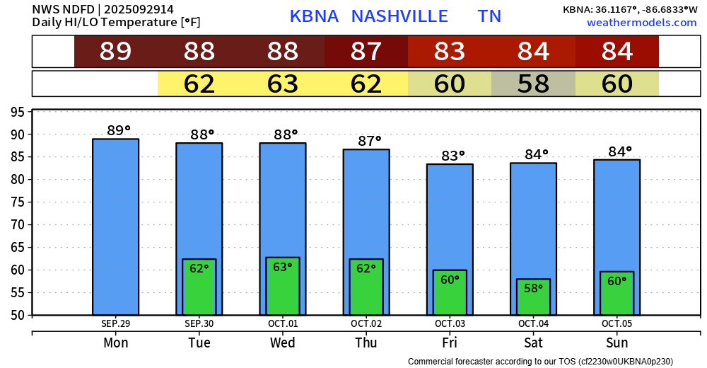
Our average high temperature for September 29th is 77°. We’ll get close to, if not reach, 90° today.

At least we are far away from our daily record high of 98°?
Upper 80s will be with us thru the middle of the week. We “cool” down to the low/mid 80s by the end of the week – improvement, but still above average.
Fairly consistent weather coming up for us.
High temps will be about 10° above average over the next several days – nearing 90°.
Temps will come down a bit towards the end of the week, still will be above average tho.
Some nice weather in the forecast for the foreseeable future.
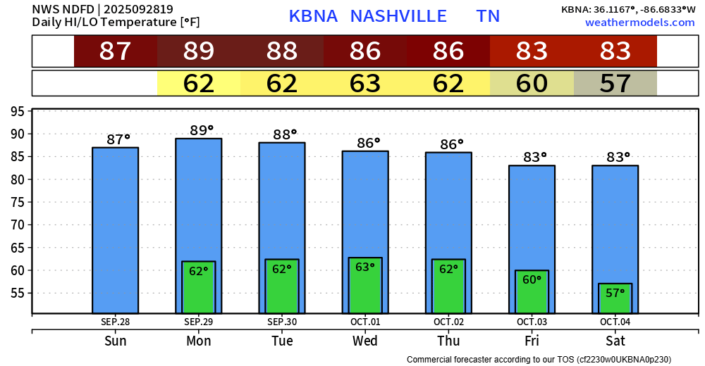
Temperatures slightly above average over the next few days, closer to average by the middle of next week.
Very little, if any rain chances over the next 7 days.
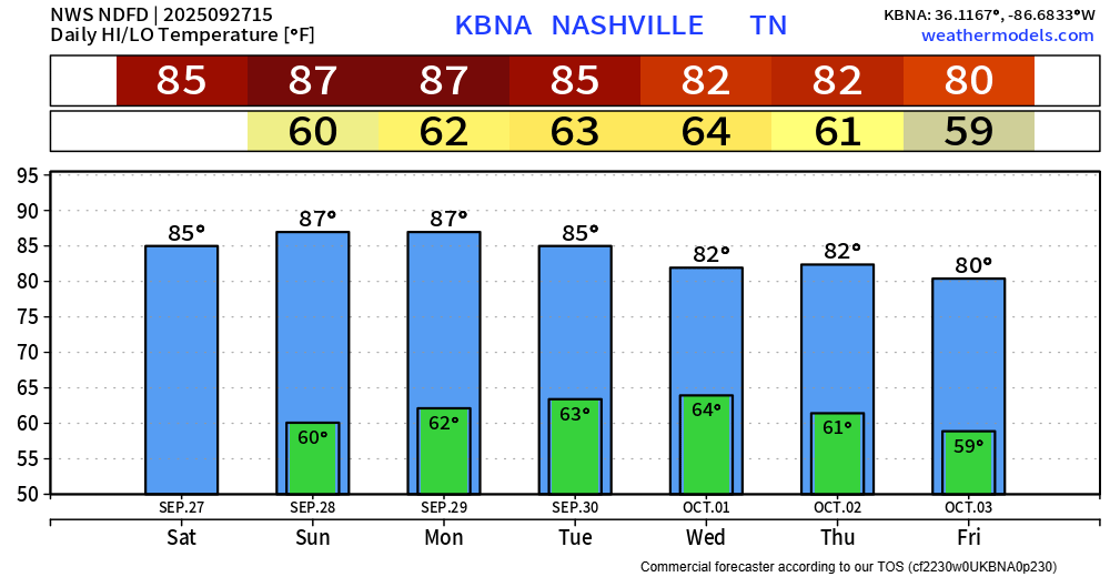
Slightly drier air has made its way in behind the cold front that moved thru yesterday – but it won’t be all that noticeable.
Overall, it will be a nice weekend ahead. Not crazy temps w/ no rain – good weather to watch the crazy good slate of college football.
One last day of rain chances for at least a good bit.
Some scattered showers and storms will be possible this afternoon and evening thanks to a “cold” front moving thru – most of us will probably stay dry.
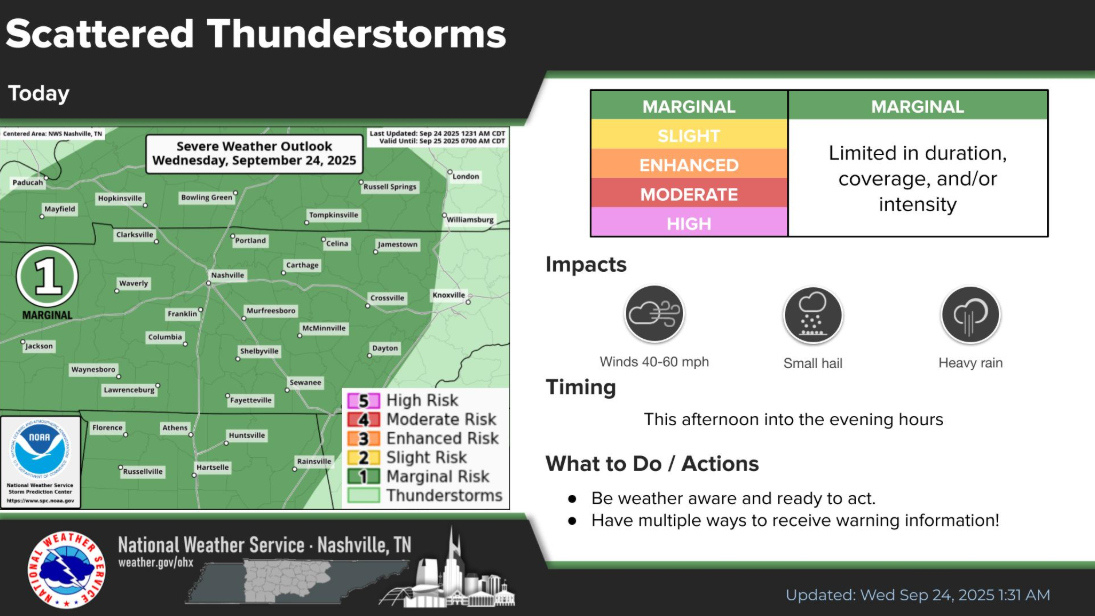
Today is the last day of our little stretch of low-end flash flood and damaging wind threat.
Timeframe for storms will be this afternoon into the overnight hours. Main focus will be on our threat for isolated flash flooding, then maybe some damaging straight-line winds (5% chance within 25 miles). Regardless, chances for both are low. We are not outlooked with any probabilities for tornadoes.
Activity from last night and this morning has moved out. Pretty much everyone got some healthy rainfall amounts, especially S of I-40.
Big question today will be if we see any additional storms this afternoon and evenings.
You must be logged in to post a comment.